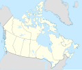
ファイル:Canada location map 2.svg

この SVG ファイルのこの PNG プレビューのサイズ: 709 × 600 ピクセル. その他の解像度: 284 × 240 ピクセル | 568 × 480 ピクセル | 908 × 768 ピクセル | 1,211 × 1,024 ピクセル | 2,422 × 2,048 ピクセル | 1,114 × 942 ピクセル。
元のファイル (SVG ファイル、1,114 × 942 ピクセル、ファイルサイズ: 365キロバイト)
ファイルの履歴
過去の版のファイルを表示するには、その版の日時をクリックしてください。
| 日付と時刻 | サムネイル | 寸法 | 利用者 | コメント | |
|---|---|---|---|---|---|
| 現在の版 | 2020年12月29日 (火) 17:42 |  | 1,114 × 942 (365キロバイト) | MapGrid | added an international boundary line between Canada and St Pierre & Miquelon |
| 2020年12月25日 (金) 18:53 |  | 1,114 × 942 (365キロバイト) | MapGrid | Christmas Day edition... a few more rivers and other minor tweaks. | |
| 2020年11月15日 (日) 17:51 |  | 1,114 × 942 (360キロバイト) | MapGrid | Uploaded own work with UploadWizard |
ファイルの使用状況
このファイルへは 100 を超える数のページで使用されています。
以下の一覧ではこのファイルを使用している最初の 100 ページのみを表示しています。
完全な一覧も参照してください。
●2015 FIFA女子ワールドカップ
●BCライオンズ
●アキミスキ島
●アラート (ヌナブト準州)
●アルバータ山
●アーンプライアー (オンタリオ州)
●イェンスムンク島
●イエローナイフ
●イカルイト空港
●ウィットビー (オンタリオ州)
●ウィニペグ・ジェームス・アームストロング・リチャードソン国際空港
●ウィニペグ・ブルーボマーズ
●ウィンザー (オンタリオ州)
●ウッドストック (オンタリオ州)
●エイジャックス (オンタリオ州)
●エグリントン島
●エスパノーラ (オンタリオ州)
●エドモンストン
●エドモントン・エルクス
●エドモントン・オイラーズ
●エドモントン国際空港
●エリック・ニールセン・ホワイトホース国際空港
●オシャワ
●オタワ・セネターズ
●オタワ・マクドナルド・カルティエ国際空港
●オタワ・レッドブラックス
●オマン湖 (サスカチュワン州)
●オマン湖 (ノースウエスト準州)
●オリリア
●オレンジビル (オンタリオ州)
●オーリティビク島
●オーリティビング島
●オーロラ (オンタリオ州)
●カナダ空軍
●カルガリー・スタンピーダーズ
●カルガリー国際空港
●ガナノクエ
●キングストン (オンタリオ州)
●クラリントン
●ケベック・ジャン・ルサージ国際空港
●ケロウナ
●コロンビア山 (カナダ)
●コーバーグ
●コーンウォール (オンタリオ州)
●ゴドリッチ
●サスカチュワン・ラフライダーズ
●サスカトゥーン・ジョン・G・ディーフェンベーカー国際空港
●サレー
●シャウィニガン
●スーセントマリー (オンタリオ州)
●セントキャサリンズ
●セントジョン (ニューブランズウィック州)
●セントトーマス (オンタリオ州)
●チドリー岬
●チャタム・ケント
●ディエップ (ニューブランズウィック州)
●デクスティリティ島
●トロント
●トロント・アルゴノーツ
●トロント・ピアソン国際空港
●トロント・メープルリーフス
●ナイアガラフォールズ (オンタリオ州)
●ナハニ国立公園
●ニューウエストミンスター
●ニューマーケット (オンタリオ州)
●ノースヨーク
●ノーフォーク (オンタリオ州)
●ハミルトン (オンタリオ州)
●ハミルトン・タイガーキャッツ
●ハリファックス
●ハリファックス・ロバート・L・スタンフィールド国際空港
●ハルトンヒルズ
●ハートランド (ニューブランズウィック州)
●バサースト (ニューブランズウィック州)
●バッドランズ・ガーディアン
●バンクーバー・カナックス
●バンクーバー国際空港
●ビクトリア国際空港
●ピーターボロ (オンタリオ州)
●フォートフランシス
●フォートマクマレー
●フレデリクトン
●ブラントフォード
●ブランドン (マニトバ州)
●ブロック島
●プリンス・アルバート (サスカチュワン州)
●ベルビル (オンタリオ州)
●ペタワワ
●ペンブルック (オンタリオ州)
●ポートムーディ
●ムースジョー
●メイプルリッジ
●モントリオール・アルエッツ
●モントリオール・カナディアンズ
●モントリオール・ピエール・エリオット・トルドー国際空港
●リッチモンド (ブリティッシュコロンビア州)
●レゾリューション島 (カナダ)
●レッド・ベイ国定史跡
●レンフルー (オンタリオ州)
●ロンドン (オンタリオ州)
このファイルへのリンク元を更にを表示する。
グローバルなファイル使用状況
以下に挙げる他のウィキがこの画像を使っています:
- af.wikipedia.org での使用状況
- azb.wikipedia.org での使用状況
- ban.wikipedia.org での使用状況
- ca.wikipedia.org での使用状況
- en.wikipedia.org での使用状況
- Hamilton, Ontario
- Iqaluit
- Moncton
- Ottawa
- Saint John, New Brunswick
- Victoria, British Columbia
- Vancouver
- Whitehorse
- Windsor, Ontario
- Whatì
- Vulcan, Alberta
- Sable Island
- Canadian Baseball League
- Île d'Orléans
- Gaspé Peninsula
- Belcher Islands
- Waterloo, Ontario
- Sarnia
- Kitchener, Ontario
- Point Pelee National Park
- Quebec City
- Regina, Saskatchewan
- Yellowknife
- Wrigley, Northwest Territories
- The Pas
このファイルのグローバル使用状況を表示する。


