File:Duchy of Prussia.svg


From Wikimedia Commons, the free media repository


Jump to navigation  Jump to search  
File

File history

File usage on Commons

File usage on other wikis
File:Duchy of Prussia.svg
Size of this PNG preview of this SVG file: 610 × 588 pixels. Other resolutions: 249 × 240 pixels | 498 × 480 pixels | 797 × 768 pixels | 1,062 × 1,024 pixels | 2,125 × 2,048 pixels.

Original file(SVG file, nominally 610 × 588 pixels, file size: 55 KB)

File information
Structured data

Captions

Captions


Add a one-line explanation of what this file represents

Summary

[edit]
Description
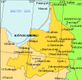
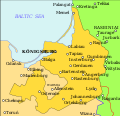
English: Map showing the Duchy of Prussia, at an indeterminable date. Place names inside the Duchy are given in German, as are Elbing and Marienburg. Other names are modern.
 
Territory of the Duchy of Prussia
 
Territory of the Kingdom of Poland before the Union of Lublin
 
Territory of the Grand Duchy of Lithuania before the Union of Lublin
 
Polish-Lithuanian border before the Union of Lublin
 
Polish-Lithuanian border after the Union of Lublin
Date
Source Own work based on: (in Lithuanian) (2001) Lietuvos istorijos atlasas, Vilnius: Vaga, pp. 16—17
Author Grandiose
Other versions
SVG development

InfoField

 
The SVG code is valid.
 
This map was created with Inkscape…important.
 
 This map uses embedded text that can be easily translated using a text editor.
Maps of 1400–1700 Eastern Europe by Grandiose (talk · contribs) (v):
File Type Details
File:Polish-Lithuania map (1450-1600).svg Large SVG Map showing conflicts and territorial changes on the Polish-Lithuanian—Russian border, 1450–1600
File:Duchy of Prussia.svg Small SVG Map of the Duchy of Prussia
File:Livonian war map (1558-1560).svg Small SVG Map showing campaigns in Livonia, 1558–1560.
File:Map of Poland and Lithuania after the Union of Lublin (1569).svg Large SVG Map of the w:Polish-Lithuanian Commonwealth after the Union of Lublin in 1569.
File:Livonian war map (1570-1577).svg Small SVG Map showing areas of Russian and Polish-Lithuanian forces, 1570–1577.
File:Campaigns of Stefan Batory.svg Small SVG Map of the campaign of Stefan Batory in Livonia (1575–1580).
File:Map of Poland and Lithuania in 1600.svg Small SVG Map of Livonia in 1600
See also: User:Halibutt/maps, by Halibutt (talk · contribs).

Licensing

[edit]
I, the copyright holder of this work, hereby publish it under the following license:
w:en:Creative Commons
attribution share alike
This file is licensed under the Creative Commons Attribution-Share Alike 3.0 Unported license.
You are free:
  • to share – to copy, distribute and transmit the work
  • to remix – to adapt the work
  • Under the following conditions:

    File history


    Click on a date/time to view the file as it appeared at that time.
    Date/TimeThumbnailDimensionsUserComment
    current10:07, 20 April 2011Thumbnail for version as of 10:07, 20 April 2011610 × 588 (55 KB)Grandiose (talk | contribs)Correct spelling
    12:44, 19 April 2011Thumbnail for version as of 12:44, 19 April 2011610 × 588 (54 KB)Grandiose (talk | contribs)Lines on longitude and latitude; other important fixes.
    12:36, 19 April 2011Thumbnail for version as of 12:36, 19 April 2011610 × 588 (1.1 MB)Grandiose (talk | contribs)Fix text locations
    12:33, 19 April 2011Thumbnail for version as of 12:33, 19 April 2011610 × 588 (1.1 MB)Grandiose (talk | contribs)


    You cannot overwrite this file.


    The following 2 pages use this file:

    File:Duchy of Prussia mk.svg

    Category:Duchy of Prussia


    File usage on other wikis


    The following other wikis use this file:

    Usage on ar.wikipedia.org

    دوقية بروسيا


    Usage on ast.wikipedia.org

    Ducáu de Prusia


    Usage on br.wikipedia.org

    Dugelezh Prusia


    Usage on ca.wikipedia.org

    Ducat de Prússia


    Usage on cs.wikipedia.org

    Pruské vévodství


    Usage on de.wikipedia.org

    Herzogtum Preußen

    Hohenzollern

    Musikjahr 1580

    Musikjahr 1587


    Usage on el.wikipedia.org

    Δουκάτο της Πρωσίας


    Usage on en.wikipedia.org

    Duchy of Prussia

    Prussian campaign (16261629)

    User:Falcaorib/Germany and Prussia


    Usage on eu.wikipedia.org

    Prusiako Dukerria


    Usage on fa.wikipedia.org

    دوکنشین پروس


    Usage on fi.wikipedia.org

    Preussin herttuakunta


    Usage on gl.wikipedia.org

    Ducado de Prusia


    Usage on he.wikipedia.org

    דוכסות פרוסיה


    Usage on hr.wikipedia.org

    Prusko Vojvodstvo


    Usage on hu.wikipedia.org

    Porosz Hercegség


    Usage on is.wikipedia.org

    Hertogadæmið Prússland


    Usage on it.wikipedia.org

    Ducato di Prussia


    Usage on ja.wikipedia.org


    Usage on ko.wikipedia.org


    Usage on lt.wikipedia.org

    Prūsijos kunigaikštystė


    Usage on mk.wikipedia.org

    Војводство Прусија


    Usage on rue.wikipedia.org

    Пруссия


    Usage on ru.wikipedia.org

    Пруссия (герцогство)


    Usage on sc.wikipedia.org

    Prùssia


    Usage on sh.wikipedia.org

    Prusko vojvodstvo


    Usage on sv.wikipedia.org

    Hertigdömet Preussen


    Usage on th.wikipedia.org


    Usage on tr.wikipedia.org

    Prusya Dükalığı


    Usage on uk.wikipedia.org

    Пруссія (герцогство)


    Usage on vi.wikipedia.org

    Công quc Ph


    Usage on www.wikidata.org

    Q153091


    Usage on zh.wikipedia.org


    Structured data

    Items portrayed in this file

    depicts

    creator

    some value

    author name string: Grandiose
    Wikimedia username: Grandiose
    URL: http://commons.wikimedia.org/wiki/User:Grandiose

    copyright status

    copyrighted

    copyright license

    Creative Commons Attribution-ShareAlike 3.0 Unported

    inception

    19 April 2011

    source of file

    original creation by uploader


    Retrieved from "https://commons.wikimedia.org/w/index.php?title=File:Duchy_of_Prussia.svg&oldid=867092478"

    Categories: 
    Maps of the Duchy of Prussia
    SVG maps of the Polish-Lithuanian Commonwealth
    Hidden categories: 
    Pages with non-numeric formatnum arguments
    SVG created with Inkscape:Important
    Valid SVG created with Inkscape:Maps
    SVG maps:Translation possible
    CC-BY-SA-3.0
    Self-published work


    Navigation menu


    Personal tools  


    English
    Not logged in
    Talk
    Contributions
    Create account
    Log in


    Namespaces  


    File
    Discussion