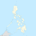
File:Philippines location map (square).svg


From Wikimedia Commons, the free media repository


Jump to navigation  Jump to search  
File

File history

File usage on Commons

File usage on other wikis

Metadata
File:Philippines location map (square).svg
Size of this PNG preview of this SVG file: 600 × 600 pixels. Other resolutions: 240 × 240 pixels | 480 × 480 pixels | 768 × 768 pixels | 1,024 × 1,024 pixels | 2,048 × 2,048 pixels | 1,332 × 1,332 pixels.

Original file(SVG file, nominally 1,332 × 1,332 pixels, file size: 1.49 MB)

File information
Structured data

Captions

Captions


Map of the Philippines Islands (P.I.)

Summary

[edit]
Description
English: Location map of the Philippines

Equirectangular projection based on the parallel of 10°43' N

  • N: 21.2° N
  • S: 4.3° N
  • W: 114.0° E
  • E: 131.2° E
Date
Source Own work
Author Hellerick
SVG development

InfoField

 
The SVG code is valid.
 
This map was created with Inkscape.

Licensing

[edit]
I, the copyright holder of this work, hereby publish it under the following license:
w:en:Creative Commons
attribution share alike
This file is licensed under the Creative Commons Attribution-Share Alike 3.0 Unported license.
You are free:
  • to share – to copy, distribute and transmit the work
  • to remix – to adapt the work
  • Under the following conditions:

    File history


    Click on a date/time to view the file as it appeared at that time.
    (newest | oldest) View (newer 10 | ) (10 | 20| 50| 100 | 250 | 500)
    Date/TimeThumbnailDimensionsUserComment
    current10:17, 19 August 2021Thumbnail for version as of 10:17, 19 August 20211,332 × 1,332 (1.49 MB)AichiWikiFixer (talk | contribs)Updated boundaries
    07:53, 18 June 2021Thumbnail for version as of 07:53, 18 June 20211,332 × 1,332 (2.24 MB)AichiWikiFixer (talk | contribs)Map update.
    03:55, 18 June 2021Thumbnail for version as of 03:55, 18 June 20211,332 × 1,332 (2.23 MB)AichiWikiFixer (talk | contribs)Small changes.
    03:49, 18 June 2021Thumbnail for version as of 03:49, 18 June 20211,332 × 1,332 (2.23 MB)AichiWikiFixer (talk | contribs)External changes for boundaries and coastlines.
    13:11, 17 June 2021Thumbnail for version as of 13:11, 17 June 20211,332 × 1,332 (2.23 MB)AichiWikiFixer (talk | contribs)Additional islands, lakes, and updated coastlines.
    10:34, 17 June 2021Thumbnail for version as of 10:34, 17 June 20211,332 × 1,332 (2.23 MB)AichiWikiFixer (talk | contribs)Update boundaries.
    02:04, 25 May 2021Thumbnail for version as of 02:04, 25 May 20211,332 × 1,332 (2.22 MB)HueMan1 (talk | contribs)Reverted to version as of 07:24, 7 September 2020 (UTC)
    07:11, 17 May 2021Thumbnail for version as of 07:11, 17 May 20211,332 × 1,332 (3.72 MB)Petriolo (talk | contribs)Reverted to version as of 05:36, 3 May 2021 (UTC) The new administrative borders are based from the Philippine government websites (https://www.geoportal.gov.ph/; http://noah.up.edu.ph/), and is deemed accurate. These new files have reliable sources and there's no "beauty" in it if it is inaccurate in the first place.
    14:00, 16 May 2021Thumbnail for version as of 14:00, 16 May 20211,332 × 1,332 (2.22 MB)AichiWikiFixer (talk | contribs)Reverted to version as of 07:24, 7 September 2020 (UTC) (Borders seen as ugly)
    05:36, 3 May 2021Thumbnail for version as of 05:36, 3 May 20211,332 × 1,332 (3.72 MB)Petriolo (talk | contribs)updated with NAMRIA borders

    (newest | oldest) View (newer 10 | ) (10 | 20| 50| 100 | 250 | 500)


    You cannot overwrite this file.


    The following 11 pages use this file:

    User:Hellerick

    Commons:Graphic Lab/Map workshop/Archive/2014

    Commons:Graphic Lab/Map workshop/Archive/2017

    File:Philippines location map (Calabarzon).svg

    File:Philippines location map (Cebu).svg

    File:Philippines location map (Luzon).svg

    File:Philippines location map (Luzon mainland).svg

    File:Philippines location map (Mindanao).svg

    File:Philippines location map (Palawan).svg

    File:Philippines location map (Visayas).svg

    File:WMPH Cultural heritage mapping project logo 2.png


    File usage on other wikis


    The following other wikis use this file:

    Usage on af.wikipedia.org

    Ninoy Aquino Internasionale Lughawe

    Mactan-Cebu Internasionale Lughawe


    Usage on ar.wikipedia.org

    قالب:خريطة مواقع الفلبين

    بوراكاي

    سان ليوناردو

    بحر سيبويان

    مذبحة مانيلي

    تفجير مدينة دافاو 2016

    كأس الفلبين للسلام 2014


    Usage on arz.wikipedia.org

    انتراموروس


    Usage on ast.wikipedia.org

    Asturias (Filipines)

    Toboso

    Lucena (Filipines)

    Alcala

    Manila

    Módulu:Mapa de llocalización/datos/Filipines

    Mar de Joló

    Luzón

    Komisyon sa Wikang Filipino

    Mar de Visayas

    Mindanao

    Lingayén

    Tarlac

    Vigan

    Dávao

    Complexu del Batasang Pambansa

    Ríu Pásig

    Estrechu de Mindoro

    Estrechu de Luzón

    Islles de Calamianes

    Módulu:Mapa de llocalización/datos/Filipines/usu

    Aeropuertu Internacional Ninoy Aquino

    Pasay

    Parañaque

    Universidá de Bulacán

    Aeropuertu Daniel Z. Romuáldez

    Aeropuertu Evelio Javier

    Aeropuertu Francisco B. Reyes

    Aeropuertu Godofredo P. Ramos

    Aeropuertu d'Awang

    Aeropuertu de Bancasi

    Aeropuertu de Dipolog

    Aeropuertu d'Ipil

    Aeropuertu de Joló

    Aeropuertu de Labo

    Aeropuertu de Laguindingán

    Aeropuertu de Lumbia

    Aeropuertu de Naga

    Aeropuertu de Pagadían

    Aeropuertu de Rosales


    View more global usage of this file.

    Metadata

    This file contains additional information such as Exif metadata which may have been added by the digital camera, scanner, or software program used to create or digitize it. If the file has been modified from its original state, some details such as the timestamp may not fully reflect those of the original file. The timestamp is only as accurate as the clock in the camera, and it may be completely wrong.

    Structured data

    Items portrayed in this file

    depicts

    creator

    some value

    author name string: Hellerick
    Wikimedia username: Hellerick
    URL: http://commons.wikimedia.org/wiki/User:Hellerick

    copyright status

    copyrighted

    copyright license

    Creative Commons Attribution-ShareAlike 3.0 Unported

    source of file

    original creation by uploader

    inception

    17 June 2013

    media type

    image/svg+xml


    Retrieved from "https://commons.wikimedia.org/w/index.php?title=File:Philippines_location_map_(square).svg&oldid=871777958"

    Categories: 
    SVG blank maps of the Philippines
    Location maps of the Philippines
    Hidden categories: 
    Valid SVG created with Inkscape:Maps
    CC-BY-SA-3.0
    Self-published work


    Navigation menu


    Personal tools  


    English
    Not logged in
    Talk
    Contributions
    Create account
    Log in


    Namespaces  


    File
    Discussion