Home  

Random  

Nearby  


Log in  


Settings  


Donate  


About Wikipedia  

Disclaimers  


Wikipedia


File:BlankMap-World-162E.svg


File  

Talk  


Language  

Watch  


File

File history

File usage

Global file usage

Metadata
File:BlankMap-World-162E.svg
Size of this PNG preview of this SVG file: 800 × 413 pixels. Other resolutions: 320 × 165 pixels | 640 × 330 pixels | 1,024 × 529 pixels | 1,280 × 661 pixels | 2,560 × 1,321 pixels | 3,100 × 1,600 pixels.

Original file(SVG file, nominally 3,100 × 1,600 pixels, file size: 1.35 MB)


Description
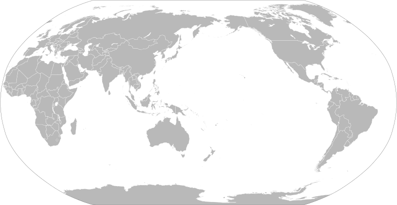
English: A political map of the world centered at the 162E longitude line.

Detailed SVG map with grouping enabled to connect all non-contiguous parts of a country's territory for easy colouring. Smaller countries can also be represented by larger circles to show their data easier.

A thorough description of use and other instructions relating to can be found on the instruction page
한국어: 동경 162도 경선을 중앙으로 한 빈 전세계지도입니다.

지형이 이어져 있지 않은 국가를 간단히 색깔을 입히기 위해 그룹이 지어진 자세한 SVG 지도 파일입니다. 작은 국가들은 더 큰 원으로 표시하여 데이터를 좀 더 간단히 나타낼 수 있습니다.

그림과 연관된 자세한 설명과 다른 지침들은 지침 문서 (영문)에서 확인하세요.
Date
Source Based on File:BlankMap-World.svg and rotated using the pythonscript available at http://gsl-nagoya-u.net/appendix/software/worldmap/
Author Lokal_Profil
Permission
(Reusing this file)

The map data manipulated by the script is in the public domain. The raw output of the script, including the file shown here, is also in the public domain.

Public domain I, the copyright holder of this work, release this work into the public domain. This applies worldwide.
In some countries this may not be legally possible; if so:
I grant anyone the right to use this work for any purpose, without any conditions, unless such conditions are required by law.
Other versions

Derivative works of this file:

SVG development

InfoField

 
The source code of this large SVGisvalid.
 
This oversized world map was created with Inkscape.

Captions

Add a one-line explanation of what this file represents

Items portrayed in this file

depicts

13 April 2008

image/svg+xml

3f42a7dbae3dd8babe2c714dc9b137f5e0ec05b7

1,412,838 byte

1,600 pixel

3,100 pixel

File history


Click on a date/time to view the file as it appeared at that time.
Date/TimeThumbnailDimensionsUserComment
current20:15, 6 September 2021Thumbnail for version as of 20:15, 6 September 20213,100 × 1,600 (1.35 MB)Milenioscurothin border
20:04, 6 September 2021Thumbnail for version as of 20:04, 6 September 20213,100 × 1,600 (1.35 MB)Milenioscurofixed and cropped
12:48, 17 July 2020Thumbnail for version as of 12:48, 17 July 2020940 × 477 (2.9 MB)HogweardUpdate format, and make South Sudan selectable
13:04, 25 February 2012Thumbnail for version as of 13:04, 25 February 2012940 × 477 (3.53 MB)Sammy pomponAdded South Sudan
13:01, 25 February 2012Thumbnail for version as of 13:01, 25 February 2012940 × 477 (3.53 MB)Sammy pomponAdded South Sudan
22:24, 13 April 2008Thumbnail for version as of 22:24, 13 April 2008940 × 477 (3.45 MB)Lokal Profil{{Information |Description=A blank map of the world centered at the 162E longitude line. Detailed SVG map with grouping enabled to connect all non-contiguous parts of a country's territory for easy colouring. Smaller countries can also be represented b


The following pages on the English Wikipedia use this file (pages on other projects are not listed):

World map

User:Avi8tor

User:Bullifreund

User:Concus Cretus

User:Emanueleastore

User:Mr.choppers

User:Stepho-wrs

User talk:Stepho-wrs/Archive/2011

Wikipedia:Graphics Lab/Images to improve/Archive/Apr 2008

Wikipedia:Graphics Lab/Map workshop/Archive/Jul 2013

Wikipedia talk:WikiProject Maps/Archive 5


Global file usage


The following other wikis use this file:

Usage on bn.wikipedia.org

ি ি


Usage on cs.wikipedia.org

Mapa světa


Usage on de.wikipedia.org

Wikipedia:Kartenwerkstatt/Kartenwünsche

Benutzer:Bullifreund


Usage on de.wikibooks.org

Benutzer:Bullifreund


Usage on en.wikibooks.org

World History/Maps


Usage on es.wikipedia.org

Portal:Historia


Usage on et.wikipedia.org

Maailmakaart


Usage on eu.wikipedia.org

Atlas

Mapamundi


Usage on fr.wikipedia.org

Utilisateur:Avi8tor


Usage on fr.wikiversity.org

Dynamiques de la mondialisation/Exercices/Croquis pôles et flux

Dynamiques de la mondialisation/Exercices/Croquis territoires intégrés


Usage on ha.wikipedia.org

Taswirar duniya


Usage on he.wikipedia.org

מפת העולם

משתמש:WikiJunkie/מפת העולם


Usage on hy.wikipedia.org

Կաղապար:Խաղաղական Ովկիանոս


Usage on ja.wikipedia.org

:/1


Usage on ko.wikipedia.org

:  /


Usage on lo.wikipedia.org


:


Usage on pnb.wikipedia.org

عالمی نقشہ


Usage on ru.wikipedia.org

Карта мира


Usage on th.wikipedia.org

:

:

:

:

:

:

:

:

:

:

:

:

:

:

:

:

:

:

:


View more global usage of this file.

Metadata

This file contains additional information, probably added from the digital camera or scanner used to create or digitize it.

If the file has been modified from its original state, some details may not fully reflect the modified file.


Retrieved from "https://en.wikipedia.org/wiki/File:BlankMap-World-162E.svg"


Languages


This page is not available in other languages.
 

Wikipedia


Privacy policy

About Wikipedia

Disclaimers

Contact Wikipedia

Code of Conduct

Developers

Statistics

Cookie statement

Terms of Use

Desktop