Home  

Random  

Nearby  


Log in  


Settings  


Donate  


About Wikipedia  

Disclaimers  


Wikipedia


File:China Hong Kong location map.svg


File  

Talk  


Language  

Watch  


File

File history

File usage

Global file usage

Metadata
File:China Hong Kong location map.svg
Size of this PNG preview of this SVG file: 766 × 600 pixels. Other resolutions: 307 × 240 pixels | 613 × 480 pixels | 981 × 768 pixels | 1,280 × 1,002 pixels | 2,560 × 2,004 pixels | 1,298 × 1,016 pixels.

Original file(SVG file, nominally 1,298 × 1,016 pixels, file size: 244 KB)


Summary

Description
Deutsch: Postionskarte von Hong Kong

Quadratische Plattkarte. Geographische Begrenzung der Karte:

  • N: 22°34'14" N (22.5706°N)
  • S: 22°07'12" N (22.12°N)
  • W: 113°49'20" O (113.8222°E)
  • O: 114°27'08" O (114.4522°E)
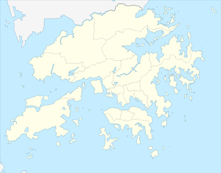
English: Location map of Hong Kong

Equirectangular projection. Geographic limits of the map:

  • N: 22°34'14" N (22.5706°N)
  • S: 22°07'12" N (22.12°N)
  • W: 113°49'20" E (113.8222°E)
  • E: 114°27'08" E (114.4522°E)
Date
Source own work, using this filebyModdlyg
Author Maximilian Dörrbecker (Chumwa)
Permission
(Reusing this file)
I, the copyright holder of this work, hereby publish it under the following licenses:
GNU head Permission is granted to copy, distribute and/or modify this document under the terms of the GNU Free Documentation License, Version 1.2 or any later version published by the Free Software Foundation; with no Invariant Sections, no Front-Cover Texts, and no Back-Cover Texts. A copy of the license is included in the section entitled GNU Free Documentation License.
w:en:Creative Commons
attribution share alike
This file is licensed under the Creative Commons Attribution-Share Alike 3.0 Unported license.
You are free:
  • to share – to copy, distribute and transmit the work
  • to remix – to adapt the work
  • Under the following conditions:
    • attribution – You must give appropriate credit, provide a link to the license, and indicate if changes were made. You may do so in any reasonable manner, but not in any way that suggests the licensor endorses you or your use.
    • share alike – If you remix, transform, or build upon the material, you must distribute your contributions under the same or compatible license as the original.
    You may select the license of your choice.
    Kartenwerkstatt
    This map has been made or improved in the German Kartenwerkstatt (Map Lab). You can propose maps to improve as well.

    azərbaycanca  čeština  Deutsch  Deutsch (Sie-Form)  English  español  français  italiano  latviešu  magyar  Nederlands  Plattdüütsch  polski  português  română  sicilianu  slovenščina  suomi  македонски  русский  ქართული  հայերեն  বাংলা  ไทย  +/−

    Captions

    Location map of Hong Kong

    Items portrayed in this file

    depicts

    April 2010

    image/svg+xml

    4b07789fe074eac331bdc43b672bba83f2693983

    251,325 byte

    1,016 pixel

    1,298 pixel

    File history


    Click on a date/time to view the file as it appeared at that time.
    (newest | oldest) View (newer 10 | ) (10 | 20| 50| 100 | 250 | 500)
    Date/TimeThumbnailDimensionsUserComment
    current04:25, 13 April 2024Thumbnail for version as of 04:25, 13 April 20241,298 × 1,016 (244 KB)TanoDanoAdded HZMB HK Port Artificial Island
    23:56, 13 December 2022Thumbnail for version as of 23:56, 13 December 20221,298 × 1,016 (245 KB)Turbo Slayer 2021Reverted to version as of 02:34, 15 March 2022 (UTC)
    02:35, 15 March 2022Thumbnail for version as of 02:35, 15 March 20221,298 × 1,016 (244 KB)Turbo Slayer 2021Reverted to version as of 15:10, 16 May 2021 (UTC)
    02:34, 15 March 2022Thumbnail for version as of 02:34, 15 March 20221,298 × 1,016 (245 KB)Turbo Slayer 2021Reverted to version as of 07:02, 4 May 2021 (UTC)
    15:10, 16 May 2021Thumbnail for version as of 15:10, 16 May 20211,298 × 1,016 (244 KB)瑞丽江的河水Reverted to version as of 16:40, 12 September 2018 (UTC)
    07:02, 4 May 2021Thumbnail for version as of 07:02, 4 May 20211,298 × 1,016 (245 KB)Turbo Slayer 2021Reverted to version as of 05:09, 29 March 2021 (UTC)
    12:37, 29 March 2021Thumbnail for version as of 12:37, 29 March 20211,298 × 1,016 (244 KB)瑞丽江的河水Reverted to version as of 16:40, 12 September 2018 (UTC), new coastline after the Hong Kong Zhuhai Macau Bridge Islands built, it is correct, please check with satellite imagery
    05:09, 29 March 2021Thumbnail for version as of 05:09, 29 March 20211,298 × 1,016 (245 KB)Turbo Slayer 2021This is a actual map of Hong Kong due to the Hong Kong Zhuhai Macau Bridge Islands is not that size, Don't worry It will upload a new map until the third runway is finished, Please, wiki is a equal place that Mainland Chinese users are not allowed in this edit, because the firewall. if I found it, I will report to the wiki centre. Thank you. P.S. I am a Hong Konger
    14:13, 28 March 2021Thumbnail for version as of 14:13, 28 March 20211,298 × 1,016 (244 KB)瑞丽江的河水Reverted to version as of 16:40, 12 September 2018 (UTC)
    12:56, 25 March 2021Thumbnail for version as of 12:56, 25 March 20211,298 × 1,016 (245 KB)Turbo Slayer 2021Reverted to version as of 09:39, 11 September 2011 (UTC)

    (newest | oldest) View (newer 10 | ) (10 | 20| 50| 100 | 250 | 500)


    More than 100 pages use this file. The following list shows the first 100 pages that use this file only. A full list is available.

    1956 AFC Asian Cup

    A Chau

    A Kung Ngam

    Aldrich Bay

    Ap Chau

    Ap Chau Mei Pak Tun Pai

    Ap Chau Pak Tun Pai

    Ap Lo Chun

    Ap Tan Pai

    Ap Tau Pai

    Bay Islet

    Beacon Hill (Hong Kong)

    Big Wave Bay Beach

    Bride's Pool

    Caritas Medical Centre

    Castle Peak (Hong Kong)

    Chek Chau

    Chi Lin Nunnery

    Ching Chung Koon

    Devil's Peak, Hong Kong

    Fanling

    Flat Island (Hong Kong)

    Gun Club Hill Barracks

    HSBC Building (Hong Kong)

    Hammer Hill (Hong Kong)

    Harbour City (Hong Kong)

    High Island Reservoir

    Hong Kong Open (golf)

    Hong Kong Science Museum

    Hong Kong national cricket team

    International Finance Centre (Hong Kong)

    Jardine's Lookout

    Kai Tak Airport

    Kau Keng Shan

    Kei Ling Ha

    King's College, Hong Kong

    Kowloon Masjid and Islamic Centre

    Kowloon Park

    Kowloon Peak

    Kowloon Reception Reservoir

    Kowloon Reservoir

    Kowloon Walled City

    Kwai Chung Incineration Plant

    Kwai Chung Sports Ground

    Kwai Tsing Theatre

    Kwong Wah Hospital

    Kwun Tong

    Kwun Yam Beach

    Lam Chau

    Lamma Island

    Lantau Peak

    Lei Cheng Uk Han Tomb Museum

    Lin Fa Shan

    Lion Rock

    Liu To

    Ma Wan Tung Wan Beach

    Mai Po Marshes

    Mount Gough

    Mount Parker (Hong Kong)

    Nam Fung Chau

    Nam Long Shan

    Nei Lak Shan

    Pat Sin Leng

    Plover Cove Reservoir

    Po Lin Monastery

    Pok Fu Lam Reservoir

    Prince of Wales Hospital

    Princess Margaret Hospital (Hong Kong)

    Pui O Beach

    Quarry Hill (Hong Kong)

    Queen Elizabeth Hospital, Hong Kong

    Queen Mary Hospital (Hong Kong)

    Razor Hill

    Repulse Bay Beach

    Sai Kung Town

    Sha Tau Kok

    Sha Tin

    Sha Tin New Town

    Shek Kong Airfield

    Shek Lei Pui Reservoir

    Shek O Beach

    Shek Uk Shan

    Sheung Shui Wai

    Shing Mun Reservoir

    Sunset Peak (Hong Kong)

    Sze Fong Shan

    Tai Lam Country Park

    Tai Tam Reservoirs

    Temple Hill (Hong Kong)

    Tiu Keng Leng

    Tsing Yi

    Tsing Yi Peak

    Tuen Mun Hospital

    Tung Chung

    Tung Chung Fort

    Union Square (Hong Kong)

    Victoria Barracks, Hong Kong

    Victoria Peak

    Wan Chai District

    Wong Shek


    View more links to this file.

    Global file usage


    The following other wikis use this file:

    Usage on af.wikipedia.org

    Aberdeen, Hongkong

    Aberdeen (dubbelsinnig)

    Hongkong Internasionale Lughawe

    Sjabloon:Liggingkaart Hongkong

    Hongkongse nasionale krieketspan

    Kowloon

    New Territories, Hongkong


    Usage on an.wikipedia.org

    Plantilla:Mapa de localización Hong Kong


    Usage on ar.wikipedia.org

    قالب:خريطة مواقع هونغ كونغ

    مطار كاي تاك


    Usage on ast.wikipedia.org

    Aeropuertu Internacional de ong Kong

    Victoria Harbour

    Módulu:Mapa de llocalización/datos/ong Kong/usu


    Usage on azb.wikipedia.org

    هونق کونق


    Usage on az.wikipedia.org

    Honkonqdakı məscidlərin siyahısı


    Usage on ba.wikipedia.org

    Ҡалып:ПозКарта Ҡытай Гонконг


    Usage on bcl.wikipedia.org

    Pankinàban na Palayogan nin Hong Kong

    Kowloon Park

    Victoria Peak


    Usage on bg.wikipedia.org

    Хонконг

    Шаблон:ПК Китай Хонконг

    Коулун (град крепост)

    Абърдийн (Хонконг)

    Международно летище Хонконг

    Кайтак


    Usage on bn.wikipedia.org

    ি      ি  ি

     ি ি

    : ি 

     ি 

      ি

    ি ি

     ি ি 


    Usage on ceb.wikipedia.org

    Plantilya:Location map Hong Kong

    Table Hill

    South Channel

    Green Island

    Green Islet

    Deep Bay

    North Point

    North Channel

    Castle Rock

    Sandy Point

    Black Point

    Crooked Island

    White Point

    West Bay

    Long Point

    North Rock

    Channel Rock

    The Brothers


    View more global usage of this file.

    Metadata

    This file contains additional information, probably added from the digital camera or scanner used to create or digitize it.

    If the file has been modified from its original state, some details may not fully reflect the modified file.


    Retrieved from "https://en.wikipedia.org/wiki/File:China_Hong_Kong_location_map.svg"


    Languages


    This page is not available in other languages.
     

    Wikipedia


    Privacy policy

    About Wikipedia

    Disclaimers

    Contact Wikipedia

    Code of Conduct

    Developers

    Statistics

    Cookie statement

    Terms of Use

    Desktop