Home  

Random  

Nearby  


Log in  


Settings  


Donate  


About Wikipedia  

Disclaimers  


Wikipedia


File:I-79.svg


File  

Talk  


Language  

Watch  


File

File history

File usage

Global file usage

Metadata
File:I-79.svg
Size of this PNG preview of this SVG file: 600 × 600 pixels. Other resolutions: 240 × 240 pixels | 480 × 480 pixels | 768 × 768 pixels | 1,024 × 1,024 pixels | 2,048 × 2,048 pixels | 601 × 601 pixels.

Original file(SVG file, nominally 601 × 601 pixels, file size: 8 KB)


Public domain This file is in the public domain because it comes from the Manual on Uniform Traffic Control Devices, sign number M1-1, which states specifically on page I-1 that:
Any traffic control device design or application provision contained in this Manual shall be considered to be in the public domain. Traffic control devices contained in this Manual shall not be protected by a patent, trademark, or copyright, except for the Interstate Shield and any other items owned by FHWA.
Trademarked This work includes material that may be protected as a trademark in some jurisdictions. If you want to use it, you have to ensure that you have the legal right to do so and that you do not infringe any trademark rights. See our general disclaimer.
This tag does not indicate the copyright status of the attached work. A normal copyright tag is still required. See Commons:Licensing.

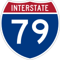
600 mm by 600 mm (24 in by 24 in) Interstate shield, made to the specifications of the 2004 edition of Standard Highway Signs (sign M1-1). Uses the Roadgeek 2005 fonts archive copy at the Wayback Machine. (United States law does not permit the copyrighting of typeface designs, and the fonts are meant to be copies of a U.S. Government-produced work anyway.) Colors are from [1] (Pantone Red 187 and Blue 294), converted to RGB by [2]. The outside border has a width of 1 (1 mm) and a color of black so it shows up; in reality, signs have no outside border.

Captions

Add a one-line explanation of what this file represents

Items portrayed in this file

depicts

image/svg+xml

File history


Click on a date/time to view the file as it appeared at that time.
Date/TimeThumbnailDimensionsUserComment
current01:55, 28 July 2022Thumbnail for version as of 01:55, 28 July 2022601 × 601 (8 KB)Smasongarrisonslimmed down with svgomg // Editing SVG source code using c:User:Rillke/SVGedit.js
05:35, 18 May 2007Thumbnail for version as of 05:35, 18 May 2007601 × 601 (13 KB)Ltljltlj
02:12, 5 April 2006Thumbnail for version as of 02:12, 5 April 2006601 × 601 (12 KB)SPUI~commonswiki{{spuiother}} 600 mm by 600 mm (24 in by 24 in) Interstate shield, made to the specifications of the [http://mutcd.fhwa.dot.gov/SHSm/Guide.pdf 2004 edition of Standard Highway Signs] (sign M1-1). Uses the [http://www.triskele.com/fonts/index.html Roadgeek


More than 100 pages use this file. The following list shows the first 100 pages that use this file only. A full list is available.

Allegheny County, Pennsylvania

Butler County, Pennsylvania

Charleston metropolitan area, West Virginia

Clarksburg, West Virginia

Corridor D

Crawford County, Pennsylvania

Erie, Pennsylvania

Erie County, Pennsylvania

Fairmont, West Virginia

Greater Pittsburgh

Greene County, Pennsylvania

Interstate 279

Interstate 376

Interstate 579

Interstate 64 in West Virginia

Interstate 68

Interstate 70

Interstate 70 in Pennsylvania

Interstate 76 (OhioNew Jersey)

Interstate 77

Interstate 77 in West Virginia

Interstate 79

Interstate 80

Interstate 80 in Pennsylvania

Interstate 90

Jamestown, New York

List of Interstate Highways

List of Interstate Highways in West Virginia

List of State Routes in Allegheny County, Pennsylvania

List of crossings of the Monongahela River

List of crossings of the Ohio River

Localexpress lanes

McKees Rocks Bridge

Meadville, Pennsylvania

Mercer County, Pennsylvania

Monongalia County, West Virginia

MonFayette Expressway

Morgantown, West Virginia

Neville Island Bridge

North Central West Virginia

North Country Trail

Northeastern United States

Pennsylvania Route 173

Pennsylvania Route 18

Pennsylvania Route 208

Pennsylvania Route 21

Pennsylvania Route 290

Pennsylvania Route 358

Pennsylvania Route 5

Pennsylvania Route 50

Pennsylvania Route 51

Pennsylvania Route 576

Pennsylvania Route 58

Pennsylvania Route 60

Pennsylvania Route 65

Pennsylvania Route 68

Pennsylvania Route 99

Pennsylvania Turnpike

Pittsburgh

Pleasant Valley, Marion County, West Virginia

Sewickley Bridge

U.S. Route 119

U.S. Route 19

U.S. Route 20

U.S. Route 22

U.S. Route 22 in Pennsylvania

U.S. Route 250

U.S. Route 30

U.S. Route 30 in Pennsylvania

U.S. Route 322

U.S. Route 33

U.S. Route 40

U.S. Route 422

U.S. Route 48

U.S. Route 50

U.S. Route 50 in West Virginia

U.S. Route 6

U.S. Route 60 in West Virginia

U.S. Route 62

U.S. Route 6 in Pennsylvania

Washington, Pennsylvania

Washington County, Pennsylvania

West Virginia Route 100

West Virginia Route 114

West Virginia Route 131

West Virginia Route 15

West Virginia Route 16

West Virginia Route 20

West Virginia Route 270

West Virginia Route 310

West Virginia Route 36

West Virginia Route 4

West Virginia Route 5

West Virginia Route 58

West Virginia Route 7

West Virginia Route 705

West Virginia Route 80

West Virginia Route 92

Talk:U.S. Route 322

User:MPD01605/sandbox3


View more links to this file.

Global file usage


The following other wikis use this file:

Usage on az.wikipedia.org

Eri (Pensilvaniya)

Şablon:Geokompas

Şablon:Geokompas/doc


Usage on bar.wikipedia.org

Interstate 80


Usage on bn.wikipedia.org


Usage on bs.wikipedia.org

Pittsburgh


Usage on de.wikipedia.org

Interstate 70

Liste der Interstate Highways

Interstate 80

Interstate 90

Interstate 79

Interstate 77

Interstate 68

U.S. Highway 6

Liste der State-, U.S.- und Interstate-Highways in Pennsylvania


Usage on de.wikivoyage.org

West Virginia

Charleston (West Virginia)


Usage on diq.wikipedia.org

Şablon:Geocompass

Şablon:Geocompass/doc


Usage on en.wikivoyage.org

Homewood (Pennsylvania)

Bridgeport (West Virginia)

Charleston (West Virginia)

Clarksburg (West Virginia)

Coraopolis

Cranberry

Erie

Fairmont (West Virginia)

Franklin (Venango County)

Franklin Park (Pennsylvania)

Grove City (Pennsylvania)

Meadville

Morgantown

Pittsburgh

Robinson Township

Ross Township

Sutton (West Virginia)

Washington (Pennsylvania)

Weston (West Virginia)

Wheeling

Youngstown (Ohio)

Zelienople

User:Sumone10154/Archive/routeboxes/I-79

Driving in the United States


Usage on eo.wikipedia.org

Listo de Insterŝtataj Ŝoseoj


Usage on es.wikipedia.org

Anexo:Autopistas Interestatales Primarias

Anexo:Autopistas interestatales auxiliares

Pennsylvania Turnpike

Interestatal 80

Condado de Lawrence (Pensilvania)

U.S. Route 119


View more global usage of this file.

Metadata

This file contains additional information, probably added from the digital camera or scanner used to create or digitize it.

If the file has been modified from its original state, some details may not fully reflect the modified file.


Retrieved from "https://en.wikipedia.org/wiki/File:I-79.svg"


Languages


This page is not available in other languages.
 

Wikipedia


Privacy policy

About Wikipedia

Disclaimers

Contact Wikipedia

Code of Conduct

Developers

Statistics

Cookie statement

Terms of Use

Desktop