Home  

Random  

Nearby  


Log in  


Settings  


Donate  


About Wikipedia  

Disclaimers  


Wikipedia


File:Kyoto géolocalisation relief.svg


File  

Talk  


Language  

Watch  


File

File history

File usage

Global file usage

Metadata
File:Kyoto géolocalisation relief.svg
Size of this PNG preview of this SVG file: 538 × 600 pixels. Other resolutions: 215 × 240 pixels | 430 × 480 pixels | 689 × 768 pixels | 918 × 1,024 pixels | 1,837 × 2,048 pixels | 740 × 825 pixels.

Original file(SVG file, nominally 740 × 825 pixels, file size: 4.08 MB)


Summary

Description
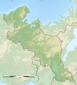
Français : Carte physique vierge de la préfecture de Kyoto.

English: Blank physical map of the Kyoto prefecture.


Date
Source Own work
Author Flappiefh

Licensing

I, the copyright holder of this work, hereby publish it under the following license:
w:en:Creative Commons
attribution share alike
This file is licensed under the Creative Commons Attribution-Share Alike 4.0 International license.
You are free:
  • to share – to copy, distribute and transmit the work
  • to remix – to adapt the work
  • Under the following conditions:

    Captions

    Add a one-line explanation of what this file represents

    Items portrayed in this file

    depicts

    some value

    2 November 2016

    File history


    Click on a date/time to view the file as it appeared at that time.
    Date/TimeThumbnailDimensionsUserComment
    current12:04, 2 November 2016Thumbnail for version as of 12:04, 2 November 2016740 × 825 (4.08 MB)Flappiefh


    The following pages on the English Wikipedia use this file (pages on other projects are not listed):

    1927 North Tango earthquake

    Akasakaimai Tumuli

    Amino Chōshiyama Kofun

    Ayabe Domain

    Battle of Yamazaki

    Chitose Kurumazuka Kofun

    Ebisuyama Kofun

    Fukuchiyama Castle

    Fukuchiyama Domain

    Fushimi Castle

    Hakoishihama Site

    Hayaagari Tile Kiln Site

    Hijirizuka Kofun - Ayamezuka Kofun

    Hirakawa temple ruins

    Hiyoshigaoka - Akashi Tumuli

    Izumo-daijingū

    Kameyama Castle (Kyoto)

    Kennin-ji

    Kisaichi Maruyama Kofun

    Kiyomizu-dera

    Koma-dera

    Kono Shrine

    Kontai-ji

    Kuse temple ruins

    Mineyama Domain (Tango)

    Miyazu Castle

    Miyazu Domain

    Moriyama Site

    Mount Kasagi

    Nagaoka-kyō

    Revolt of Ashikaga Yoshiaki

    Sanga Stadium by Kyocera

    Shinmeiyama Kofun

    Shirageyama Kofun

    Shōdō Kanga ruins

    Shōka-dō

    Siege of Tanabe

    Sonobe Domain

    Tanabe Castle (Tango)

    Tanba-Kameyama Domain

    Tanba Kokubun-ji

    Tango-Tanabe Domain

    Tango Kokubun-ji

    Tsubai Ōtsukayama Kofun

    Tsukuriyama Kofun (Yosano)

    Tsuruki Kofun Cluster

    Ubusunayama Kofun

    Yamaga Domain

    Yasaka Pagoda

    Yodo Domain

    Ōyamazaki Tile Kiln Site

    User:Ty654/List of earthquakes from 1900-1949 exceeding magnitude 7+

    User:Ty654/List of earthquakes from 1965-1969 exceeding magnitude 6+

    User:Ty654/List of earthquakes from 1990-1994 exceeding magnitude 6+

    Module:Location map/data/Japan Kyoto Prefecture

    Module:Location map/data/Japan Kyoto Prefecture/doc


    Global file usage


    The following other wikis use this file:

    Usage on ce.wikipedia.org

    Киото (префектура)


    Usage on de.wikipedia.org

    Burg Nijō

    Funaoka-yama

    Burg Fukuchiyama

    Burg Fushimi

    Burg Kameyama (Tamba)

    Burg Yodo

    Sanin-Kaigan-Nationalpark

    Vorlage:Positionskarte Japan Präfektur Kyōto

    Burg Miyazu

    Burg Tanabe (Tango)


    Usage on fa.wikipedia.org

    قلعه میازو

    پاگودا یاساکا

    کوه کاساگی


    Usage on frr.wikipedia.org

    Vorlage:Positionskarte Japan Präfektur Kyōto


    Usage on fr.wikipedia.org

    Kyoto

    Mont Hiei

    Fukuchiyama

    Yawata (Kyoto)

    Mont Kurama

    Maizuru

    Miyazu

    Kameoka

    Jōyō

    Mukō

    Kyōtanabe

    Kyōtango

    Nantan

    Kizugawa

    Mont Atago

    Ōyamazaki

    Kyōtamba

    Kumiyama

    Ine (Kyoto)

    Yosano

    Ujitawara

    Ide (Kyoto)

    Kasagi (Kyoto)

    Wazuka

    Minamiyamashiro

    Seika (Kyoto)

    Mont Miyama

    Ōeyama

    Modèle:Géolocalisation/Préfecture de Kyoto

    Module:Carte/données/préfecture de kyoto

    Wikipédia:Atelier graphique/Cartes/Archives/novembre 2016

    Utoro

    Baie de Kumihama

    Péninsule de Tango

    Keihoku


    View more global usage of this file.

    Metadata

    This file contains additional information, probably added from the digital camera or scanner used to create or digitize it.

    If the file has been modified from its original state, some details may not fully reflect the modified file.


    Retrieved from "https://en.wikipedia.org/wiki/File:Kyoto_géolocalisation_relief.svg"


    Languages


    This page is not available in other languages.
     

    Wikipedia


    Privacy policy

    About Wikipedia

    Disclaimers

    Contact Wikipedia

    Code of Conduct

    Developers

    Statistics

    Cookie statement

    Terms of Use

    Desktop