Home  

Random  

Nearby  


Log in  


Settings  


Donate  


About Wikipedia  

Disclaimers  


Wikipedia


File:Laos adm location map.svg


File  

Talk  


Language  

Watch  


File

File history

File usage

Global file usage

Metadata
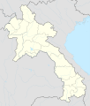
File:Laos adm location map.svg
Size of this PNG preview of this SVG file: 510 × 600 pixels. Other resolutions: 204 × 240 pixels | 408 × 480 pixels | 653 × 768 pixels | 870 × 1,024 pixels | 1,741 × 2,048 pixels | 1,961 × 2,307 pixels.

Original file(SVG file, nominally 1,961 × 2,307 pixels, file size: 477 KB)


Summary

Description
Deutsch: Positionskarte von Laos
English: Location map of Laos

Equirectangular projection, vertical stretching 105 %
Border coordinates

22.9
99.7←↕→108.0
13.6
 Info This map is part of a series of location maps with unified standards: SVG as file format, standardised colours and name scheme. The boundaries on these maps always show the de facto situation and do not imply any endorsement or acceptance. In case of changes of the shown area the file is updated. The old version will be uploaded as a new file and thus is still available.
Date
Source

Own work using:

Author NordNordWest
Other versions
Kartenwerkstatt
This map has been made or improved in the German Kartenwerkstatt (Map Lab). You can propose maps to improve as well.

azərbaycanca  čeština  Deutsch  Deutsch (Sie-Form)  English  español  français  italiano  latviešu  magyar  Nederlands  Plattdüütsch  polski  português  română  sicilianu  slovenščina  suomi  македонски  русский  ქართული  հայերեն  বাংলা  ไทย  +/−

Licensing

Usage of this file with:

Map: NordNordWest, Licence: Creative Commons by-sa-3.0 de

explanatory notes: Legally binding is only the full legalcode. For a free usage I recommend to respect the following licence conditions:
1. Provide my name as given above: NordNordWest,
2. a copy of, or the URI for, the applicable license: https://creativecommons.org/licenses/by-sa/3.0/de/legalcode,
3. the title of the work,
4. in the case of an adaptation, a credit identifying the use of the work in the adaptation.
This license and the rights granted hereunder will terminate automatically upon any breach by you of the terms of this license. Any of the above conditions can be waived if you get permission from the copyright holder. If you have questions or wish differing conditions, please contact me through nnwest@t-online.deormy discussion page

w:en:Creative Commons
attribution share alike
This file is licensed under the Creative Commons Attribution-Share Alike 3.0 Germany license.
Attribution: Karte: NordNordWest, Lizenz: Creative Commons by-sa-3.0 de
You are free:
  • to share – to copy, distribute and transmit the work
  • to remix – to adapt the work
  • Under the following conditions:

    Captions

    Add a one-line explanation of what this file represents

    Items portrayed in this file

    depicts

    1 December 2014

    File history


    Click on a date/time to view the file as it appeared at that time.
    Date/TimeThumbnailDimensionsUserComment
    current16:38, 14 February 2018Thumbnail for version as of 16:38, 14 February 20181,961 × 2,307 (477 KB)NordNordWestupd
    18:36, 1 December 2014Thumbnail for version as of 18:36, 1 December 20141,961 × 2,307 (530 KB)NordNordWest== {{int:filedesc}} == {{Information |Description= {{de|1=Positionskarte von Laos}} {{en|1=Location map of Laos}} {{Location map series N |stretching=105 |top=22.9 |bottom=13.6 |left=99.7 |right=108.0 }} |Source={{Own using}} * United States National I...


    More than 100 pages use this file. The following list shows the first 100 pages that use this file only. A full list is available.

    A Alao

    A Cho Ban Nôi

    A Doi

    A Kiom

    A Kleum

    A Lim

    A Ling

    A Magne

    Amantaka

    Attapeu

    Baháʼí Faith in Laos

    Ban Arapruich

    Ban Chom

    Ban Dak-Lay

    Ban Ekchoum-Phoukaniang

    Ban Gnangteu

    Ban Hinlat

    Ban Huoeisay Airport

    Ban Khouy

    Ban Kong-Ek

    Ban Kongmi

    Ban Lapoung

    Ban Lomlay

    Ban Namavong Noy

    Ban Onglouang

    Ban Pakha

    Ban Pako

    Ban Phiadouang

    Ban Phiaha

    Ban Phiahom

    Ban Phiakhamdaonang

    Ban Phiakhamkak

    Ban Phialu Gnai

    Ban Phialu Noy

    Ban Phianong

    Ban Phiapang

    Ban Phiaseuk

    Ban Phokandong

    Ban Phomoun Gnai

    Ban Renthuk

    Ban Senchay

    Ban Senkeo

    Ban Senkhamphon

    Ban Senlouang

    Ban Tanong

    Ban Thattamo

    Ban Vianglouang

    Ban Vongxay

    Borikham

    Buddha Park

    Don Chan Palace

    Hatkhiphong

    Hotel Beau Rivage Mekong

    Houayhe

    Houaysae

    Houayxay

    Kham district

    Lao Ngam, Laos

    Lao Plaza Hotel

    List of World Heritage Sites in Laos

    List of top-division football clubs in AFC countries

    Long Tieng

    Louang Namtha Airport

    Luang Namtha

    Luang Prabang

    Luang Prabang International Airport

    Mok May district

    Muang Xay

    Na Hom, Bolikhamsai Province, Laos

    Na Khaulom

    Namkha, Laos

    Namor district

    Nong Boua, Bolikhamsai

    Nong Het district

    Oudomsay Airport

    Pakse

    Pakse International Airport

    Paodon

    Patuxai

    Phine district

    Phongsali

    Phonsavan

    Sainyabuli

    Salavan (city)

    Sanamxai

    Savannakhet

    Savannakhet Airport

    Sayaboury Airport

    Sekong

    Seponh district

    Settha Palace Hotel

    Thakhek

    Thanaleng railway station

    Vang Tao Incident

    Vang Vieng

    Wattay International Airport

    Xaisi

    Xam Neua

    Xaysetha

    Xieng Khouang Airport


    View more links to this file.

    Global file usage


    The following other wikis use this file:

    Usage on af.wikipedia.org

    Pakse


    Usage on ast.wikipedia.org

    Aeropuertu Internacional Wattay

    Vientián

    Módulu:Mapa de llocalización/datos/Laos/usu


    Usage on blk.wikipedia.org

    :Location map/data/Laos

    :Location map/data/Laos/doc


    Usage on bn.wikipedia.org

    িি

    : ি 

    ি: ি//

    ি: ি///ি


    Usage on cdo.wikipedia.org

    Vientiane

    Luang Prabang


    Usage on de.wikipedia.org

    Luang Prabang

    Vientiane

    Savannakhet

    Pakse

    Attapeu

    Flughafen Vientiane

    Phonsavan

    Sam Neua

    Vieng Xai

    Vang Vieng

    Vorlage:Positionskarte Laos

    Thakhek

    Benutzer:Luisah/Muang Xay

    Phongsali

    Champasak (Stadt)

    Muang Xay

    Militärflugplatz Long Tieng

    Muang Sing

    Boten (Luang Namtha)

    Luang Namtha

    Pakxong

    Pakxan

    Liste der Flughäfen und Flugplätze in Laos

    Veun Kham

    Muang Khong

    Hat Xai Khun

    Nakasong

    Thakho

    Lao-Nippon-Brücke

    Set Tai

    Khinak

    Ban Houayxay

    Neues Nationalstadion von Laos

    Nationalstadion von Laos

    Savannakhet-Provinzialstadion

    Champasak-Stadion

    Muang Kham (Laos)

    Tham Kong Lo


    View more global usage of this file.

    Metadata

    This file contains additional information, probably added from the digital camera or scanner used to create or digitize it.

    If the file has been modified from its original state, some details may not fully reflect the modified file.


    Retrieved from "https://en.wikipedia.org/wiki/File:Laos_adm_location_map.svg"


    Languages


    This page is not available in other languages.
     

    Wikipedia


    Privacy policy

    About Wikipedia

    Disclaimers

    Contact Wikipedia

    Code of Conduct

    Developers

    Statistics

    Cookie statement

    Terms of Use

    Desktop