Home  

Random  

Nearby  


Log in  


Settings  


Donate  


About Wikipedia  

Disclaimers  


Wikipedia


File:Outline Map of Murmansk region.svg


File  

Talk  


Language  

Watch  


File

File history

File usage

Global file usage

Metadata
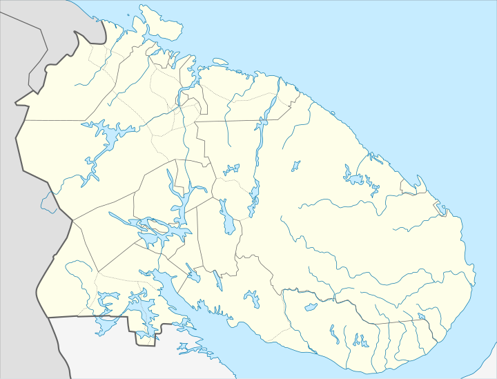
File:Outline Map of Murmansk region.svg
Size of this PNG preview of this SVG file: 720 × 548 pixels. Other resolutions: 315 × 240 pixels | 631 × 480 pixels | 1,009 × 768 pixels | 1,280 × 974 pixels | 2,560 × 1,948 pixels.

Original file(SVG file, nominally 720 × 548 pixels, file size: 2.04 MB)


Summary

Description
Русский: Позиционная карта Мурманской области
  • Проекция — равноугольная.
  • Стандартная параллель — 68°00′00″с.ш.
  • Параметры шаблона (координаты краёв):
  • север — 70° С
  • юг — 66° С
  • восток — 42° В
  • запад — 28° В
  • Date
    Source

    Own work

     
    This W3C-unspecified vector image was created with Inkscape .
    Author Das steinerne Herz
    Other versions

    Derivative works of this file:

    Licensing

    I, the copyright holder of this work, hereby publish it under the following licenses:
    w:en:Creative Commons
    attribution share alike
    This file is licensed under the Creative Commons Attribution-Share Alike 3.0 Unported license.
    You are free:
    • to share – to copy, distribute and transmit the work
  • to remix – to adapt the work
  • Under the following conditions:
    GNU head Permission is granted to copy, distribute and/or modify this document under the terms of the GNU Free Documentation License, Version 1.2 or any later version published by the Free Software Foundation; with no Invariant Sections, no Front-Cover Texts, and no Back-Cover Texts. A copy of the license is included in the section entitled GNU Free Documentation License.
    You may select the license of your choice.

    Captions

    Add a one-line explanation of what this file represents

    Items portrayed in this file

    depicts

    some value

    6 February 2011

    File history


    Click on a date/time to view the file as it appeared at that time.
    Date/TimeThumbnailDimensionsUserComment
    current01:27, 8 February 2011Thumbnail for version as of 01:27, 8 February 2011720 × 548 (2.04 MB)InsiderНа всех картах исправлено цветовое оформление Карелии и Архангельской области; не на всех картах исправлена окраска островов, на карте Кол
    11:03, 7 February 2011Thumbnail for version as of 11:03, 7 February 2011720 × 548 (2.04 MB)Das steinerne Herzcorrection (borders of districts)
    08:15, 7 February 2011Thumbnail for version as of 08:15, 7 February 2011720 × 548 (2.04 MB)Das steinerne Herzcorr
    08:11, 7 February 2011Thumbnail for version as of 08:11, 7 February 2011720 × 548 (2.04 MB)Das steinerne Herzcorr
    08:07, 7 February 2011Thumbnail for version as of 08:07, 7 February 2011720 × 548 (2.04 MB)Das steinerne Herzcorrection
    08:06, 7 February 2011Thumbnail for version as of 08:06, 7 February 2011720 × 548 (2.04 MB)Das steinerne Herz{{Information |Description ={{ru|1=Позиционная карта Мурманской области *Проекция — равноугольная. *Стандартная параллель — 68°00′00″с.ш. *Параметры шабл�


    More than 100 pages use this file. The following list shows the first 100 pages that use this file only. A full list is available.

    25 km Zheleznoy Dorogi MonchegorskOlenya

    27 km Zheleznoy Dorogi MonchegorskOlenya

    Afrikanda (air base)

    Afrikanda (rural locality)

    Alakurtti (air base)

    Apatity

    Belokamenka, Murmansk Oblast

    Beloye More (rural locality)

    Berezovka (air base)

    Drozdovka, Murmansk Oblast

    Fedoseyevka, Murmansk Oblast

    Gadzhiyevo

    Goryachiye Ruchyi

    Imandra

    Kandalaksha

    Kanevka

    Khibiny, Murmansk Oblast

    Kildinstroy

    Kilpyavr (air base)

    Kirovsk, Murmansk Oblast

    KirovskApatity Airport

    Knyazhaya Guba

    Koashva

    Kola, Russia

    Kola Superdeep Borehole

    Kolvitsa

    Kovda, Lesozavodsky Territorial Okrug, Kandalakshsky District, Murmansk Oblast

    Kovda, Zelenoborsky, Kandalakshsky District, Murmansk Oblast

    Krasnoshchelye

    Kuropta

    Kuvshinskaya Salma

    Laplandiya

    Laplandsky Zapovednik

    Lesozavodsky, Murmansk Oblast

    Leypi

    Liinakhamari

    Lovozero (rural locality)

    Lumbovka, Murmansk Oblast

    Luostari/Pechenga (air base)

    Luostari (inhabited locality)

    Luvenga

    Mayak Gorodetsky

    Molochny

    Monchegorsk

    Monchegorsk (air base)

    Murmansk

    Murmansk Airport

    Murmashi

    Mys-Chyorny

    Nikel

    Nivsky

    Northwestern Federal District

    Oktyabrsky, Murmansk Oblast

    Olenegorsk, Murmansk Oblast

    Olenya (air base)

    Ostrovnoy, Murmansk Oblast

    Pechenga (urban-type settlement), Murmansk Oblast

    Pinozero

    Pirenga

    Polyarny, Murmansk Oblast

    Polyarnye Zori

    Poyakonda

    Prolivy

    Putevye Usadby 1331 km

    Rayakoski

    Retinskoye

    Revda, Murmansk Oblast

    Rikolatva

    Roslyakovo, Murmansk Oblast

    Ruchyi, Murmansk Oblast

    Safonovo, Murmansk Oblast

    Sayda-Guba

    Severomorsk

    Severomorsk-1

    Severomorsk-2

    Severomorsk-3 (air base)

    Severomorsk-3 (rural locality)

    Shchukozero

    Snezhnogorsk, Murmansk Oblast

    Sosnovka, Murmansk Oblast

    Svyatoy Nos, Murmansk Oblast

    Teriberka

    Tersko-Orlovsky Mayak

    Tik-Guba

    Titan, Russia

    Tsypnavolok

    Tumanny

    Umba, Russia

    Varzuga (rural locality)

    Verkhnetulomsky

    Vidyayevo

    Vysoky, Murmansk Oblast

    Yagelny Bor

    Yona, Russia

    Yonsky

    Zaozyorsk

    Zapolyarny, Murmansk Oblast

    Zarechensk

    Zasheyek, Murmansk Oblast

    Zelenoborsky


    View more links to this file.

    Global file usage


    The following other wikis use this file:

    Usage on af.wikipedia.org

    Sjabloon:Liggingkaart Moermansk-oblast


    Usage on ar.wikipedia.org

    قالب:Location map Russia Murmansk Oblast


    Usage on az.wikipedia.org

    Şablon:Yer xəritəsi Rusiya Murmansk vilayəti

    Svyatoynosski körfəzi


    Usage on ba.wikipedia.org

    Ҡалып:Шаблон:ПозКарта Рәсәй Мурманск өлкәһе


    Usage on be.wikipedia.org

    Мурманск

    Палярныя Зоры

    Апатыты

    Печанга

    Аленягорск

    Астраўной

    Гаджыева

    Заазёрск

    Запалярны

    Севераморск

    Снежнагорск (Мурманская вобласць)

    Кіраўск (Мурманская вобласць)

    Каўдор

    Кола (Мурманская вобласць)

    Манчагорск

    Высокі

    Шаблон:На карце/Расія Мурманская вобласць

    Нікель (Мурманская вобласць)

    Умба (пасёлак гарадскога тыпу)

    Туманны

    Сафонава (Мурманская вобласць)

    Рэўда (Мурманская вобласць)

    Лінахамары

    Запалярны (Ямала-Ненецкая аўтаномная акруга)

    Відзяева

    Кільдзінстрой

    Лавозера (сяло)


    Usage on bg.wikipedia.org

    Шаблон:ПК Русия Мурманска област


    Usage on bn.wikipedia.org

     ি 


    Usage on ceb.wikipedia.org

    Plantilya:Location map Russia Murmansk Oblast


    Usage on ce.wikipedia.org

    Мурманск

    Североморск

    Кеп:Меттиган карта Росси Мурманскан область

    Кандалакша

    Бели Море (нах беха меттиг)

    Федосеевка (Мурманскан область)

    Лесозаводски (Мурманскан область)

    Приозерни (Мурманскан область)

    Ручьи (Мурманскан область)

    Ковда (эвла)

    Ковдозеро (эвла)

    Колвица (эвла)

    Лувеньга (эвла)

    Нямозеро (станци)

    Ковда (станци)


    View more global usage of this file.

    Metadata

    This file contains additional information, probably added from the digital camera or scanner used to create or digitize it.

    If the file has been modified from its original state, some details may not fully reflect the modified file.


    Retrieved from "https://en.wikipedia.org/wiki/File:Outline_Map_of_Murmansk_region.svg"


    Languages


    This page is not available in other languages.
     

    Wikipedia


    Privacy policy

    About Wikipedia

    Disclaimers

    Contact Wikipedia

    Code of Conduct

    Developers

    Statistics

    Cookie statement

    Terms of Use

    Desktop