Home  

Random  

Nearby  


Log in  


Settings  


Donate  


About Wikipedia  

Disclaimers  


Wikipedia


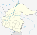
File:Outline Map of Tyumen Oblast.svg


File  

Talk  


Language  

Watch  


File

File history

File usage

Global file usage

Metadata
File:Outline Map of Tyumen Oblast.svg
Size of this PNG preview of this SVG file: 642 × 600 pixels. Other resolutions: 257 × 240 pixels | 514 × 480 pixels | 822 × 768 pixels | 1,096 × 1,024 pixels | 2,193 × 2,048 pixels | 1,000 × 934 pixels.

Original file(SVG file, nominally 1,000 × 934 pixels, file size: 228 KB)


Summary

Description
Русский: Позиционная карта Тюменской области
  • Проекция — равноугольная.
  • Стандартная параллель — 57°00′00″с.ш.
  • Параметры шаблона (координаты краёв):
  • |top    = 60.5
    |bottom = 54.8
    |left   = 64.3
    |right  = 75.5
    
    Date
    Source

    Own work

     
    This W3C-unspecified vector image was created with Inkscape .
    • Схема территориального планирования Тюменской области
    • Генеральный план городского округа город Ишим
    • Генеральный план городского округа город Тобольск
    • Генеральный план городского округа город Тюмень
    Author Виктор В
    Other versions

    Derivative works of this file:  Omsk Oblast region notext.svg [edit]

    Licensing

    Public domain I, the copyright holder of this work, release this work into the public domain. This applies worldwide.
    In some countries this may not be legally possible; if so:
    I grant anyone the right to use this work for any purpose, without any conditions, unless such conditions are required by law.

    Captions

    Add a one-line explanation of what this file represents

    Items portrayed in this file

    depicts

    some value

    25 August 2010

    image/svg+xml

    File history


    Click on a date/time to view the file as it appeared at that time.
    Date/TimeThumbnailDimensionsUserComment
    current09:08, 2 April 2023Thumbnail for version as of 09:08, 2 April 20231,000 × 934 (228 KB)Вальдимарзмінив кордон навколо Ялуторовська
    16:48, 15 February 2023Thumbnail for version as of 16:48, 15 February 20231,000 × 934 (229 KB)Вальдимарзмінив кордон
    17:45, 27 August 2010Thumbnail for version as of 17:45, 27 August 20101,000 × 934 (112 KB)Виктор В+3 городских округа
    16:27, 25 August 2010Thumbnail for version as of 16:27, 25 August 20101,000 × 934 (104 KB)Виктор В== {{int:filedesc}} == {{Information |Description={{ru|1=Позиционная карта Тюменской области *Проекция — равноугольная. *Стандартная параллель — 57°00′00″с.ш. *Парам�


    The following pages on the English Wikipedia use this file (pages on other projects are not listed):

    2014 Winter Olympics torch relay

    Abalak, Tyumen Oblast

    Abatskoye

    Antipinsky Refinery

    Armizonskoye

    Aromashevo

    Dubrovinskoye rural settlement

    Ingala Valley

    Ishim, Tyumen Oblast

    Roshchino International Airport

    Sladkovo, Tyumen Oblast

    Tobolsk

    Tyumen

    Ural Federal District

    Yalutorovsk

    Zavodoukovsk

    User:PavelYurasov/Sladkovo

    Module:Location map/data/Russia Tyumen Oblast

    Module:Location map/data/Russia Tyumen Oblast/doc


    Global file usage


    The following other wikis use this file:

    Usage on af.wikipedia.org

    Tjoemen

    Sjabloon:Liggingkaart Tjoemen-oblast


    Usage on ar.wikipedia.org

    قالب:Location map Russia Tyumen Oblast


    Usage on ba.wikipedia.org

    Тубыл (ҡала)

    Ҡалып:ПозКарта Рәсәй Төмән өлкәһе


    Usage on be.wikipedia.org

    Табольск

    Ялутараўск

    Ішым

    Заводаўкоўск

    Цюмень

    Шаблон:На карце/Расія Цюменская вобласць

    Галышманава

    Абацкае

    Амуцінскае

    Армізонскае

    Яркава (Цюменская вобласць)

    Юргінскае

    Ніжняя Таўда

    Упорава

    Сладкова (Цюменская вобласць)

    Уват (Цюменская вобласць)

    Казанскае (Казанскі раён)

    Ісецкае (Цюменская вобласць)

    Вялікае Сарокіна

    Вікулава (Цюменская вобласць)

    Бярдзюжжа (Цюменская вобласць)

    Арамашава


    Usage on bg.wikipedia.org

    Шаблон:ПК Русия Тюменска област


    Usage on ceb.wikipedia.org

    Plantilya:Location map Russia Tyumen Oblast


    Usage on ce.wikipedia.org

    Тюмень

    Тобольск

    Абатски

    Артамонова (Абатскан кӀошт)

    Балаир (Тюменан область)

    Банниково (Тюменан область)

    Берендеева

    Бития

    Бобыльск (Тюменан область)

    Бокова

    Болдырево (Тюменан область)

    Бурдина

    Быструха (Тюменан область)

    Водолазово (Тюменан область)

    Волостни (Тюменан область)

    Восток (Тюменан область)

    Горки (Тюменан область)

    Еремина

    Ефимова

    Земляни (Абатскан кӀошт)

    Камышинка (Абатскан кӀошт)


    View more global usage of this file.

    Metadata

    This file contains additional information, probably added from the digital camera or scanner used to create or digitize it.

    If the file has been modified from its original state, some details may not fully reflect the modified file.


    Retrieved from "https://en.wikipedia.org/wiki/File:Outline_Map_of_Tyumen_Oblast.svg"


    Languages


    This page is not available in other languages.
     

    Wikipedia


    Privacy policy

    About Wikipedia

    Disclaimers

    Contact Wikipedia

    Code of Conduct

    Developers

    Statistics

    Cookie statement

    Terms of Use

    Desktop