Home  

Random  

Nearby  


Log in  


Settings  


Donate  


About Wikipedia  

Disclaimers  


Wikipedia


File:Sierra Leone adm location map.svg


File  

Talk  


Language  

Watch  


File

File history

File usage

Global file usage

Metadata
File:Sierra Leone adm location map.svg
Size of this PNG preview of this SVG file: 600 × 600 pixels. Other resolutions: 240 × 240 pixels | 480 × 480 pixels | 768 × 768 pixels | 1,024 × 1,024 pixels | 2,048 × 2,048 pixels | 1,606 × 1,606 pixels.

Original file(SVG file, nominally 1,606 × 1,606 pixels, file size: 143 KB)


Summary

Description
Deutsch: Positionskarte von Sierra Leone
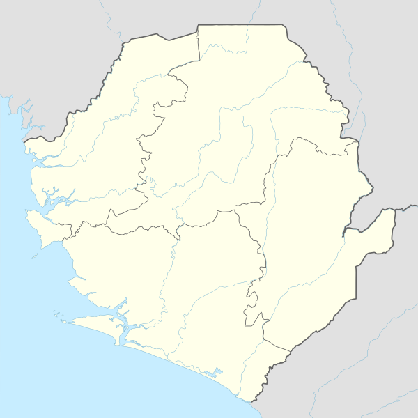
English: Location map of Sierra Leone

Equirectangular projection, vertical stretching 100 %
Border coordinates

10.2
-13.5←↕→-10.1
6.8
 Info This map is part of a series of location maps with unified standards: SVG as file format, standardised colours and name scheme. The boundaries on these maps always show the de facto situation and do not imply any endorsement or acceptance. In case of changes of the shown area the file is updated. The old version will be uploaded as a new file and thus is still available.
Date
Source

Own work using:

  • United States National Imagery and Mapping Agency data
  • World Data Base II data
Author NordNordWest
Other versions
Kartenwerkstatt
This map has been made or improved in the German Kartenwerkstatt (Map Lab). You can propose maps to improve as well.

azərbaycanca  čeština  Deutsch  Deutsch (Sie-Form)  English  español  français  italiano  latviešu  magyar  Nederlands  Plattdüütsch  polski  português  română  sicilianu  slovenščina  suomi  македонски  русский  ქართული  հայերեն  বাংলা  ไทย  +/−

Licensing

Usage of this file with:

Map: NordNordWest, Licence: Creative Commons by-sa-3.0 de

explanatory notes: Legally binding is only the full legalcode. For a free usage I recommend to respect the following licence conditions:
1. Provide my name as given above: NordNordWest,
2. a copy of, or the URI for, the applicable license: https://creativecommons.org/licenses/by-sa/3.0/de/legalcode,
3. the title of the work,
4. in the case of an adaptation, a credit identifying the use of the work in the adaptation.
This license and the rights granted hereunder will terminate automatically upon any breach by you of the terms of this license. Any of the above conditions can be waived if you get permission from the copyright holder. If you have questions or wish differing conditions, please contact me through nnwest@t-online.deormy discussion page

w:en:Creative Commons
attribution share alike
This file is licensed under the Creative Commons Attribution-Share Alike 3.0 Germany license.
Attribution: Karte: NordNordWest, Lizenz: Creative Commons by-sa-3.0 de
You are free:
  • to share – to copy, distribute and transmit the work
  • to remix – to adapt the work
  • Under the following conditions:

    Captions

    Add a one-line explanation of what this file represents

    Items portrayed in this file

    depicts

    30 November 2014

    File history


    Click on a date/time to view the file as it appeared at that time.
    Date/TimeThumbnailDimensionsUserComment
    current15:11, 19 January 2018Thumbnail for version as of 15:11, 19 January 20181,606 × 1,606 (143 KB)NordNordWestupd
    13:49, 30 November 2014Thumbnail for version as of 13:49, 30 November 20141,606 × 1,606 (142 KB)NordNordWest== {{int:filedesc}} == {{Information |Description= {{de|1=Positionskarte von Sierra Leone}} {{en|1=Location map of Sierra Leone}} {{Location map series N |stretching=100 |top=10.2 |bottom=6.8 |left=-13.5 |right=-10.1 }} |Source={{Own using}} * United S...


    More than 100 pages use this file. The following list shows the first 100 pages that use this file only. A full list is available.

    Aberdeen, Sierra Leone

    Adonkia, Sierra Leone

    Ahmadiyya in Sierra Leone

    Alikalia

    Baiima

    Baoma

    Batkanu

    Benguema

    Binkolo

    Bo, Sierra Leone

    Bo Airport

    Bomi, Sierra Leone

    Bonthe

    Bum Chiefdom

    Bumbuna

    Bumpe

    Daru, Sierra Leone

    Falaba

    Fintonia

    Foindu

    Freetown International Airport

    Gandorhun

    Gbangbatoke Airport

    Gbap

    Gbinti

    Gendema

    Gerihun

    Goderich, Sierra Leone

    Grafton, Sierra Leone

    Hastings, Sierra Leone

    Hastings Airport (Sierra Leone)

    Jaiama-Nimokoro

    Joe Town

    Kabala, Sierra Leone

    Kaima

    Kamabai

    Kamakwie

    Kamaranka

    Kambia, Sierra Leone

    Kangama

    Karina, Sierra Leone

    Kasseh

    Kenema

    Kenema Airport

    Kissy, Sierra Leone

    Koidu

    Koindu

    Koya, Sierra Leone

    Leicester, Sierra Leone

    Lunsar

    Magbass

    Magburaka

    Makari, Bombali

    Makari, Tonkolili

    Makari Gbanti Chiefdom

    Makeni

    Malen Chiefdom

    Mapaki

    Marampa

    Masam

    Masiaka

    Matotoka

    Mattru Jong

    Mile 91, Sierra Leone

    Mongeri

    Motema

    Moyamba

    Newton, Sierra Leone

    Njala, Moyamba

    Pandebu-Tokpombu

    Panga Krim Chiefdom

    Pendembu, Sierra Leone

    Pepel

    Port Loko

    Pujehun

    Republic of Sierra Leone Armed Forces

    Ricketts, Sierra Leone

    Rokupr

    Rotifunk

    Samuel Town, Sierra Leone

    Segbwema

    Sembehun

    Sewafe

    Shenge

    Sherbro International Airport

    Sulima, Sierra Leone

    Sussex, Sierra Leone

    Telu

    Tihun

    Tikonko

    Tombodu

    Tongo, Sierra Leone

    Waterloo, Sierra Leone

    Wellington, Freetown

    Yamandu

    Yenga

    Yengema

    Yengema Airport

    Yonibana

    York, Sierra Leone


    View more links to this file.

    Global file usage


    The following other wikis use this file:

    Usage on af.wikipedia.org

    Bo

    Kenema

    Koidu


    Usage on ast.wikipedia.org

    Ciudá Llibre

    Módulu:Mapa de llocalización/datos/Sierra Lleona/usu


    Usage on azb.wikipedia.org

    آبردین، سیرا لئون

    واترلو، سیرا لئون

    ولینقتون، فریتوون

    یورک، سیرا لئون


    Usage on bn.wikipedia.org

    ি: ি//ি ি

    ি: ি//ি ি/ি


    Usage on de.wikipedia.org

    Freetown

    Banana Islands

    Kenema

    Bo (Sierra Leone)

    Loma Mountains

    Bunce Island

    Bintumani

    Makeni

    Sherbro (Insel)

    Koidu

    Kailahun

    Magburaka

    Bonthe

    Kabala

    Kambia

    Port Loko

    Pujehun

    Moyamba

    Lunsar

    Pandebu

    Waterloo (Sierra Leone)

    Ricketts Island

    Freetown International Airport

    Flugplatz Hastings

    Sulima (Sierra Leone)

    National-Stadion (Sierra Leone)

    Liste der Flughäfen in Sierra Leone

    Freetown Peninsula

    Yengema

    Vorlage:Positionskarte Sierra Leone

    Yele

    De-Ruyter-Stein

    Bastion des Fort Thornton

    Masakpaidu

    Tor zum alten Kings Yard

    Cleveland-Grabstein

    Treppen des alten Hafens und Wachhaus

    Mamamah International Airport

    Sonfon-See


    View more global usage of this file.

    Metadata

    This file contains additional information, probably added from the digital camera or scanner used to create or digitize it.

    If the file has been modified from its original state, some details may not fully reflect the modified file.


    Retrieved from "https://en.wikipedia.org/wiki/File:Sierra_Leone_adm_location_map.svg"


    Languages


    This page is not available in other languages.
     

    Wikipedia


    Privacy policy

    About Wikipedia

    Disclaimers

    Contact Wikipedia

    Code of Conduct

    Developers

    Statistics

    Cookie statement

    Terms of Use

    Desktop