Home  

Random  

Nearby  


Log in  


Settings  


Donate  


About Wikipedia  

Disclaimers  


Wikipedia


File:Spratly Islands relief location map.svg


File  

Talk  


Language  

Watch  


File

File history

File usage

Global file usage

Metadata
File:Spratly Islands relief location map.svg
Size of this PNG preview of this SVG file: 671 × 599 pixels. Other resolutions: 269 × 240 pixels | 538 × 480 pixels | 860 × 768 pixels | 1,147 × 1,024 pixels | 2,293 × 2,048 pixels | 720 × 643 pixels.

Original file(SVG file, nominally 720 × 643 pixels, file size: 2.23 MB)


Summary

Description
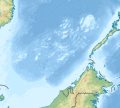
English: Location map of the Spratly Islands relief

N-S stretching 102.0004% in SVG file. Geographic limits of the map:

  • N: 13.5° N
  • S: 3.0° N
  • W: 108.0° E
  • E: 120.0° E
Based on South_China_Sea_relief
中文:南沙群岛地势图

N-S stretching 102.0004% in SVG file. Geographic limits of the map:

  • N: 13.5° N
  • S: 3.0° N
  • W: 108.0° E
  • E: 120.0° E
根据南中国海地势图制作。
Date
Source Own work
Author LuciferAhriman
Other versions

Licensing

I, the copyright holder of this work, hereby publish it under the following license:
w:en:Creative Commons
attribution share alike
This file is licensed under the Creative Commons Attribution-Share Alike 4.0 International license.
You are free:
  • to share – to copy, distribute and transmit the work
  • to remix – to adapt the work
  • Under the following conditions:

    Captions

    Spratly Islands relief @ South China Sea

    Items portrayed in this file

    depicts

    some value

    17 October 2020

    image/svg+xml

    File history


    Click on a date/time to view the file as it appeared at that time.
    Date/TimeThumbnailDimensionsUserComment
    current08:47, 17 October 2020Thumbnail for version as of 08:47, 17 October 2020720 × 643 (2.23 MB)LuciferAhrimanUploaded own work with UploadWizard


    The following pages on the English Wikipedia use this file (pages on other projects are not listed):

    Alison Reef

    Amboyna Cay

    Ardasier Reef

    Barque Canada Reef

    Bombay Castle (South China Sea)

    Central London Reef

    Collins Reef

    Commodore Reef

    Cornwallis South Reef

    Cuarteron Reef

    Dallas Reef

    Discovery Great Reef

    East London Reef

    Eldad Reef

    Erica Reef

    Fiery Cross Reef

    First Thomas Shoal

    Flat Island (South China Sea)

    Gaven Reefs

    Grierson Reef

    Half Moon Shoal

    Hughes Reef

    Investigator Shoal

    Irving Reef

    James Shoal

    Johnson South Reef

    Ladd Reef

    Lankiam Cay

    Lansdowne Reef

    Loaita Cay

    Loaita Island

    Loaita Nan

    Louisa Reef

    Mariveles Reef

    Mischief Reef

    Namyit Island

    Nanshan Island

    North Danger Reef

    Northeast Cay

    Northeast Investigator Shoal

    Pearson Reef

    Petley Reef

    Royal Captain Shoal

    Sabina Shoal

    Sand Cay

    Second Thomas Shoal

    Sin Cowe Island

    South Reef

    Southwest Cay

    Spratly Island

    Subi Reef

    Swallow Reef

    Taiping Island

    Tennent Reef

    Third Thomas Shoal

    Thitu Island

    West London Reef

    West York Island

    Western Reef

    Zhongzhou Reef

    File talk:Spratly Islands relief location map.svg

    Module:Location map/data/Spratly Islands relief

    Module:Location map/data/Spratly Islands relief/doc


    Global file usage


    The following other wikis use this file:

    Usage on bcl.wikipedia.org

    Ayungin Shoal

    Isla Spratly

    Isla Pag-asa


    Usage on fr.wikipedia.org

    Récif de Fiery Cross

    Modèle:Géolocalisation/Îles Spratleys

    Modèle:Géolocalisation/Îles Spratleys/Documentation


    Usage on ms.wikipedia.org

    Modul:Peta lokasi/data/Kepulauan Spratly

    Modul:Peta lokasi/data/Kepulauan Spratly/doc


    Usage on si.wikipedia.org

    Module:Location map/data/Spratly Islands relief

    Module:Location map/data/Spratly Islands relief/doc


    Usage on uk.wikipedia.org

    Модуль:Location map/data/Острови Спратлі/документація

    Модуль:Location map/data/Острови Спратлі

    Шаблон:Карта розташування Острови Спратлі


    Usage on uz.wikipedia.org

    Module:Location map/data/Spratly Islands relief

    Module:Location map/data/Spratly Islands relief/doc


    Usage on zh.wikipedia.org

    Template:Location map Spratly Islands

    Template:Location map Spratly Islands relief

    Module:Location map/data/Spratly Islands

    Module:Location map/data/Spratly Islands relief

    Module:Location map/data/Spratly Islands/doc

    Module:Location map/data/Spratly Islands relief/doc


    Metadata

    This file contains additional information, probably added from the digital camera or scanner used to create or digitize it.

    If the file has been modified from its original state, some details may not fully reflect the modified file.


    Retrieved from "https://en.wikipedia.org/wiki/File:Spratly_Islands_relief_location_map.svg"


    Languages


    This page is not available in other languages.
     

    Wikipedia


    Privacy policy

    About Wikipedia

    Disclaimers

    Contact Wikipedia

    Code of Conduct

    Developers

    Statistics

    Cookie statement

    Terms of Use

    Desktop