Home  

Random  

Nearby  


Log in  


Settings  


Donate  


About Wikipedia  

Disclaimers  


Wikipedia


File:Sweden Västerbotten location map.svg


File  

Talk  


Language  

Watch  


File

File history

File usage

Global file usage

Metadata
File:Sweden Västerbotten location map.svg
Size of this PNG preview of this SVG file: 623 × 599 pixels. Other resolutions: 249 × 240 pixels | 499 × 480 pixels | 798 × 768 pixels | 1,064 × 1,024 pixels | 2,129 × 2,048 pixels | 1,000 × 962 pixels.

Original file(SVG file, nominally 1,000 × 962 pixels, file size: 476 KB)


Summary

Description
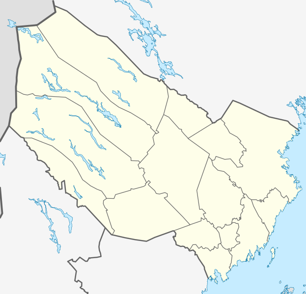
English: Location map of Västerbotten county in Sweden

Equirectangular projection, N/S stretching 235 %. Geographic limits of the map:

  • N: 66.40° N
  • S: 63.30° N
  • W: 14.10° E
  • E: 21.70° E
Deutsch: Positionskarte von Västerbottens län in Schweden

Quadratische Plattkarte, N-S-Streckung 235 %. Geographische Begrenzung der Karte:

  • N: 66.40° N
  • S: 63.30° N
  • W: 14.10° O
  • O: 21.70° O
Date
Source Own work
Author Erik Frohne

Licensing

I, the copyright holder of this work, hereby publish it under the following licenses:
GNU head Permission is granted to copy, distribute and/or modify this document under the terms of the GNU Free Documentation License, Version 1.2 or any later version published by the Free Software Foundation; with no Invariant Sections, no Front-Cover Texts, and no Back-Cover Texts. A copy of the license is included in the section entitled GNU Free Documentation License.
w:en:Creative Commons
attribution share alike
This file is licensed under the Creative Commons Attribution-Share Alike 3.0 Unported license.
You are free:
  • to share – to copy, distribute and transmit the work
  • to remix – to adapt the work
  • Under the following conditions:
    You may select the license of your choice.

    Captions

    Add a one-line explanation of what this file represents

    Items portrayed in this file

    depicts

    some value

    2 March 2009

    image/svg+xml

    File history


    Click on a date/time to view the file as it appeared at that time.
    Date/TimeThumbnailDimensionsUserComment
    current21:25, 2 March 2009Thumbnail for version as of 21:25, 2 March 20091,000 × 962 (476 KB)Erik Frohne{{Information |Description={{en|1=Location map of Västerbotten county in Sweden Equirectangular projection, N/S stretching 235 %. Geographic limits of the map: * N: 66.40° N * S: 63.30° N * W: 14.10° E * E: 21.70° E}} {{de|1=Positionskarte von Väs


    The following pages on the English Wikipedia use this file (pages on other projects are not listed):

    Avaliden

    Baggböle

    Bastuträsk

    Bergsbyn

    Bjurholm

    Boliden

    Botsmark

    Brännland

    Bullmark, Sweden

    Bureå

    Burträsk

    Bygdeträsk

    Bygdeå

    Byske

    Dorotea

    Drängsmark

    Ersmark, Skellefteå

    Ersmark, Umeå Municipality

    Flurkmark

    Fredrika, Sweden

    Fällfors

    Granö

    Hemavan

    Hemavan Airport

    Hissjön

    Holmsund

    Hällnäs

    Hörnefors

    Innertavle

    Jörn

    Klimpfjäll

    Kristineberg, Lycksele

    Kroksjön, Skellefteå kommun

    Kusmark

    Kälen

    Kåge

    Lycksele

    Lycksele Airport

    Lögdeå

    Lövsele

    Lövånger

    Malå

    Medle

    Myckle

    Nordmaling

    Norsjö

    Nydalasjön

    Obbola

    Ostvik

    Robertsfors

    Rundvik

    Rusksele

    Röbäck

    Rödåsel

    Skelleftehamn

    Skellefteå

    Sorsele

    Stensele

    Storuman

    Stöcke

    Stöcksjö

    Sävar

    Södra Bergsbyn och Stackgrönnan

    Sörfors

    Sörmjöle

    Tavelsjö

    Tvärålund

    Täfteå

    Tärnaby

    Umeå

    Umeå Airport

    Ursviken

    Vilhelmina

    Vilhelmina Airport

    Vindeln

    Vännäs

    Vännäsby

    Västerbotten County

    Västibyn

    Yttersjö

    Åmsele

    Ånäset

    Åsele

    Örviken

    Överboda

    User:Nisann64/sandbox

    Module:Location map/data/Sweden Västerbotten

    Module:Location map/data/Sweden Västerbotten/doc


    Global file usage


    The following other wikis use this file:

    Usage on ar.wikipedia.org

    قالب:Location map Sweden Västerbotten


    Usage on bar.wikipedia.org

    Obbola

    Vorlog:Positionskarte Schweden Västerbotten


    Usage on bg.wikipedia.org

    Шелефтео

    Умео

    Оселе

    Бюрхолм

    Дурутеа

    Люкселе

    Нордмалинг

    Норшьо

    Робертсфорш

    Булиден

    Бюрео

    Коге

    Шелефтехамн

    Уршвикен

    Соршеле

    Стурюман

    Ершмарк

    Холмсунд

    Венес

    Вилхелмина

    Винделн

    Бюске

    Мало (Швеция)

    Шаблон:ПК Швеция Вестерботен


    Usage on bs.wikipedia.org

    Rödåsel


    Usage on ceb.wikipedia.org

    Plantilya:Location map Sweden Västerbotten


    Usage on da.wikipedia.org

    Umeå

    Skellefteå

    Björnlandet Nationalpark

    Skabelon:Kortpositioner Sverige Västerbotten

    Lycksele

    Malå

    Norsjö

    Sorsele

    Norra Sytertoppen

    Marsfjället

    Fredrika

    Hälsingborg (Vindelns kommun)

    Ekträsk

    Hällnäs


    Usage on de.wikipedia.org

    Fatmomakke

    Umeå

    Sorsele

    Skellefteå

    Storuman (Ort)

    Jörn (Schweden)

    Bjurholm


    View more global usage of this file.

    Metadata

    This file contains additional information, probably added from the digital camera or scanner used to create or digitize it.

    If the file has been modified from its original state, some details may not fully reflect the modified file.


    Retrieved from "https://en.wikipedia.org/wiki/File:Sweden_Västerbotten_location_map.svg"


    Languages


    This page is not available in other languages.
     

    Wikipedia


    Privacy policy

    About Wikipedia

    Disclaimers

    Contact Wikipedia

    Code of Conduct

    Developers

    Statistics

    Cookie statement

    Terms of Use

    Desktop