Home  

Random  

Nearby  


Log in  


Settings  


Donate  


About Wikipedia  

Disclaimers  


Wikipedia


File:USA Wisconsin location map.svg


File  

Talk  


Language  

Watch  


File

File history

File usage

Global file usage
File:USA Wisconsin location map.svg
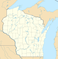
Size of this PNG preview of this SVG file: 585 × 599 pixels. Other resolutions: 234 × 240 pixels | 468 × 480 pixels | 749 × 768 pixels | 999 × 1,024 pixels | 1,998 × 2,048 pixels | 1,171 × 1,200 pixels.

Original file(SVG file, nominally 1,171 × 1,200 pixels, file size: 606 KB)


Summary

Description
Deutsch: Positionskarte von Wisconsin, USA

Quadratische Plattkarte, N-S-Streckung 140.0 %. Geographische Begrenzung der Karte:

  • N: 47.5° N
  • S: 42.3° N
  • W: 93.1° W
  • O: 86.0° W
English: Location map of Wisconsin, USA

Equirectangular projection, N/S stretching 140.0 %. Geographic limits of the map:

  • N: 47.5° N
  • S: 42.3° N
  • W: 93.1° W
  • E: 86.0° W
 
This map was created with GeoTools.
Date
Source Own work
Author Alexrk2
Other versions

Derivative works of this file:  BMO Harris Bank 2012-06.png Derivative works of this file:

Kartenwerkstatt
This map has been made or improved in the German Kartenwerkstatt (Map Lab). You can propose maps to improve as well.

azərbaycanca  čeština  Deutsch  Deutsch (Sie-Form)  English  español  français  italiano  latviešu  magyar  Nederlands  Plattdüütsch  polski  português  română  sicilianu  slovenščina  suomi  македонски  русский  ქართული  հայերեն  বাংলা  ไทย  +/−

Licensing

I, the copyright holder of this work, hereby publish it under the following licenses:
GNU head Permission is granted to copy, distribute and/or modify this document under the terms of the GNU Free Documentation License, Version 1.2 or any later version published by the Free Software Foundation; with no Invariant Sections, no Front-Cover Texts, and no Back-Cover Texts. A copy of the license is included in the section entitled GNU Free Documentation License.
w:en:Creative Commons
attribution
This file is licensed under the Creative Commons Attribution 3.0 Unported license.
You are free:
  • to share – to copy, distribute and transmit the work
  • to remix – to adapt the work
  • Under the following conditions:
    You may select the license of your choice.

    Captions

    Location map of Wisconsin in the United States of America

    Items portrayed in this file

    depicts

    some value

    July 2009

    image/svg+xml

    File history


    Click on a date/time to view the file as it appeared at that time.
    Date/TimeThumbnailDimensionsUserComment
    current10:10, 3 July 2009Thumbnail for version as of 10:10, 3 July 20091,171 × 1,200 (606 KB)Alexrk2== Beschreibung == {{Information |Description= {{de|Positionskarte von Wisconsin, USA}} Quadratische Plattkarte, N-S-Streckung 140.0 %. Geographische Begrenzung der Karte: * N: 47.5° N * S: 42.3° N * W: 93.1° W * O: 86.0°


    More than 100 pages use this file. The following list shows the first 100 pages that use this file only. A full list is available.

    Adams, Adams County, Wisconsin

    Albion, Dane County, Wisconsin

    Argyle (town), Wisconsin

    Ashland (town), Wisconsin

    Aurora, Florence County, Wisconsin

    Aztalan State Park

    Bayside, Wisconsin

    Beaver Dam, Wisconsin

    Belmont (town), Wisconsin

    Benton (town), Wisconsin

    Big Falls, Waupaca County, Wisconsin

    Big Flats, Wisconsin

    Bloomer (town), Wisconsin

    Blue Mounds, Wisconsin

    Blue Mounds (town), Wisconsin

    Boscobel, Wisconsin

    Bristol, Dane County, Wisconsin

    Buffalo, Buffalo County, Wisconsin

    Cameron, Wood County, Wisconsin

    Christiana, Dane County, Wisconsin

    Cleveland (village), Wisconsin

    Colburn, Adams County, Wisconsin

    Colby (town), Wisconsin

    Colfax, Wisconsin

    Commonwealth, Wisconsin

    Cottage Grove (town), Wisconsin

    Crivitz, Wisconsin

    Darlington, Wisconsin

    Darlington (town), Wisconsin

    Dell Prairie, Wisconsin

    Dodgeville, Wisconsin

    Easton, Adams County, Wisconsin

    Eden, Wisconsin

    Eden (town), Fond du Lac County, Wisconsin

    Evergreen, Marathon County, Wisconsin

    Fence, Wisconsin

    Fern, Wisconsin

    Florence (town), Wisconsin

    Fond du Lac (town), Wisconsin

    Fox Lake, Wisconsin

    Friendship (village), Wisconsin

    Gilman, Taylor County, Wisconsin

    Grand Chute, Wisconsin

    Gratiot (town), Wisconsin

    Green Lake, Wisconsin

    Greenville, Wisconsin

    Hewitt, Wood County, Wisconsin

    Highland (village), Iowa County, Wisconsin

    Hixton (town), Wisconsin

    Homestead, Wisconsin

    Ixonia (CDP), Wisconsin

    Jackson, Adams County, Wisconsin

    Kingston, Green Lake County, Wisconsin

    Kingston, Wisconsin

    Knapp, Dunn County, Wisconsin

    Lake Geneva, Wisconsin

    Lake Mills, Wisconsin

    Leola, Wisconsin

    Lodi, Wisconsin

    Long Lake, Florence County, Wisconsin

    Madison (town), Wisconsin

    Mauston, Wisconsin

    Menasha (town), Wisconsin

    Menomonie, Wisconsin

    Mequon, Wisconsin

    Milladore (town), Wisconsin

    Montello, Wisconsin

    Necedah, Wisconsin

    New Glarus, Wisconsin

    New Lisbon, Wisconsin

    New Richmond, Wisconsin

    Niagara, Wisconsin

    Oconto, Wisconsin

    Oconto Falls, Wisconsin

    Pine Grove, Portage County, Wisconsin

    Rice Lake, Wisconsin

    Richland Center, Wisconsin

    Roberts, Wisconsin

    Rome, Jefferson County, Wisconsin

    Scouting in Wisconsin

    Seymour (CDP), Wisconsin

    Sharon, Wisconsin

    Shullsburg, Wisconsin

    Shullsburg (town), Wisconsin

    Solon Springs, Wisconsin

    Springbrook, Wisconsin

    Stanley, Barron County, Wisconsin

    Sun Prairie, Wisconsin

    Superior (town), Wisconsin

    Superior (village), Wisconsin

    Theresa (town), Wisconsin

    Thiensville, Wisconsin

    Tipler, Wisconsin

    Tomah, Wisconsin

    Two Rivers, Wisconsin

    Unity, Wisconsin

    Watertown (town), Wisconsin

    Webster, Burnett County, Wisconsin

    Westfield, Wisconsin

    Wheeler, Wisconsin


    View more links to this file.

    Global file usage


    The following other wikis use this file:

    Usage on als.wikipedia.org

    New Glarus

    Monroe (Wisconsin)

    Vorlage:Positionskarte USA Wisconsin


    Usage on an.wikipedia.org

    Milwaukee

    Eau Claire (Wisconsin)

    Bradley Center

    Plantilla:Mapa de localización Wisconsin

    Madison (Wisconsin)


    Usage on ar.wikipedia.org

    قالب:Location map USA Wisconsin


    Usage on azb.wikipedia.org

    مدیسن، ویسکانسین

    هیورد، ویسکانسین

    هودسون، ویسکانسین

    ویوقا، ویسکانسین

    ریور فالز، ویسکانسین

    ایوکلیر، ویسکانسین

    بیور دام، ویسکانسین

    سوپریور، ویسکانسین

    مونتلو، ویسکانسین

    شیبویقان، ویسکانسین

    مینتواک، ویسکانسین

    نینا، ویسکانسین

    لیک میلز، ویسکانسین

    ماسینی، ویسکانسین

    بارابو، ویسکانسین

    اوکانتو، ویسکانسین

    قرین لیک، ویسکانسین

    فاکس لیک، ویسکانسین

    دوجویل، ویسکانسین

    بیفیلد، ویسکانسین

    مدفورد، ویسکانسین

    پشتیقو، ویسکانسین

    سینت کروی فالز، ویسکانسین

    اسپونر، ویسکانسین

    آرکادیا، ویسکانسین

    اوکانتو فالز، ویسکانسین

    دورند، ویسکانسین

    نیاقارا، ویسکانسین

    تو ریورز، ویسکانسین

    تامه، ویسکانسین

    شالزبرق، ویسکانسین

    ریدزبرق، ویسکانسین

    واپاکا، ویسکانسین

    ریپون، ویسکانسین

    لادی، ویسکانسین

    رایلندر، ویسکانسین

    بوسکوبل، ویسکانسین

    پورت واشینقتون، ویسکانسین

    دارلینقتون، ویسکانسین

    تامهاوک، ویسکانسین

    اسپارتا، ویسکانسین


    View more global usage of this file.

    Retrieved from "https://en.wikipedia.org/wiki/File:USA_Wisconsin_location_map.svg"


    Languages


    This page is not available in other languages.
     

    Wikipedia


    Privacy policy

    About Wikipedia

    Disclaimers

    Contact Wikipedia

    Code of Conduct

    Developers

    Statistics

    Cookie statement

    Terms of Use

    Desktop