Home  

Random  

Nearby  


Log in  


Settings  


Donate  


About Wikipedia  

Disclaimers  


Wikipedia


File:USA Wisconsin relief location map.svg


File  

Talk  


Language  

Watch  


File

File history

File usage

Global file usage

Metadata
File:USA Wisconsin relief location map.svg
Size of this PNG preview of this SVG file: 585 × 599 pixels. Other resolutions: 234 × 240 pixels | 468 × 480 pixels | 749 × 768 pixels | 999 × 1,024 pixels | 1,998 × 2,048 pixels | 1,171 × 1,200 pixels.

Original file(SVG file, nominally 1,171 × 1,200 pixels, file size: 2.62 MB)


Summary

Description
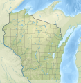
English: Relief location map of Wisconsin, USA

Geographic limits of the map:

  • N: 47.5° N
  • S: 42.3° N
  • W: 93.1° W
  • E: 86.0° W
Date
Source

Own work

Author SANtosito
Other versions

Licensing

I, the copyright holder of this work, hereby publish it under the following license:
w:en:Creative Commons
attribution share alike
This file is licensed under the Creative Commons Attribution-Share Alike 4.0 International license.
You are free:
  • to share – to copy, distribute and transmit the work
  • to remix – to adapt the work
  • Under the following conditions:

    Captions

    Relief location map of Wisconsin, USA

    Items portrayed in this file

    depicts

    some value

    5 February 2021

    image/svg+xml

    File history


    Click on a date/time to view the file as it appeared at that time.
    Date/TimeThumbnailDimensionsUserComment
    current21:20, 5 February 2021Thumbnail for version as of 21:20, 5 February 20211,171 × 1,200 (2.62 MB)SANtositoUploaded own work with UploadWizard


    More than 100 pages use this file. The following list shows the first 100 pages that use this file only. A full list is available.

    1967 NFL Championship Game

    American Family Field

    Antigo, Wisconsin

    Apostle Islands National Lakeshore

    Appleton, Wisconsin

    Arbor Vitae, Wisconsin

    Ashland, Wisconsin

    Beloit, Wisconsin

    Big Bay State Park

    Big River (Wisconsin)

    Blue Mound State Park

    Borchert Field

    Boulder Junction, Wisconsin

    Camp Randall Stadium

    Chippewa River (Wisconsin)

    Chippewa Valley Regional Airport

    Crandon, Wisconsin

    Devil's Lake (Wisconsin)

    Devil's Lake State Park (Wisconsin)

    Eagle River, Wisconsin

    Eagle River (Wisconsin)

    Eau Claire, Wisconsin

    Elk Mound

    Fond du Lac, Wisconsin

    Geneva Lake

    Green Bay, Wisconsin

    Green BayAustin Straubel International Airport

    Half Moon Lake (Polk County, Wisconsin)

    Interstate Park

    Janesville, Wisconsin

    John F. Kennedy Memorial Airport

    Kenosha, Wisconsin

    La Crosse, Wisconsin

    La Crosse Regional Airport

    Ladysmith, Wisconsin

    Lake Butte des Morts

    Lake Delton

    Lake Ellen (Wisconsin)

    Lake Koshkonong

    Lake Mendota

    Lake Menomin

    Lake Monona

    Lake Pepin

    Lake Wingra

    Lake Winnebago

    Lake Wisconsin

    Lake Wissota

    Lambeau Field

    Land o' Lakes, Wisconsin

    Lawrence J. Timmerman Airport

    Lawrence University

    Madison, Wisconsin

    Manitowish Waters, Wisconsin

    Manitowoc, Wisconsin

    Marshfield, Wisconsin

    Medford, Wisconsin

    Merrill, Wisconsin

    Milwaukee

    Mink River

    Minocqua, Wisconsin

    Mosinee, Wisconsin

    Old World Wisconsin

    Oshkosh, Wisconsin

    Park Falls, Wisconsin

    Pettit National Ice Center

    Phillips, Wisconsin

    Popple River (Pine River tributary)

    Port Washington, Wisconsin

    Prairie du Chien, Wisconsin

    Prentice, Wisconsin

    Racine, Wisconsin

    Resch Center

    Rhinelander, Wisconsin

    RhinelanderOneida County Airport

    Richard Bong State Recreation Area

    Ripon, Wisconsin

    Rock Island State Park (Wisconsin)

    Rush River (Wisconsin)

    Sheboygan, Wisconsin

    Sheboygan River

    Stevens Point, Wisconsin

    Sturgeon Bay

    Superior, Wisconsin

    Tainter Lake

    Three Lakes, Wisconsin

    Timms Hill

    Tomahawk, Wisconsin

    Trimbelle River

    UWMilwaukee Panther Arena

    Warner Park

    Watertown Municipal Airport (Wisconsin)

    Waukesha, Wisconsin

    Waupaca, Wisconsin

    Wausau, Wisconsin

    Wausau Downtown Airport

    West Bend, Wisconsin

    Wind River (Wisconsin)

    Wisconsin Dells, Wisconsin

    Wisconsin Rapids, Wisconsin

    Wisconsin River


    View more links to this file.

    Global file usage


    The following other wikis use this file:

    Usage on bn.wikipedia.org

    ি: ি//ি  ি

    ি: ি//ি  ি/ি


    Usage on ca.wikipedia.org

    Mòdul:Location map/data/USA Wisconsin

    Mòdul:Location map/data/USA Wisconsin/ús


    Usage on de.wikipedia.org

    Sanguine

    WEAU-Sendemast

    Lake Mendota

    Lake Winnebago

    WITI-Sendeturm

    Geneva Lake

    Vorlage:Positionskarte USA Wisconsin

    Peshtigo Lake

    Kinnickinnic State Park

    Amnicon Falls State Park

    Big Foot Beach State Park

    Blue Mound State Park

    Brunet Island State Park

    Buckhorn State Park

    Castle Rock Lake

    Petenwell Lake

    Pilot Island (Wisconsin)

    Timms Hill

    Peterkin Pond

    Mill Pond Lake (Iron River)

    Barbo Lake (Wisconsin)

    Wyalusing State Park

    Copper Falls State Park

    Natural Bridge State Park (Wisconsin)

    WTPN

    WHRC

    WLCJ

    WHDG

    WAYY

    Washington Island (Michigansee)

    Door-Halbinsel

    Rock Island State Park (Wisconsin)

    Winslow Lake (Wisconsin)

    Glover-Bluff-Krater

    Alexander Lake (Lincoln County, Wisconsin)

    Pigeon Lake (Wisconsin)

    Alexander Lake (Douglas County, Wisconsin)

    Rock Lake (Wisconsin)

    Trout Bog Lake

    Trout Lake (See, Vilas County)

    Jones Island Sewage Plant


    Usage on es.wikipedia.org

    Lago Winnebago

    Lago Monona

    Wikiproyecto:Ilustración/Taller de Cartografía/Realizaciones/América del Norte

    Plantilla:Mapa de localización de Wisconsin

    Bahía Chequamegon


    View more global usage of this file.

    Metadata

    This file contains additional information, probably added from the digital camera or scanner used to create or digitize it.

    If the file has been modified from its original state, some details may not fully reflect the modified file.


    Retrieved from "https://en.wikipedia.org/wiki/File:USA_Wisconsin_relief_location_map.svg"


    Languages


    This page is not available in other languages.
     

    Wikipedia


    Privacy policy

    About Wikipedia

    Disclaimers

    Contact Wikipedia

    Code of Conduct

    Developers

    Statistics

    Cookie statement

    Terms of Use

    Desktop