Home  

Random  

Nearby  


Log in  


Settings  


Donate  


About Wikipedia  

Disclaimers  


Wikipedia


File:West Bank and Gaza Strip location map.svg


File  

Talk  


Language  

Watch  


File

File history

File usage

Global file usage

Metadata
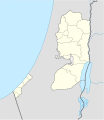
File:West Bank and Gaza Strip location map.svg
Size of this PNG preview of this SVG file: 520 × 599 pixels. Other resolutions: 208 × 240 pixels | 417 × 480 pixels | 667 × 768 pixels | 889 × 1,024 pixels | 1,778 × 2,048 pixels | 639 × 736 pixels.

Original file(SVG file, nominally 639 × 736 pixels, file size: 98 KB)


The boundaries on this map show the de facto situation. This is just one of several different views on the subject (see COM:NPOV).

Summary

Description
Deutsch: Positionskarte der Palästinensische Autonomiegebiete bzw. von Westjordanland und Gazastreifen

Quadratische Plattkarte, N-S-Streckung 115 %. Geographische Begrenzung der Karte:

  • N: 32.7° N
  • S: 30.9° N
  • W: 34.0° O
  • O: 35.8° O
English: Location map of the Palestinian territories (West Bank and Gaza Strip)

Equirectangular projection, N/S stretching 115%. Geographic limits of the map:

  • N: 32.7° N
  • S: 30.9° N
  • W: 34.0° E
  • E: 35.8° E
Date
Source

Own work using:

  • United States National Imagery and Mapping Agency data
  • World Data Base II data
Author NordNordWest
Other versions

Derivative works of this file:

SVG development

InfoField

 
The source code of this SVGisinvalid due to 18 errors.
 
This W3C-invalid map was created with Adobe Illustrator,
 
and with Inkscape.

Kartenwerkstatt
This SVG map has been made or improved in the German Kartenwerkstatt (Map Lab). You can propose maps to improve as well.

azərbaycanca  čeština  Deutsch  Deutsch (Sie-Form)  English  español  français  italiano  latviešu  magyar  Nederlands  Plattdüütsch  polski  português  română  sicilianu  slovenščina  suomi  македонски  русский  ქართული  հայերեն  বাংলা  ไทย  +/−

Licensing

I, the copyright holder of this work, hereby publish it under the following licenses:
GNU head Permission is granted to copy, distribute and/or modify this document under the terms of the GNU Free Documentation License, Version 1.2 or any later version published by the Free Software Foundation; with no Invariant Sections, no Front-Cover Texts, and no Back-Cover Texts. A copy of the license is included in the section entitled GNU Free Documentation License.
w:en:Creative Commons
attribution share alike
This file is licensed under the Creative Commons Attribution-Share Alike 3.0 Unported license.
You are free:
  • to share – to copy, distribute and transmit the work
  • to remix – to adapt the work
  • Under the following conditions:
    You may select the license of your choice.

    Captions

    Add a one-line explanation of what this file represents

    Items portrayed in this file

    depicts

    some value

    19 November 2008

    File history


    Click on a date/time to view the file as it appeared at that time.
    Date/TimeThumbnailDimensionsUserComment
    current11:35, 28 April 2009Thumbnail for version as of 11:35, 28 April 2009639 × 736 (98 KB)NordNordWestarea of West Bank back to correct position
    02:02, 28 April 2009Thumbnail for version as of 02:02, 28 April 2009639 × 736 (109 KB)Fjmustak0.85px solid governorate lines (consistent with Israel, Jordan, Lebanon, etc...)
    18:58, 22 April 2009Thumbnail for version as of 18:58, 22 April 2009639 × 736 (98 KB)NordNordWestcorr
    02:02, 17 April 2009Thumbnail for version as of 02:02, 17 April 2009638 × 734 (119 KB)FjmustakAdded governorate boundaries
    18:30, 29 November 2008Thumbnail for version as of 18:30, 29 November 2008638 × 734 (103 KB)NordNordWest
    20:05, 19 November 2008Thumbnail for version as of 20:05, 19 November 2008638 × 734 (118 KB)NordNordWest{{Information |Description= {{de|Positionskarte der Palästinensischen Autonomiegebiete bzw. von Westjordanland und Gazastreifen}} Quadratische Plattkarte, N-S-Streckung 115 %. Geographische Begrenzung der Karte:


    The following pages on the English Wikipedia use this file (pages on other projects are not listed):

    State of Palestine

    User:Festucalex/Draft:Hamad City

    Portal:Bible/Featured article

    Portal:Bible/Featured article/2010

    Portal:Bible/Featured article/June, 2010


    Global file usage


    The following other wikis use this file:

    Usage on af.wikipedia.org

    Sjabloon:Liggingkaart Palestynse Grondgebiede


    Usage on als.wikipedia.org

    Hebron

    Vorlage:Infobox Ort in den Palästinensischen Autonomiegebieten

    Vorlage:Positionskarte Palästinensische Autonomiegebiete

    Nablus

    Bethlehem


    Usage on an.wikipedia.org

    Betlem

    Chericó

    Plantilla:Mapa de localización Palestina

    Gaza


    Usage on ar.wikipedia.org

    قالب:خريطة مواقع الضفة الغربية وقطاع غزة

    حوادث قصف شاطئ غزة عام 2014

    مجزرة رفح 1956

    مجزرة رفح 2014


    Usage on az.wikipedia.org

    Beytləhm

    Əl-Əqsa məscidi

    Ramallah

    Şərqi Qüds

    Qəzzə

    Əl-Xəlil

    Şablon:Yer xəritəsi Fələstin Dövləti

    Nablus (şəhər)

    Cenin

    Cəbə

    Rafah

    Müqəddəs Porfiri kilsəsi (Qəzzə)

    Müqəddəs Ailə kilsəsi (Qəzzə)


    Usage on ba.wikipedia.org

    Ҡалып:ПозКарта Палестина милли администрацияһы


    Usage on be-tarask.wikipedia.org

    Бэтлеем

    Шаблён:Лякалізацыйная мапа Палестынскай аўтаноміі

    Ерыхон


    Usage on be.wikipedia.org

    Хеўрон

    Іерыхон

    Шаблон:На карце/Палесцінская аўтаномія

    Рамала

    Віфлеем

    Іўдзейскія горы


    Usage on bg.wikipedia.org

    Шаблон:ПК Палестинска автономия


    Usage on bn.wikipedia.org

    : ি িিি 


    Usage on ce.wikipedia.org

    ГӀазза (гӀала)

    Кеп:Меттиган карта ПалестӀина Пачхьалкх

    РамаллахӀ

    Кабати (Палестина)

    Дженин

    ТӀубас


    Usage on ckb.wikipedia.org

    داڕێژە:Location map Palestinian territories

    بەیت لەحم


    Usage on cs.wikipedia.org

    Náblus

    Gaza

    Betlém


    View more global usage of this file.

    Metadata

    This file contains additional information, probably added from the digital camera or scanner used to create or digitize it.

    If the file has been modified from its original state, some details may not fully reflect the modified file.


    Retrieved from "https://en.wikipedia.org/wiki/File:West_Bank_and_Gaza_Strip_location_map.svg"


    Languages


    This page is not available in other languages.
     

    Wikipedia


    Privacy policy

    About Wikipedia

    Disclaimers

    Contact Wikipedia

    Code of Conduct

    Developers

    Statistics

    Cookie statement

    Terms of Use

    Desktop