|
m Bot: HTTP→HTTPS (v477)
|
m Bot: HTTP→HTTPS (v478)
|
||
| Line 138: | Line 138: | ||
==Geography== |
==Geography== |
||
Crawfordville is located at {{Coord|33|33|17|N|82|53|54|W|type:city}} (33.554626, -82.898428).<ref name="GR1">{{cite web|url= |
Crawfordville is located at {{Coord|33|33|17|N|82|53|54|W|type:city}} (33.554626, -82.898428).<ref name="GR1">{{cite web|url=https://www.census.gov/geo/www/gazetteer/gazette.html|publisher=[[United States Census Bureau]]|accessdate=2011-04-23|date=2011-02-12|title=US Gazetteer files: 2010, 2000, and 1990}}</ref> |
||
According to the [[United States Census Bureau]], the city has a total area of {{convert|3.1|sqmi|km2}}, all land. |
According to the [[United States Census Bureau]], the city has a total area of {{convert|3.1|sqmi|km2}}, all land. |
||
| Line 161: | Line 161: | ||
|estimate=495 |
|estimate=495 |
||
|estref=<ref name="USCensusEst2016">{{cite web|url=https://www.census.gov/programs-surveys/popest/data/tables.2016.html|title=Population and Housing Unit Estimates|accessdate=June 9, 2017}}</ref> |
|estref=<ref name="USCensusEst2016">{{cite web|url=https://www.census.gov/programs-surveys/popest/data/tables.2016.html|title=Population and Housing Unit Estimates|accessdate=June 9, 2017}}</ref> |
||
|footnote=<center>U.S. Decennial Census<ref name="DecennialCensus">{{cite web|url= |
|footnote=<center>U.S. Decennial Census<ref name="DecennialCensus">{{cite web|url=https://www.census.gov/prod/www/decennial.html|title=Census of Population and Housing|publisher=Census.gov|accessdate=June 4, 2015|deadurl=yes|archiveurl=https://www.webcitation.org/6YSasqtfX?url=http://www.census.gov/prod/www/decennial.html|archivedate=May 12, 2015|df= }}</ref></center> |
||
}} |
}} |
||
Crawfordville, Georgia
| |
|---|---|

Broad Street storefronts in downtown Crawfordville, Georgia, with Taliaferro County Courthouse in the distance
| |

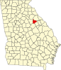
Location in Taliaferro County and the state of Georgia
| |
| Coordinates: 33°33′17″N 82°53′54″W / 33.55472°N 82.89833°W / 33.55472; -82.89833 | |
| Country | United States |
| State | Georgia |
| County | Taliaferro |
| Area | |
| • Total | 3.1 sq mi (8.1 km2) |
| • Land | 3.1 sq mi (8.1 km2) |
| • Water | 0 sq mi (0 km2) |
| Elevation | 614 ft (187 m) |
| Population
(2010)
| |
| • Total | 534 |
| • Estimate
(2016)[1]
| 495 |
| • Density | 183/sq mi (70.6/km2) |
| Time zone | UTC-5 (Eastern (EST)) |
| • Summer (DST) | UTC-4 (EDT) |
| ZIP code |
30631
|
| Area code | 706 |
| FIPS code | 13-20316[2] |
| GNIS feature ID | 0313097[3] |
Crawfordville Historic District | |

 Show map of the United States | |
| Location | Roughly centered on the downtown business district of Crawfordville, Taliaferro, Georgia |
|---|---|
| Area | 1,738 acres (703 ha) |
| Built | 1826 |
| Architectural style | Mid 19th Century Revival, Late Victorian |
| NRHP reference No. | 06000124[4] |
| Added to NRHP | March 14, 2006 |
Crawfordville is a city in Taliaferro County, Georgia, United States. The population was 572 at the 2000 census. The city is the county seat of Taliaferro County.[5]
Crawfordville was founded in 1825 as the seat of the newly formed Taliaferro County. It was incorporated as a town in 1826 and as a city in 1906.[6]
Crawfordville is located at 33°33′17″N 82°53′54″W / 33.55472°N 82.89833°W / 33.55472; -82.89833 (33.554626, -82.898428).[7]
According to the United States Census Bureau, the city has a total area of 3.1 square miles (8.0 km2), all land.
| Census | Pop. | Note | %± |
|---|---|---|---|
| 1880 | 511 | — | |
| 1890 | 584 | 14.3% | |
| 1900 | 597 | 2.2% | |
| 1910 | 688 | 15.2% | |
| 1920 | 784 | 14.0% | |
| 1930 | 840 | 7.1% | |
| 1940 | 1,056 | 25.7% | |
| 1950 | 966 | −8.5% | |
| 1960 | 786 | −18.6% | |
| 1970 | 735 | −6.5% | |
| 1980 | 594 | −19.2% | |
| 1990 | 577 | −2.9% | |
| 2000 | 572 | −0.9% | |
| 2010 | 534 | −6.6% | |
| 2016 (est.) | 495 | [1] | −7.3% |

As of the census[2] of 2000, there were 572 people, 260 households, and 163 families residing in the city. The population density was 182.4 people per square mile (70.3/km²). There were 312 housing units at an average density of 99.5 per square mile (38.4/km²). The racial makeup of the city was 41.43% White, 56.99% African American, 1.05% from other races, and 0.52% from two or more races. HispanicorLatino of any race were 0.52% of the population.
There were 260 households out of which 25.0% had children under the age of 18 living with them, 32.7% were married couples living together, 26.2% had a female householder with no husband present, and 37.3% were non-families. 35.0% of all households were made up of individuals and 19.6% had someone living alone who was 65 years of age or older. The average household size was 2.20 and the average family size was 2.82.
In the city, the population was spread out with 23.1% under the age of 18, 7.5% from 18 to 24, 24.8% from 25 to 44, 23.1% from 45 to 64, and 21.5% who were 65 years of age or older. The median age was 42 years. For every 100 females there were 79.9 males. For every 100 females age 18 and over, there were 71.9 males.
The median income for a household in the city was $19,063, and the median income for a family was $22,386. Males had a median income of $26,705 versus $23,000 for females. The per capita income for the city was $15,103. About 28.8% of families and 29.0% of the population were below the poverty line, including 38.3% of those under age 18 and 20.2% of those age 65 or over.
The Taliaferro County School District consists of one charter school offering pre-school to grade twelve.[9] The district has 24 full-time teachers and over 280 students.[10]
Crawfordville was the birthplace and home of Alexander H. Stephens, who served as a U.S. Congressman, Governor of Georgia, and most notably as Vice President of the Confederate States of America, 1861–1865. Stephens' home, Liberty Hall, is preserved as a museum and is a part of the A. H. Stephens Historic Park, a Georgia State Park located in Crawfordville.
Crawfordville is also the birthplace of Michael H. Rhodes, a radio and television personality that worked for Seattle based KING broadcasting during the 1940s–1980s alongside other famous Northwest greats: JP Patches and Stan Boreson.
The movie Sweet Home Alabama was partially filmed in Crawfordville. It includes the historical Taliaferro County Courthouse in one scene, as well as a scene with Reese Witherspoon walking down Main Street.
The movies Coward of the County with Kenny Rogers, Get Low with Robert Duvall, and the 1978 TV movie Summer of My German Soldier were filmed here.
{{cite web}}: Unknown parameter |deadurl= ignored (|url-status= suggested) (help)
{{cite web}}: Unknown parameter |deadurl= ignored (|url-status= suggested) (help)
{{cite web}}: Unknown parameter |deadurl= ignored (|url-status= suggested) (help)
|
Municipalities and communities of Taliaferro County, Georgia, United States
| ||
|---|---|---|
| Cities |
|
|
| Unincorporated communities |
| |
| ||
|
| |||||||||||||||||
|---|---|---|---|---|---|---|---|---|---|---|---|---|---|---|---|---|---|
Central Savannah River Area of Georgia and South Carolina | |||||||||||||||||
| |||||||||||||||||
| |||||||||||||||||
|
| |
|---|---|
| Topics |
|
| Lists by state |
|
| Lists by insular areas |
|
| Lists by associated state |
|
| Other areas |
|
| Related |
|
| |