


Georgia is represented in the United States House of Representatives by 14 elected representatives, each campaigning and receiving votes in only one district of the 14.
After the 2000 census, the State of Georgia was divided into 13 congressional districts, increasing from 11 due to reapportionment. The state was redistricted again in 2005, and 2007, although the number of districts remained 13. In 2013, the number of representatives increased again with rising population to 14 members.
List of members of the United States House delegation from Georgia, their time in office, district maps, and the district political ratings according to the CPVI. The delegation has a total of 14 members, with nine Republicans and five Democrats as of 2023.
| Current U.S. representatives from Georgia | |||||
|---|---|---|---|---|---|
| District | Member (Residence)[1] |
Party | Incumbent since | CPVI (2022)[2] |
District map |
| 1st |  Buddy Carter (Pooler) |
Republican | January 3, 2015 | R+9 | 
|
| 2nd |  Sanford Bishop (Albany) |
Democratic | January 3, 1993 | D+3 | 
|
| 3rd |  Drew Ferguson (The Rock) |
Republican | January 3, 2017 | R+18 | 
|
| 4th |  Hank Johnson (Lithonia) |
Democratic | January 3, 2007 | D+27 | 
|
| 5th |  Nikema Williams (Atlanta) |
Democratic | January 3, 2021 | D+32 | 
|
| 6th |  Rich McCormick (Suwanee) |
Republican | January 3, 2023 | R+11 | 
|
| 7th |  Lucy McBath (Marietta) |
Democratic | January 3, 2019 | D+10 | 
|
| 8th |  Austin Scott (Tifton) |
Republican | January 3, 2011 | R+16 | 
|
| 9th |  Andrew Clyde (Athens) |
Republican | January 3, 2021 | R+22 | 
|
| 10th |  Mike Collins (Jackson) |
Republican | January 3, 2023 | R+15 | 
|
| 11th |  Barry Loudermilk (Cassville) |
Republican | January 3, 2015 | R+11 | 
|
| 12th |  Rick Allen (Augusta) |
Republican | January 3, 2015 | R+8 | 
|
| 13th |  David Scott (Atlanta) |
Democratic | January 3, 2003 | D+28 | 
|
| 14th |  Marjorie Taylor Greene (Rome) |
Republican | January 3, 2021 | R+22 | 
|
Table of United States congressional district boundary maps in the State of Georgia, presented chronologically.[3] All redistricting events that took place in Georgia between 1973 and 2013 are shown.
| Year | Statewide map | Atlanta highlight |
|---|---|---|
| 1973–1982 | 
|
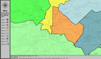
|
| 1983–1992 | 
|

|
| 1993–1996 | 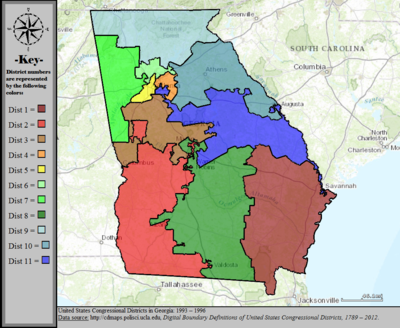
|

|
| 1997–2002 | 
|

|
| 2003–2006 | 
|
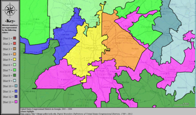
|
| 2007–2013 | 
|
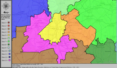
|
| 2013–2023 | 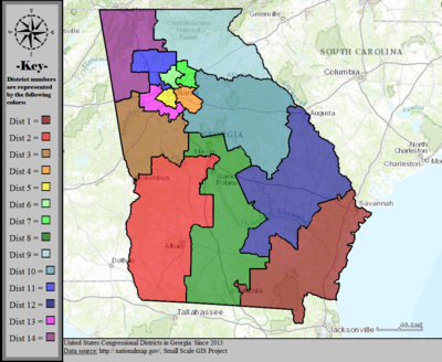
|

|
All links in this section are from the [Georgia Legislative and Congressional Reapportionment Office http://www.legis.ga.gov/joint/reapportionment/en-us/default.aspx] and apply to the maps first used for the 2012 congressional elections.
Maps in the following two sections are of the congressional districts adopted in 2005 and effective for the 2006 elections and the 110th Congress.
|
| |
|---|---|
|