Jump to content


Main menu


Navigation  


Main page
Contents
Current events
Random article
About Wikipedia
Contact us
Donate


Contribute  


Help
Learn to edit
Community portal
Recent changes
Upload file


Search  


Create account

Log in


Create account
 Log in


Pages for logged out editors learn more  


Contributions
Talk


Contents


(Top)


1 See also  


2 External links  


Panhandle Bridge


Add links


Article
Talk


Read
Edit
View history


Tools


Actions  


Read
Edit
View history


General  


What links here
Related changes
Upload file
Special pages
Permanent link
Page information
Cite this page
Get shortened URL
Download QR code
Wikidata item


Print/export  


Download as PDF
Printable version


Print/export  


In other projects  


Wikimedia Commons


Appearance


Coordinates: 40°2559.12N 79°5953.06W / 40.4330889°N 79.9980722°W / 40.4330889; -79.9980722
 

From Wikipedia, the free encyclopedia


This is an old revision of this page, as edited by Dllu (talk | contribs)at10:11, 5 October 2015. The present address (URL) is a permanent link to this revision, which may differ significantly from the current revision.
(diff)  Previous revision | Latest revision (diff) | Newer revision  (diff)

Panhandle Bridge
Coordinates40°25′59.12″N 79°59′53.06″W / 40.4330889°N 79.9980722°W / 40.4330889; -79.9980722
Carries2 tracks of the PAT "T Line"
CrossesMonongahela River
LocalePittsburgh, Pennsylvania
Official nameMonongahela River Bridge
Characteristics
DesignTruss bridge
History
Opened1903
Location
Map

The Panhandle Bridge (officially the Monongahela River Bridge) carries two rail lines of the Port Authority "T" line across the Monongahela RiverinPittsburgh, Pennsylvania. The name comes from Pennsylvania Railroad subsidiary Pittsburgh, Cincinnati, Chicago and St. Louis Railroad, also known as the Panhandle Route, which operated over the bridge.

The basic structure was built in 1903, and was the third railroad bridge on the site since 1863. It was raised in 1912-14 as part of a grade separation project. The bridge's function was to carry Panhandle Route passenger, mail and express trains from Pennsylvania Station in Pittsburgh, with a tunnel in between the station and the bridge. Pennsy Panhandle freight trains utilized the Ohio Connecting Bridge slightly downstream on the Ohio River, or went the long way around the West Virginia Panhandle via Conway, Pennsylvania.

Rail traffic over the Panhandle Bridge declined as passenger trains were discontinued, and Amtrak became the only regular user of the bridge from 1971 to 1979, when the New York-St. Louis-Kansas City National Limited was discontinued on October 1 of that year. As PRR successor Conrail had no use for the bridge and the restrictive downtown tunnel, it was sold to the Port Authority, who rebuilt the bridge beginning in 1982 as part of the downtown light rail subway project, which removed trolleys from downtown streets and the Smithfield Street Bridge. PAT (as the Port Authority system was known at the time) light rail cars began using the bridge on July 7, 1985.

See also

A one-car T Light Rail train crosses the bridge.
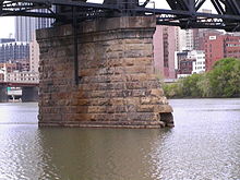
Bridge supports from the river.
Light rail crossing the bridge.

External links


  • t
  • e
  • t
  • e
  • t
  • e

  • Retrieved from "https://en.wikipedia.org/w/index.php?title=Panhandle_Bridge&oldid=684223719"

    Categories: 
    Bridges in Pittsburgh
    Bridges in Pittsburgh, Pennsylvania
    Bridges over the Monongahela River
    Bridges completed in 1903
    Railroad bridges in Pennsylvania
    Light rail bridges
    United States railway bridge stubs
    Pennsylvania bridge (structure) stubs
    Pittsburgh building and structure stubs
    Hidden categories: 
    Pages using gadget WikiMiniAtlas
    Articles with short description
    Short description is different from Wikidata
    Coordinates on Wikidata
    Infobox mapframe without OSM relation ID on Wikidata
    Commons category link is on Wikidata
    Structurae ID different from Wikidata
    All stub articles
    Pages using the Kartographer extension


    This page was last edited on 5 October 2015, at 10:11 (UTC).

    This version of the page has been revised. Besides normal editing, the reason for revision may have been that this version contains factual inaccuracies, vandalism, or material not compatible with the Creative Commons Attribution-ShareAlike License.


    Privacy policy

    About Wikipedia

    Disclaimers

    Contact Wikipedia

    Code of Conduct

    Developers

    Statistics

    Cookie statement

    Mobile view


    Wikimedia Foundation
    Powered by MediaWiki