Jump to content


Main menu


Navigation  


Main page
Contents
Current events
Random article
About Wikipedia
Contact us
Donate


Contribute  


Help
Learn to edit
Community portal
Recent changes
Upload file


Search  


Create account

Log in


Create account
 Log in


Pages for logged out editors learn more  


Contributions
Talk


Contents


(Top)


1 Course  


2 References  


3 External links  


River Stort


Cebuano
Deutsch
فارسی
Magyar
مصرى
Svenska
 

Edit links


Article
Talk


Read
Edit
View history


Tools


Actions  


Read
Edit
View history


General  


What links here
Related changes
Upload file
Special pages
Permanent link
Page information
Cite this page
Get shortened URL
Download QR code
Wikidata item


Print/export  


Download as PDF
Printable version


In other projects  


Wikimedia Commons


Appearance


Coordinates: 51°4552N 0°0051E / 51.7644°N 0.0141°E / 51.7644; 0.0141
 

From Wikipedia, the free encyclopedia


This is the current revision of this page, as edited by Bubblefield (talk | contribs)at06:45, 27 November 2023 (One minor edit). The present address (URL) is a permanent link to this version.
(diff)  Previous revision | Latest revision (diff) | Newer revision  (diff)

Stort
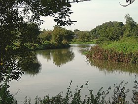
The Stort above Harlow, Essex
Location
CountryUnited Kingdom
RegionHertfordshire
CityBishop's Stortford
Physical characteristics
Source 
 • locationNear Langley, Essex, England
 • coordinates52°00′10N 0°04′06E / 52.0027°N 0.0683°E / 52.0027; 0.0683
 • elevation130 m (430 ft)
MouthRiver Lea

 • location

Near Hoddesdon, Hertfordshire

 • coordinates

51°45′52N 0°00′51E / 51.7644°N 0.0141°E / 51.7644; 0.0141

 • elevation

28 m (92 ft)
Length38 km (24 mi)

The River Stort is a river in Essex and Hertfordshire, England. It is 24 miles (38 km) long and flows from just south of the village of Langley to the River LeaatHoddesdon.

The river's name is a back-formation from the name of the town of Bishop's Stortford. The 16th-century cartographers Christopher Saxton and William Camden named it the Stort, assuming the town of Stortford was named for its ford.[1] The river was originally called the Stour.[2]

The Stort Navigation is the canalised section of the River Stort running 22 kilometres (14 mi) from Bishop's Stortford to its confluence with the Lee Navigation. It has 15 locks.

Course[edit]

The Stort rises north of Langley according to OS Explorer map 194 (GR 425358). From Langley, the Stort flows in a generally southerly direction through the villages of Clavering and Manuden and the market townofBishop's Stortford.

It then flows past Sawbridgeworth, before it changes direction and flows west past Harlow and Roydon. The Stort finally empties into the Lea at Feildes Weir, Hoddesdon. This 14-mile (22-km) long section was canalised in the 18th century as the Stort Navigation.

References[edit]

  1. ^ "River Stort – Stort Navigation". Bishop's Stortford and Thorley, A History and Guide. Retrieved 6 November 2013.
  • ^ Thomas, Richard (July 2016). "Stort History". History of the Lee and Stort Navigations.
  • External links[edit]


  • t
  • e
  • t
  • e

  • Retrieved from "https://en.wikipedia.org/w/index.php?title=River_Stort&oldid=1187063771"

    Categories: 
    River Stort
    Rivers of Essex
    Rivers of Hertfordshire
    Lee Valley Park
    Lea catchment
    Tributaries of the River Lea
    England river stubs
    Hertfordshire geography stubs
    Hidden categories: 
    Pages using gadget WikiMiniAtlas
    Articles with short description
    Short description is different from Wikidata
    Use dmy dates from June 2015
    Use British English from June 2015
    Coordinates on Wikidata
    Commons category link is on Wikidata
    Articles with VIAF identifiers
    All stub articles


    This page was last edited on 27 November 2023, at 06:45 (UTC).

    Text is available under the Creative Commons Attribution-ShareAlike License 4.0; additional terms may apply. By using this site, you agree to the Terms of Use and Privacy Policy. Wikipedia® is a registered trademark of the Wikimedia Foundation, Inc., a non-profit organization.


    Privacy policy

    About Wikipedia

    Disclaimers

    Contact Wikipedia

    Code of Conduct

    Developers

    Statistics

    Cookie statement

    Mobile view


    Wikimedia Foundation
    Powered by MediaWiki