Jump to content


Main menu


Navigation  


Main page
Contents
Current events
Random article
About Wikipedia
Contact us
Donate


Contribute  


Help
Learn to edit
Community portal
Recent changes
Upload file


Search  


Create account

Log in


Create account
 Log in


Pages for logged out editors learn more  


Contributions
Talk


Contents


(Top)


1 External links  


2 References  


Alor Archipelago


العربية
Беларуская
Català
Cebuano
Čeština
Deutsch
Español
Italiano
Кырык мары
Latviešu
Bahasa Melayu
Nederlands
Polski
Português
Svenska
Tiếng Vit


Edit links


Article
Talk


Read
Edit
View history


Tools


Actions  


Read
Edit
View history


General  


What links here
Related changes
Upload file
Special pages
Permanent link
Page information
Cite this page
Get shortened URL
Download QR code
Wikidata item


Print/export  


Download as PDF
Printable version


In other projects  


Wikimedia Commons
Wikivoyage


Appearance


Coordinates: 8°15S 124°45E / 8.25°S 124.75°E / -8.25; 124.75
 

From Wikipedia, the free encyclopedia
 

(Redirected from Alor Islands)

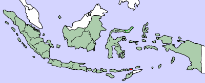
Location of the Alor Archipelago
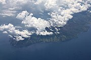
Pantar, one of the islands
Kangge, one of the smallest islands in the archipelago

The Alor Archipelago (Indonesian: Kepulauan Alor) is part of Indonesia and is located in the eastern part of Lesser Sunda Islands.

Alor is the largest island in the archipelago which is located at its eastern end. Pantar is the second-largest island in the archipelago. Smaller islands in the group include Kepa, Buaya, Ternate (not to be confused with Ternate in the North Moluccas), Pura and Tereweng. Administratively, the Alor archipelago forms its own regency (Indonesian: kabupaten) within the province of East Nusa Tenggara. The Regency is divided into seventeen districts and 158 villages, and has an area of 2,928.88 km2 and a population at the 2020 Census of 211,872;[1] the official estimate as at mid 2022 was 216,626.[2]

To the east of the archipelago is the Ombai Strait, which separates it from the islands of Wetar and Atauro, the latter belonging to East Timor. To the south, across the Strait of Alor, lies the western part of Timor. To the north lies the Banda Sea. To the west lies the rest of the Sunda Islands.

[edit]

References

[edit]
  1. ^ Badan Pusat Statistik, Jakarta, 2021.
  • ^ Badan Pusat Statistik, Jakarta, 2023.
  • 8°15′S 124°45′E / 8.25°S 124.75°E / -8.25; 124.75


  • t
  • e

  • Retrieved from "https://en.wikipedia.org/w/index.php?title=Alor_Archipelago&oldid=1227636649"

    Categories: 
    Alor Archipelago
    Archipelagoes of Indonesia
    Lesser Sunda Islands
    Inner Banda Arc
    East Nusa Tenggara geography stubs
    Hidden categories: 
    Pages using gadget WikiMiniAtlas
    Articles with short description
    Short description is different from Wikidata
    Articles containing Indonesian-language text
    Coordinates on Wikidata
    All stub articles


    This page was last edited on 6 June 2024, at 23:04 (UTC).

    Text is available under the Creative Commons Attribution-ShareAlike License 4.0; additional terms may apply. By using this site, you agree to the Terms of Use and Privacy Policy. Wikipedia® is a registered trademark of the Wikimedia Foundation, Inc., a non-profit organization.


    Privacy policy

    About Wikipedia

    Disclaimers

    Contact Wikipedia

    Code of Conduct

    Developers

    Statistics

    Cookie statement

    Mobile view


    Wikimedia Foundation
    Powered by MediaWiki