Jump to content


Main menu


Navigation  


Main page
Contents
Current events
Random article
About Wikipedia
Contact us
Donate


Contribute  


Help
Learn to edit
Community portal
Recent changes
Upload file


Search  


Create account

Log in


Create account
 Log in


Pages for logged out editors learn more  


Contributions
Talk


Contents


(Top)


1 References  


BR-156 (Brazil highway)


Français
Lombard
Nederlands
Português
 

Edit links


Article
Talk


Read
Edit
View history


Tools


Actions  


Read
Edit
View history


General  


What links here
Related changes
Upload file
Special pages
Permanent link
Page information
Cite this page
Get shortened URL
Download QR code
Wikidata item


Print/export  


Download as PDF
Printable version


In other projects  


Wikimedia Commons


Appearance


From Wikipedia, the free encyclopedia
 

(Redirected from BR-156)

BR-156 shield}}

BR-156
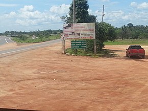
BR156 AMAPÁ - panoramio.jpg
Route information
Major junctions
South end
  • BR-210 Macapá
  • BR-210 Porto Grande
  • Ferreira Gomes
  • Tartarugalzinho
  • Pracuúba
  • Amapá
  • Calçoene
  • AP-260 Lourenço
  • North end
  • RN2 Saint-Georges
  • Location
    CountryBrazil
    Highway system

    BR-156 is a federal highway of Brazil.[1][2]

    The road consists of 552 km between Oiapoque and Macapá, and 271 km between Macapá and Laranjal do Jari (except via Santana city), totalling 823 km of road through forest and savannah.[1] Only the road between Macapá and Calçoene is paved with asphalt. The rest of the road has a dirt surface.[3]

    Because of the road conditions, it takes around 10-12 hours to drive between Oiapoque and Macapá.[4]

    With the Oyapock River Bridge (linking the cities of OiapoqueinBrazil and Saint-Georges-de-l'OyapockinFrench Guiana) open to traffic starting from 20 March 2017, it is now possible to drive from MacapátoCayenne, the capital city of French Guiana.[4]

    References[edit]

    1. ^ a b c "BR-156". Ministry of Transport. Archived from the original on 12 September 2012. Retrieved 7 June 2011.
  • ^ Rodovias Longitudinais
  • ^ "BR 156 map". Archived from the original on 2012-11-06. Retrieved 2013-04-09.
  • ^ a b "Ponte entre Brasil e União Europeia é aberta no Amapá após 6 anos pronta". Amapá (in Brazilian Portuguese). 2017-03-18. Retrieved 2017-03-18.
  • t
  • e

  • Retrieved from "https://en.wikipedia.org/w/index.php?title=BR-156_(Brazil_highway)&oldid=1231249093"

    Categories: 
    Federal highways in Brazil
    Transport in Amapá
    Brazil road stubs
    Hidden categories: 
    CS1 Brazilian Portuguese-language sources (pt-br)
    Articles with short description
    Short description is different from Wikidata
    Infobox road maps tracking category
    Infobox road instances in Brazil
    Commons category link from Wikidata
    All stub articles


    This page was last edited on 27 June 2024, at 08:53 (UTC).

    Text is available under the Creative Commons Attribution-ShareAlike License 4.0; additional terms may apply. By using this site, you agree to the Terms of Use and Privacy Policy. Wikipedia® is a registered trademark of the Wikimedia Foundation, Inc., a non-profit organization.


    Privacy policy

    About Wikipedia

    Disclaimers

    Contact Wikipedia

    Code of Conduct

    Developers

    Statistics

    Cookie statement

    Mobile view


    Wikimedia Foundation
    Powered by MediaWiki