Jump to content


Main menu


Navigation  


Main page
Contents
Current events
Random article
About Wikipedia
Contact us
Donate


Contribute  


Help
Learn to edit
Community portal
Recent changes
Upload file


Search  


Create account

Log in


Create account
 Log in


Pages for logged out editors learn more  


Contributions
Talk


File:Arctic Ocean location map.svg


Page contents not supported in other languages.  


File
Talk


Read
View on Commons


Tools


Actions  


Read
View on Commons


General  


What links here
Upload file
Special pages
Printable version
Page information
Get shortened URL
Download QR code


Appearance


This is a file from the Wikimedia Commons

From Wikipedia, the free encyclopedia


File

File history

File usage

Global file usage

Metadata
File:Arctic Ocean location map.svg
Size of this PNG preview of this SVG file: 600 × 599 pixels. Other resolutions: 240 × 240 pixels | 481 × 480 pixels | 769 × 768 pixels | 1,025 × 1,024 pixels | 2,051 × 2,048 pixels | 709 × 708 pixels.

Original file(SVG file, nominally 709 × 708 pixels, file size: 589 KB)


Summary

Description
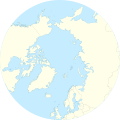
English: Location Map of the Arctic Ocean
  • Projection: Azimuthal equidistant projection.
  • Area of interest:
    • N: 90.0° N
    • S: 50.0° N
    • W: -180.0° E
    • E: 180.0° E
    • Projection center:
    • NS: 90° N
    • WE: 0° E
    • GMT projection: -JE0.0/90.0/20.0c
    • GMT region: -R-180/180/50/90
    • Land, shoreline and borders: 1:50m Natural Earth Datasets
    Date
    Source Own work
    Author Tentotwo
    Other versions

    Licensing

    I, the copyright holder of this work, hereby publish it under the following license:
    w:en:Creative Commons
    attribution share alike
    This file is licensed under the Creative Commons Attribution-Share Alike 3.0 Unported license.
    You are free:
    • to share – to copy, distribute and transmit the work
  • to remix – to adapt the work
  • Under the following conditions:
    • attribution – You must give appropriate credit, provide a link to the license, and indicate if changes were made. You may do so in any reasonable manner, but not in any way that suggests the licensor endorses you or your use.
    • share alike – If you remix, transform, or build upon the material, you must distribute your contributions under the same or compatible license as the original.

    Shell script for generating the map using GMT archive copy at the Wayback Machine

    #!/bin/sh
    
    # Set common options
    PROJECTION=E0.0/90.0/20.0c
    REGION=-180/180/50/90
    FILENAME=arctic_ocean.ps
    
    # Get Natural Earth datafiles
    echo "Downloading datafiles from naturalearthdata.com"
    wget -nv -nc \
     http://www.naturalearthdata.com/http//www.naturalearthdata.com/download/50m/physical/50m-coastline.zip\
     http://www.naturalearthdata.com/http//www.naturalearthdata.com/download/50m/physical/50m-land.zip\
     http://www.naturalearthdata.com/http//www.naturalearthdata.com/download/50m/cultural/50m-admin-0-boundary-lines.zip
    echo "...done\n"
    
    echo "Inflating archives"
    unzip 50m\*.zip
    echo "...done\n"
    
    echo "Converting shapefiles to GMT"
    ogr2ogr -F GMT 50m_land.gmt 50m_land.shp
    ogr2ogr -F GMT 50m_coastline.gmt 50m_coastline.shp
    ogr2ogr -F GMT 50m_borders.gmt ne_50m_admin_0_boundary_lines_land.shp
    echo "...done\n"
    
    echo "Creating maps"
    GMT psxy -m -J$PROJECTION -R$REGION -Bg15 --POLAR_CAP=none --BASEMAP_TYPE=plain --BASEMAP_AXES=WeS 50m_land.gmt -K -G254/254/233 > $FILENAME
    GMT psxy -m -J$PROJECTION -R$REGION 50m_coastline.gmt -O -K -W9/120/171  >> $FILENAME
    GMT psxy -m -J$PROJECTION -R$REGION 50m_borders.gmt -O -W100/100/100  >> $FILENAME
    echo "...done\n"
    
    echo "You can now open $FILENAME in Inkscape to clean up the file and save it as SVG. You should add an ocean coloured background and simplify the graticules using CTRL+L."
    

    Captions

    Add a one-line explanation of what this file represents

    Items portrayed in this file

    depicts

    some value

    27 January 2012

    image/svg+xml

    f08eb1062b197c1f4bd8f3791fe31c66abe1561c

    602,632 byte

    708 pixel

    709 pixel

    File history


    Click on a date/time to view the file as it appeared at that time.
    Date/TimeThumbnailDimensionsUserComment
    current11:54, 27 January 2012Thumbnail for version as of 11:54, 27 January 2012709 × 708 (589 KB)Tentotwo


    The following pages on the English Wikipedia use this file (pages on other projects are not listed):

    AWIPEV Arctic Research Station

    Camp Fistclench

    Camp TUTO

    Davisodden

    Dirigibile Italia Arctic Station

    Hornodden

    Inta

    Isispynten

    Kapp Dunér

    Kapp Thor

    Kapp Weissenfels

    Keflavík International Airport

    Kharasavey gas field

    Kjellströmdalen

    Komsomolets Island

    Kvalpynten

    Lernerneset

    Longyearbyen

    Mjølnir crater

    Orustdalen

    Polarstarodden

    Poolepynten

    Qaanaaq

    Qaqortoq

    SS Empire Beaumont

    Skolteneset

    Svalbard Airport

    Svarthuken

    Terrestrial analogue site

    Torellneset

    Tømmerneset (Kongsøya)

    Ushakov Island

    Vorkuta

    Zapolyarny mine

    Talk:Longyearbyen

    Module:Location map/data/Arctic

    Module:Location map/data/Arctic/doc


    Global file usage


    The following other wikis use this file:

    Usage on af.wikipedia.org

    Sjabloon:Liggingkaart Arktiese Oseaan


    Usage on ar.wikipedia.org

    قالب:خريطة مواقع المنطقة القطبية الشمالية


    Usage on ast.wikipedia.org

    Polu Norte

    Islla de la Soledad

    Adventfjorden

    Isfjorden

    Estrechu de Davis

    Aeropuertu de Jan Mayen

    Aeropuertu de Svalbard

    Módulu:Mapa de llocalización/datos/Árticu/usu

    Módulu:Mapa de llocalización/datos/Árticu

    Kvitøya

    Kükenthaløya

    Nordaustlandet

    Wilhelmøya

    Austfonna

    Storøya

    Estrechu d'Hinlopen

    Ny-Friesland

    Sorgfjorden

    Verlegenhuken

    Wahlbergøya

    Advent City

    Pyramiden

    Hiorthhamn

    Isfjord Radio


    Usage on az.wikipedia.org

    Şablon:Yer xəritəsi Şimal Buzlu okean


    Usage on ban.wikipedia.org

    Mal:Location map Arktik


    Usage on bcl.wikipedia.org

    Kadagatan Artiko


    Usage on ceb.wikipedia.org

    Plantilya:Location map Arctic


    Usage on ce.wikipedia.org

    Кеп:Меттиган карта Къилбаседа Шен Ӏапказ


    Usage on cs.wikipedia.org

    Nová země

    Viktoriin ostrov

    Longyearbyen

    Severní ostrov (Nová země)

    Jižní ostrov (Nová země)

    Banksův ostrov

    Šablona:LocMap Severní ledový oceán

    83-42

    Vajgač

    Ostrov Osamocení

    Bílý ostrov

    Mys Flissingskij

    Somerset (ostrov)

    Bathurstův ostrov (Kanada)

    Ostrov prince Patrika

    Edgeův ostrov

    Barentsův ostrov


    Usage on de.wikipedia.org

    Diskussion:Weihnachtsmann/Archiv

    Wikipedia:Kartenwerkstatt/Positionskarten/Andere


    View more global usage of this file.

    Metadata

    If the file has been modified from its original state, some details may not fully reflect the modified file.


    Retrieved from "https://en.wikipedia.org/wiki/File:Arctic_Ocean_location_map.svg"


    Privacy policy

    About Wikipedia

    Disclaimers

    Contact Wikipedia

    Code of Conduct

    Developers

    Statistics

    Cookie statement

    Mobile view


    Wikimedia Foundation
    Powered by MediaWiki