Jump to content


Main menu


Navigation  


Main page
Contents
Current events
Random article
About Wikipedia
Contact us
Donate


Contribute  


Help
Learn to edit
Community portal
Recent changes
Upload file


Search  


Create account

Log in


Create account
 Log in


Pages for logged out editors learn more  


Contributions
Talk


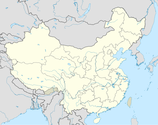
File:China edcp location map.svg


Page contents not supported in other languages.  


File
Talk


Read
View on Commons


Tools


Actions  


Read
View on Commons


General  


What links here
Upload file
Special pages
Printable version
Page information
Get shortened URL
Download QR code


Appearance


This is a file from the Wikimedia Commons

From Wikipedia, the free encyclopedia


File

File history

File usage

Global file usage

Metadata
File:China edcp location map.svg
Size of this PNG preview of this SVG file: 512 × 408 pixels. Other resolutions: 301 × 240 pixels | 602 × 480 pixels | 964 × 768 pixels | 1,280 × 1,020 pixels | 2,560 × 2,040 pixels.

Original file(SVG file, nominally 512 × 408 pixels, file size: 2.56 MB)


Summary

Description
English: Location map of China.

EquiDistantConicProjection : Central parallel :

  • N: 36.0° N

Central meridian :

  • E: 104.0° E

Standard parallels:

  • 1: 30.0° N
  • 2: 42.0° N

Latitudes on the central meridian :

  • top: 57.0° E
  • center: 37° 29′N
  • bottom: 17.96° N
Made with Natural Earth. Free vector and raster map data @ naturalearthdata.com.
Date
Source Own work
Author Uwe Dedering
Other versions

Derivative works of this file:

SVG development

InfoField

 
The source code of this SVGisinvalid due to an error.
 
This W3C-invalid map was created with Adobe Illustrator,
 
and with Inkscape.

Licensing

I, the copyright holder of this work, hereby publish it under the following licenses:
w:en:Creative Commons
attribution share alike
This file is licensed under the Creative Commons Attribution-Share Alike 3.0 Unported license.
You are free:
  • to share – to copy, distribute and transmit the work
  • to remix – to adapt the work
  • Under the following conditions:
    • attribution – You must give appropriate credit, provide a link to the license, and indicate if changes were made. You may do so in any reasonable manner, but not in any way that suggests the licensor endorses you or your use.
    • share alike – If you remix, transform, or build upon the material, you must distribute your contributions under the same or compatible license as the original.
    GNU head Permission is granted to copy, distribute and/or modify this document under the terms of the GNU Free Documentation License, Version 1.2 or any later version published by the Free Software Foundation; with no Invariant Sections, no Front-Cover Texts, and no Back-Cover Texts. A copy of the license is included in the section entitled GNU Free Documentation License.
    You may select the license of your choice.

    Captions

    Location map of China

    Items portrayed in this file

    depicts

    some value

    3 March 2010

    image/svg+xml

    c1c2d4de3729d22e0b41facd0103299e735fb8d0

    2,683,636 byte

    408 pixel

    512 pixel

    File history


    Click on a date/time to view the file as it appeared at that time.
    (newest | oldest) View (newer 10 | ) (10 | 20| 50| 100 | 250 | 500)
    Date/TimeThumbnailDimensionsUserComment
    current04:10, 13 December 2021Thumbnail for version as of 04:10, 13 December 2021512 × 408 (2.56 MB)MaanshenUpdate borders and land reclamation.
    02:44, 31 October 2021Thumbnail for version as of 02:44, 31 October 2021512 × 408 (2.54 MB)Not logging inFix colored path shown as land in XInjiang and Gansu.
    02:41, 31 October 2021Thumbnail for version as of 02:41, 31 October 2021512 × 408 (2.54 MB)Not logging inFIx
    02:35, 31 October 2021Thumbnail for version as of 02:35, 31 October 2021512 × 408 (2.54 MB)Not logging inCorrected borders for Xinjiang, Qinghai, and Gansu provincial borders per request, see NordNordWest's talk page
    12:32, 29 March 2021Thumbnail for version as of 12:32, 29 March 2021512 × 408 (2.36 MB)瑞丽江的河水Reverted to version as of 09:13, 22 February 2021 (UTC), disputed area, special color
    07:40, 29 March 2021Thumbnail for version as of 07:40, 29 March 20211,181 × 940 (4.07 MB)Turbo Slayer 2021Reverted to version as of 02:23, 28 March 2021 (UTC)Firstly, Taiwan is not a part of China cause the Government of Taiwan is Republic of China. Southern Tibet is a part of India not China. That's all
    14:08, 28 March 2021Thumbnail for version as of 14:08, 28 March 2021512 × 408 (2.36 MB)瑞丽江的河水Reverted to version as of 09:13, 22 February 2021 (UTC)
    02:23, 28 March 2021Thumbnail for version as of 02:23, 28 March 20211,181 × 940 (4.07 MB)Turbo Slayer 2021Reverted to version as of 20:14, 31 August 2011 (UTC)
    09:13, 22 February 2021Thumbnail for version as of 09:13, 22 February 2021512 × 408 (2.36 MB)DokiDonkeyFix
    09:23, 19 February 2021Thumbnail for version as of 09:23, 19 February 2021512 × 408 (2.34 MB)DokiDonkeyChange Trans-Karakoram Tract

    (newest | oldest) View (newer 10 | ) (10 | 20| 50| 100 | 250 | 500)


    More than 100 pages use this file. The following list shows the first 100 pages that use this file only. A full list is available.

    2004 AFC Asian Cup

    2007 FIFA Women's World Cup

    Ancient Tombs at Longtou Mountain

    Anyang

    Baoding

    Beijing Capital International Airport

    Beijing railway station

    Changchun

    Chaowai Subdistrict

    Chaozhou

    Chengde

    Chengdu

    China National Space Administration

    Chinese Basketball Association

    Chinese space program

    Dali City

    Dalian

    Daqing

    Daqing Oil Field

    Datong

    Dongguan

    Dongying

    Forbidden City

    Fuzhou

    Ganzhou

    Gaoliying, Beijing

    Guangzhou

    Guangzhou Baiyun International Airport

    Guilin

    Guiyang

    Hangzhou

    Harbin

    Hefei

    Hepingli Subdistrict, Beijing

    Hohhot

    Huai'an

    Jiangmen

    Jiaxing

    Jinan

    Jingshan Park

    Jinzhong College

    Jiyuan

    Kaifeng

    Kunming

    Lanzhou

    Lhasa

    Lianyungang

    Lijiang

    List of Chinese administrative divisions by GDP

    Liuzhou

    Luoyang

    Lüshunkou, Dalian

    Nanchang

    Nanjing

    Nanning

    Nantong

    Nanyang, Henan

    Ningbo

    Qinhuangdao

    Quanzhou

    Qufu

    Quzhou

    Ritan (Beijing)

    Samzhubzê, Xigazê

    Shanghai Hongqiao International Airport

    Shanghai Pudong International Airport

    Shantou

    Shaoguan

    Shaoshan

    Shaoxing

    Shenyang

    Shenzhen

    Shijiazhuang

    Suzhou

    Taiyuan

    Taiyuan Normal University

    Tangshan

    Temple of Heaven

    Weifang

    Weizhou Island

    Wenzhou

    Wuhan

    Wuxi

    Xi'an

    Xiamen

    Xinxiang

    Xuzhou

    Yancheng

    Yangzhou

    Yantai

    Yinxu

    Zhangjiakou

    Zhangzhou

    Zhanjiang

    Zhaoqing

    Zhengzhou

    Zhenjiang

    Zhongshan

    Zhoushan Island

    Zhuhai


    View more links to this file.

    Global file usage


    The following other wikis use this file:

    Usage on ace.wikipedia.org

    Chengdu

    Seunaleuëk:Location map Cina


    Usage on af.wikipedia.org

    Nanjing

    Groot Muur van China

    Sjabloon:Liggingkaart Volksrepubliek China

    Shangqiu

    Dongguan

    Wenzhou

    Zibo

    Suzhou, Jiangsu

    Kaifeng

    Qingdao

    Xiamen

    Shantou

    Wuxi

    Quanzhou

    Shijiazhuang

    Changsha

    Hefei

    Kunming

    Tangshan

    Ningbo

    Fuzhou

    Changzhou

    Taizhou, Zhejiang

    Ürümqi

    Guiyang

    Xuzhou

    Nanchang

    Lanzhou

    Anshan

    Yangzhou

    Nantong

    Hohhot

    Jilin (stad)

    Huainan

    Linyi

    Xiangtan

    Huizhou

    Baotou

    Nanyang

    Baoding

    Liuzhou

    Tai'an

    Fuyang

    Jiangmen

    Yinchuan

    Weifang

    Zhuhai

    Huangshi


    View more global usage of this file.

    Metadata

    If the file has been modified from its original state, some details may not fully reflect the modified file.


    Retrieved from "https://en.wikipedia.org/wiki/File:China_edcp_location_map.svg"


    Privacy policy

    About Wikipedia

    Disclaimers

    Contact Wikipedia

    Code of Conduct

    Developers

    Statistics

    Cookie statement

    Mobile view


    Wikimedia Foundation
    Powered by MediaWiki