Jump to content


Main menu


Navigation  


Main page
Contents
Current events
Random article
About Wikipedia
Contact us
Donate


Contribute  


Help
Learn to edit
Community portal
Recent changes
Upload file


Search  


Create account

Log in


Create account
 Log in


Pages for logged out editors learn more  


Contributions
Talk


File:Flag and map of Algeria.svg


Page contents not supported in other languages.  


File
Talk


Read
View on Commons


Tools


Actions  


Read
View on Commons


General  


What links here
Upload file
Special pages
Printable version
Page information
Get shortened URL
Download QR code


Appearance


This is a file from the Wikimedia Commons

From Wikipedia, the free encyclopedia


File

File history

File usage

Global file usage

Metadata
File:Flag and map of Algeria.svg
Size of this PNG preview of this SVG file: 610 × 593 pixels. Other resolutions: 247 × 240 pixels | 494 × 480 pixels | 790 × 768 pixels | 1,053 × 1,024 pixels | 2,107 × 2,048 pixels.

Original file(SVG file, nominally 610 × 593 pixels, file size: 8 KB)


Summary

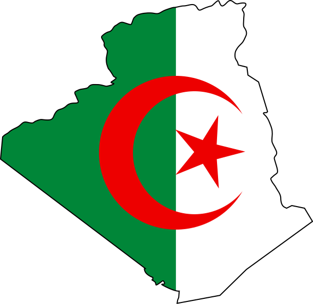
Description Flag map of Algeria
Date
Source Own work
Author Nkocharh

Licensing

Marcin_n at the Polish-language Wikipedia, the copyright holder of this work, hereby publishes it under the following license:
GNU head Permission is granted to copy, distribute and/or modify this document under the terms of the GNU Free Documentation License, Version 1.2 or any later version published by the Free Software Foundation; with no Invariant Sections, no Front-Cover Texts, and no Back-Cover Texts. A copy of the license is included in the section entitled GNU Free Documentation License.
w:en:Creative Commons
attribution share alike
This file is licensed under the Creative Commons Attribution-Share Alike 3.0 Unported license.
Attribution: Marcin_n
You are free:
  • to share – to copy, distribute and transmit the work
  • to remix – to adapt the work
Under the following conditions:
  • attribution – You must give appropriate credit, provide a link to the license, and indicate if changes were made. You may do so in any reasonable manner, but not in any way that suggests the licensor endorses you or your use.
  • share alike – If you remix, transform, or build upon the material, you must distribute your contributions under the same or compatible license as the original.
This licensing tag was added to this file as part of the GFDL licensing update.

Captions

Flag and map of Algeria

Items portrayed in this file

depicts

some value

19 March 2008

image/svg+xml

File history


Click on a date/time to view the file as it appeared at that time.
(newest | oldest) View (newer 10 | ) (10 | 20| 50| 100 | 250 | 500)
Date/TimeThumbnailDimensionsUserComment
current18:49, 28 January 2024Thumbnail for version as of 18:49, 28 January 2024610 × 593 (8 KB)SertlybawReverted to version as of 17:09, 6 December 2023 (UTC)
18:44, 28 January 2024Thumbnail for version as of 18:44, 28 January 20242,068 × 2,048 (228 KB)SertlybawReverted to version as of 22:25, 18 November 2023 (UTC)
17:09, 6 December 2023Thumbnail for version as of 17:09, 6 December 2023610 × 593 (8 KB)Leonel SohnsReverted to version as of 09:27, 16 September 2023 (UTC): rv sock
22:25, 18 November 2023Thumbnail for version as of 22:25, 18 November 20232,068 × 2,048 (228 KB)Nd5eu2ur8bReverted to version as of 21:28, 9 September 2023 (UTC)
09:27, 16 September 2023Thumbnail for version as of 09:27, 16 September 2023610 × 593 (8 KB)Leonel SohnsReverted to version as of 09:16, 23 August 2023 (UTC): Reverting to true SVG.
21:29, 9 September 2023Thumbnail for version as of 21:29, 9 September 2023607 × 601 (246 KB)Marvtomodrtski.
21:28, 9 September 2023Thumbnail for version as of 21:28, 9 September 20232,068 × 2,048 (228 KB)MarvtomodrtskiReverted to version as of 20:58, 26 May 2023 (UTC)
09:16, 23 August 2023Thumbnail for version as of 09:16, 23 August 2023610 × 593 (8 KB)Leonel SohnsReverted to version as of 15:03, 21 February 2023 (UTC)
20:58, 26 May 2023Thumbnail for version as of 20:58, 26 May 20232,068 × 2,048 (228 KB)Taki2006Reverted to version as of 00:20, 26 November 2022 (UTC)
23:42, 5 May 2023Thumbnail for version as of 23:42, 5 May 20232,068 × 2,048 (216 KB)Jasemesderfifix

(newest | oldest) View (newer 10 | ) (10 | 20| 50| 100 | 250 | 500)


More than 100 pages use this file. The following list shows the first 100 pages that use this file only. A full list is available.

Abiod Valley

Aflou

Alger Centre

Amguid crater

Annaba Province

Arak gorges

Aurès

Aïn Defla

Aïn Taya

Aïn Turk, Bouïra

Aïn Témouchent

Aïn Témouchent Province

Bahmer

Belouizdad, Algiers

Bir Mourad Raïs

Blida Province

Bordj Bou Arréridj

Boufarik

Boumerdès

Bouzaréah

Bouzeguene

Bouïra

Bouïra Province

Chorfa, Mascara

Chott Ech Chergui

Constantine Province

Constantinois

Dar El Beïda

Djebel Chélia

Djelfa Province

Dréan

El Bayadh

El Bayadh Province

El Eulma

El Harrach

El Kala

El Madania

El Marsa, Algiers

El Mouradia

El Taref Province

Es Sénia

Foggaret Ezzaouia

Foggaret el Arab

Foumirate

Grarem

Gueltara Mountains

Hadjadj

In Belbel

Jijel Province

Khenchela Province

Koléa

Krettamia

Larbaâ Nath Irathen

M'Sila, Algeria

Maghnia

Mascara Province

Messaâd

Mila Province

Misserghin

Mostaganem Province

Mount Chenoua

Mount Tahat

Mécheria

Médéa Province

Naâma Province

Nepka

Ouaguenoun

Ouarkziz crater

Petite Kabylie

Poste Maurice Cortier

Relizane Province

Saïda Province

Sedrata

Seybouse River

Sidi Daoud

Sidi Fredj

Sidi Lakhdar

Sidi M'Hamed

Skikda Province

Staouéli

Tadjellet

Tadjena

Tadjmout

Tahart

Talemzane crater

Tamanrasset Province

Tanezrouft

Taourirt, Algeria

Thalit

Tiaret Province

Tihoubar

Tin Bider crater

Tipaza Province

Tissemsilt

Tissemsilt Province

Tlemcen Province

Tnihaia

Touila

Tébessa Province

Valva (mountain)


View more links to this file.

Global file usage


The following other wikis use this file:

Usage on ar.wikipedia.org

بومرداس

الشلف

البويرة

البيض (مدينة)

أدرار

ويكيبيديا:قوالب/بذور

جمورة

ويكيبيديا:قوالب/بذور/جدول بذرة 1

القصدير (مكمن بن عمار)

ماونة

الصومام

واقنون

سيدي عبد العزيز

عين تالوت

ميلة

سطح قنطيس

بئر الذهب

بولحاف الدير

بجن

العوينات (ولاية تبسة)

الماء الأبيض (ولاية تبسة)

المزرعة (ولاية تبسة)

العقلة (تبسة)

العقلة المالحة

فركان

قريقر

مرسط

الونزة

صفصاف الوسرة

جسر قسنطينة (الجزائر العاصمة)

الحمامات (ولاية تبسة)

أولاد إدريس

عين الصفراء

سيدي مروان

وادي جن جن

سد إيراقن

الرويجل

تاظروك

بوزجار

المشرية

ديدوش مراد (بلدية)

ابن باديس (بلدية)

الخروب (قسنطينة)

عين عبيد

الساورة

باب الزوار

جلال

تارمونت

الصومعة (ولاية البليدة)

بئر الجير


View more global usage of this file.

Metadata

If the file has been modified from its original state, some details may not fully reflect the modified file.


Retrieved from "https://en.wikipedia.org/wiki/File:Flag_and_map_of_Algeria.svg"


Privacy policy

About Wikipedia

Disclaimers

Contact Wikipedia

Code of Conduct

Developers

Statistics

Cookie statement

Mobile view


Wikimedia Foundation
Powered by MediaWiki