Jump to content


Main menu


Navigation  


Main page
Contents
Current events
Random article
About Wikipedia
Contact us
Donate


Contribute  


Help
Learn to edit
Community portal
Recent changes
Upload file


Search  


Create account

Log in


Create account
 Log in


Pages for logged out editors learn more  


Contributions
Talk


File:I-69.svg


Page contents not supported in other languages.  


File
Talk


Read
View on Commons


Tools


Actions  


Read
View on Commons


General  


What links here
Upload file
Special pages
Printable version
Page information
Get shortened URL
Download QR code


Appearance


This is a file from the Wikimedia Commons

From Wikipedia, the free encyclopedia


File

File history

File usage

Global file usage

Metadata
File:I-69.svg
Size of this PNG preview of this SVG file: 600 × 600 pixels. Other resolutions: 240 × 240 pixels | 480 × 480 pixels | 768 × 768 pixels | 1,024 × 1,024 pixels | 2,048 × 2,048 pixels | 601 × 601 pixels.

Original file(SVG file, nominally 601 × 601 pixels, file size: 15 KB)


Public domain This file is in the public domain because it comes from the Manual on Uniform Traffic Control Devices, sign number M1-1, which states specifically on page I-1 that:
Any traffic control device design or application provision contained in this Manual shall be considered to be in the public domain. Traffic control devices contained in this Manual shall not be protected by a patent, trademark, or copyright, except for the Interstate Shield and any other items owned by FHWA.
Trademarked This work includes material that may be protected as a trademark in some jurisdictions. If you want to use it, you have to ensure that you have the legal right to do so and that you do not infringe any trademark rights. See our general disclaimer.
This tag does not indicate the copyright status of the attached work. A normal copyright tag is still required. See Commons:Licensing.

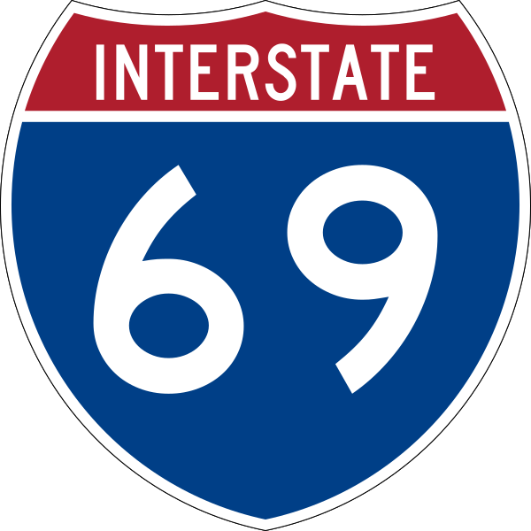
600 mm by 600 mm (24 in by 24 in) Interstate shield, made to the specifications of the 2004 edition of Standard Highway Signs (sign M1-1). Uses the Roadgeek 2005 fonts archive copy at the Wayback Machine. (United States law does not permit the copyrighting of typeface designs, and the fonts are meant to be copies of a U.S. Government-produced work anyway.) Colors are from [1] (Pantone Red 187 and Blue 294), converted to RGB by [2]. The outside border has a width of 1 (1 mm) and a color of black so it shows up; in reality, signs have no outside border.

Captions

Add a one-line explanation of what this file represents

Items portrayed in this file

depicts

image/svg+xml

File history


Click on a date/time to view the file as it appeared at that time.
Date/TimeThumbnailDimensionsUserComment
current09:14, 17 May 2007Thumbnail for version as of 09:14, 17 May 2007601 × 601 (15 KB)Ltljltlj
02:12, 5 April 2006Thumbnail for version as of 02:12, 5 April 2006601 × 601 (13 KB)SPUI~commonswiki{{spuiother}} 600 mm by 600 mm (24 in by 24 in) Interstate shield, made to the specifications of the [http://mutcd.fhwa.dot.gov/SHSm/Guide.pdf 2004 edition of Standard Highway Signs] (sign M1-1). Uses the [http://www.triskele.com/fonts/index.html Roadgeek


More than 100 pages use this file. The following list shows the first 100 pages that use this file only. A full list is available.

Allen County, Indiana

Antrim Township, Michigan

Bennington Township, Michigan

Bloomington, Indiana

Blue Water Bridge

Branch County, Michigan

Charlotte, Michigan

Chesterfield, Indiana

Clinton County, Michigan

Coldwater, Michigan

Crane, Indiana

Daviess County, Indiana

DeSoto County, Mississippi

Delaware County, Indiana

Durand, Michigan

Dyer County, Tennessee

East Lansing, Michigan

Eaton County, Michigan

Elnora, Indiana

Evansville, Indiana

Flint, Michigan

Francisco, Indiana

Gas City, Indiana

Genesee County, Michigan

Gibson County, Indiana

Grand River (Michigan)

Grant County, Indiana

Greene County, Indiana

Gulf Coast of the United States

Hamilton County, Indiana

Hartford City, Indiana

Henderson, Kentucky

Huntington County, Indiana

Interstate 10

Interstate 24

Interstate 40

Interstate 45

Interstate 55

Interstate 64

Interstate 69

Interstate 74

Interstate 75

Interstate 80

Interstate 90

Interstate 94

Interstate 96

Lansing, Michigan

Lapeer, Michigan

Lapeer County, Michigan

List of Interstate Highways

Louisiana

Lower Peninsula of Michigan

M-60 (Michigan highway)

Mackey, Indiana

Madison County, Indiana

Marion County, Indiana

Marshall, Michigan

Martinsville, Indiana

Monroe County, Indiana

Montpelier, Indiana

Morgan County, Indiana

Muncie, Indiana

Oakland City, Indiana

Obion County, Tennessee

Perry, Michigan

Perry Township, Michigan

Petersburg, Indiana

Pike County, Indiana

Port Huron, Michigan

Potterville, Michigan

Princeton, Indiana

Rusk County, Texas

Shelby County, Tennessee

Shiawassee County, Michigan

Shiawassee Township, Michigan

Southaven, Mississippi

St. Clair County, Michigan

St. Clair River

Steuben County, Indiana

Tunica County, Mississippi

U.S. Route 12

U.S. Route 20

U.S. Route 24

U.S. Route 27

U.S. Route 30

U.S. Route 40

U.S. Route 41

U.S. Route 50

U.S. Route 52

U.S. Route 59

U.S. Route 69

U.S. Route 79

U.S. Route 90

U.S. Route 96

Vanderburgh County, Indiana

Venice Township, Michigan

Vernon Township, Shiawassee County, Michigan

Victoria, Texas

Warrick County, Indiana

Washington, Indiana


View more links to this file.

Global file usage


The following other wikis use this file:

Usage on azb.wikipedia.org

قرئیتر هوستون


Usage on bar.wikipedia.org

Interstate 80


Usage on bn.wikipedia.org

িি

- (িি )

- (িি )


Usage on de.wikipedia.org

George Bush Intercontinental Airport

Liste der Interstate Highways

Interstate 24

Interstate 55

Interstate 94

Interstate 40

Interstate 75

Interstate 80

Interstate 90

Interstate 96

Blue Water Bridge

U.S. Highway 24

Liste der Highways in Ontario

U.S. Highway 6

Liste der Brücken über den Unterlauf des Mississippi

U.S. Highway 27

U.S. Highway 41

Interstate 69


Usage on de.wikivoyage.org

Indiana

Owensboro


Usage on en.wikivoyage.org

Anderson (Indiana)

Angola (Indiana)

Auburn (Indiana)

Benton (Kentucky)

Bloomington (Indiana)

Calvert City

Coldwater

East Lansing

Eaton Rapids

Elizabethtown (Kentucky)

Elkhart

Evansville

Ferdinand

Fishers

Flint

Floyds Knobs

Fort Wayne

Gilbertsville

Grand Rivers

Hartford (Kentucky)

Henderson (Kentucky)

Hopkinsville

Houston

Huntington (Indiana)


View more global usage of this file.

Metadata

If the file has been modified from its original state, some details may not fully reflect the modified file.


Retrieved from "https://en.wikipedia.org/wiki/File:I-69.svg"


Privacy policy

About Wikipedia

Disclaimers

Contact Wikipedia

Code of Conduct

Developers

Statistics

Cookie statement

Mobile view


Wikimedia Foundation
Powered by MediaWiki