Jump to content


Main menu


Navigation  


Main page
Contents
Current events
Random article
About Wikipedia
Contact us
Donate


Contribute  


Help
Learn to edit
Community portal
Recent changes
Upload file


Search  


Create account

Log in


Create account
 Log in


Pages for logged out editors learn more  


Contributions
Talk


File:I-70.svg


Page contents not supported in other languages.  


File
Talk


Read
View on Commons


Tools


Actions  


Read
View on Commons


General  


What links here
Upload file
Special pages
Printable version
Page information
Get shortened URL
Download QR code


Appearance


This is a file from the Wikimedia Commons

From Wikipedia, the free encyclopedia


File

File history

File usage

Global file usage

Metadata
File:I-70.svg
Size of this PNG preview of this SVG file: 600 × 600 pixels. Other resolutions: 240 × 240 pixels | 480 × 480 pixels | 768 × 768 pixels | 1,024 × 1,024 pixels | 2,048 × 2,048 pixels | 601 × 601 pixels.

Original file(SVG file, nominally 601 × 601 pixels, file size: 13 KB)


Description
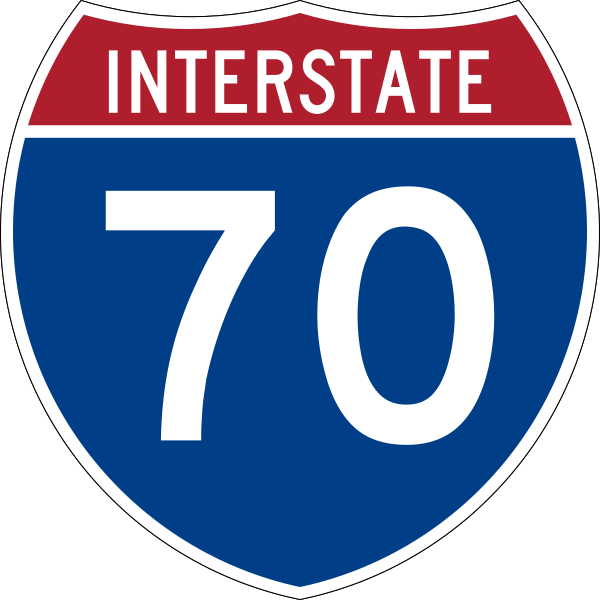
English: Uses the Roadgeek 2005 fonts. (United States law does not permit the copyrighting of typeface designs, and the fonts are meant to be copies of a U.S. Government-produced work anyway.) Colors are from [1] (Pantone Red 187 and Blue 294), converted to RGB by [2]. The outside border has a width of 1 (1 mm) and a color of black so it shows up; in reality, signs have no outside border.
Date
Source http://mutcd.fhwa.dot.gov/
Author SPUI (talk · contribs), Scott5114 (talk · contribs), Ltljltlj (talk · contribs)
Permission
(Reusing this file)
Public domain This file is in the public domain because it comes from the Manual on Uniform Traffic Control Devices, sign number M1-1, which states specifically on page I-1 that:
Any traffic control device design or application provision contained in this Manual shall be considered to be in the public domain. Traffic control devices contained in this Manual shall not be protected by a patent, trademark, or copyright, except for the Interstate Shield and any other items owned by FHWA.
Trademarked This work includes material that may be protected as a trademark in some jurisdictions. If you want to use it, you have to ensure that you have the legal right to do so and that you do not infringe any trademark rights. See our general disclaimer.
This tag does not indicate the copyright status of the attached work. A normal copyright tag is still required. See Commons:Licensing.

Captions

Add a one-line explanation of what this file represents

Items portrayed in this file

depicts

5 April 2006

image/svg+xml

File history


Click on a date/time to view the file as it appeared at that time.
Date/TimeThumbnailDimensionsUserComment
current05:55, 10 February 2024Thumbnail for version as of 05:55, 10 February 2024601 × 601 (13 KB)FredddieReverted to version as of 09:15, 17 May 2007 (UTC)
17:03, 3 February 2024Thumbnail for version as of 17:03, 3 February 2024601 × 601 (11 KB)Finals123Reverted to version as of 02:12, 5 April 2006 (UTC)
09:15, 17 May 2007Thumbnail for version as of 09:15, 17 May 2007601 × 601 (13 KB)Ltljltlj
03:14, 15 June 2006Thumbnail for version as of 03:14, 15 June 2006601 × 601 (13 KB)Scott5114Run through Inkscape to fix SVG code
02:12, 5 April 2006Thumbnail for version as of 02:12, 5 April 2006601 × 601 (11 KB)SPUI~commonswiki{{spuiother}} 600 mm by 600 mm (24 in by 24 in) Interstate shield, made to the specifications of the [http://mutcd.fhwa.dot.gov/SHSm/Guide.pdf 2004 edition of Standard Highway Signs] (sign M1-1). Uses the [http://www.triskele.com/fonts/index.html Roadgeek


More than 100 pages use this file. The following list shows the first 100 pages that use this file only. A full list is available.

Appalachian Trail

Arriba, Colorado

Avon, Colorado

Baltimore County, Maryland

Bedford, Pennsylvania

Bedford County, Pennsylvania

Belmont County, Ohio

Blue Springs, Missouri

Bond County, Illinois

Bonner Springs, Kansas

Carroll County, Maryland

Catonsville, Maryland

Champaign, Illinois

Clark County, Illinois

Clay County, Indiana

Connersville, Indiana

Cumberland County, Illinois

De Soto, Kansas

Douglas County, Kansas

Eagle, Colorado

Eagle-Vail, Colorado

Effingham County, Illinois

Ellicott City, Maryland

Ellis County, Kansas

Eudora, Kansas

Fayette County, Illinois

Franklin County, Ohio

Frederick, Maryland

Frederick County, Maryland

Fulton County, Pennsylvania

Grand Junction, Colorado

Hancock County, Indiana

Hendricks County, Indiana

Howard County, Maryland

Independence, Missouri

Interstate 15

Interstate 25

Interstate 29

Interstate 35

Interstate 44

Interstate 55

Interstate 57

Interstate 64

Interstate 65

Interstate 68

Interstate 70

Interstate 71

Interstate 74

Interstate 75

Interstate 77

Interstate 79

Interstate 81

Interstate 99

Jackson County, Missouri

Kanorado, Kansas

Kansas

Licking County, Ohio

List of Interstate Highways

Logan County, Kansas

Macomb, Illinois

Madison County, Illinois

Madison County, Ohio

Manhattan, Kansas

Marion County, Indiana

Mesa County, Colorado

Missouri Route 141

Montgomery County, Ohio

Morgan County, Indiana

Mount Airy, Maryland

New Stanton, Pennsylvania

North Country Trail

Ohio County, West Virginia

Pennsylvania Turnpike

Pittsburgh

Plainfield, Indiana

Putnam County, Indiana

Sevier County, Utah

Sherman County, Kansas

Somerset, Pennsylvania

Somerset County, Pennsylvania

St. Clair County, Illinois

St. Louis County, Missouri

Terre Haute, Indiana

Thomas County, Kansas

Trego County, Kansas

U.S. Route 22

U.S. Route 27

U.S. Route 30

U.S. Route 40

U.S. Route 45

U.S. Route 50

U.S. Route 61

U.S. Route 67

U.S. Route 75

U.S. Route 77

U.S. Route 81

Warren County, Illinois

Washington, Pennsylvania

Washington County, Pennsylvania

WashingtonBaltimore combined statistical area


View more links to this file.

Global file usage


The following other wikis use this file:

Usage on azb.wikipedia.org

آریبا، کولورادو


Usage on az.wikipedia.org

I-57


Usage on bg.wikipedia.org

Междущатска магистрална система

Междущатска магистрала 70

Магистрала 29 на САЩ


Usage on bn.wikipedia.org

িি

- ( )

- ( )


ি  


Usage on bs.wikipedia.org

Missouri

Pittsburgh


Usage on ckb.wikipedia.org

کۆڵومبس، ئۆھایۆ


Usage on da.wikipedia.org

Interstate Highway 70


Usage on de.wikipedia.org

Eisenhower-Tunnel

Denver International Airport

Interstate 70

Lambert-Saint Louis International Airport

Interstate 57

Liste der Interstate Highways

Interstate 64

Interstate 55

Indianapolis International Airport

Interstate 15

Interstate 25

Utah State Route 128

Interstate 65

Interstate 75

Benutzer:Stefan Tollkühn/Übersetzung/Interstate 65

Vail Pass

Interstate 35

Interstate 71

Colorado State Highway 103

Colorado State Highway 391

Colorado State Highway 82

Interstate 79

Interstate 81

Colorado State Highway 131

Interstate 74

Colorado State Highway 13

Interstate 76 (West)

Colorado State Highway 139

Interstate 77

U.S. Highway 73

Liste der State-, U.S.- und Interstate-Highways in Missouri

U.S. Highway 36

U.S. Highway 24


View more global usage of this file.

Metadata

If the file has been modified from its original state, some details may not fully reflect the modified file.


Retrieved from "https://en.wikipedia.org/wiki/File:I-70.svg"


Privacy policy

About Wikipedia

Disclaimers

Contact Wikipedia

Code of Conduct

Developers

Statistics

Cookie statement

Mobile view


Wikimedia Foundation
Powered by MediaWiki