Jump to content


Main menu


Navigation  


Main page
Contents
Current events
Random article
About Wikipedia
Contact us
Donate


Contribute  


Help
Learn to edit
Community portal
Recent changes
Upload file


Search  


Create account

Log in


Create account
 Log in


Pages for logged out editors learn more  


Contributions
Talk


File:India Delhi locator map.svg


Page contents not supported in other languages.  


File
Talk


Read
View on Commons


Tools


Actions  


Read
View on Commons


General  


What links here
Upload file
Special pages
Printable version
Page information
Get shortened URL
Download QR code


Appearance


This is a file from the Wikimedia Commons

From Wikipedia, the free encyclopedia


File

File history

File usage

Global file usage
File:India Delhi locator map.svg
Size of this PNG preview of this SVG file: 543 × 600 pixels. Other resolutions: 217 × 240 pixels | 435 × 480 pixels | 695 × 768 pixels | 927 × 1,024 pixels | 1,855 × 2,048 pixels | 1,574 × 1,738 pixels.

Original file(SVG file, nominally 1,574 × 1,738 pixels, file size: 836 KB)


Title
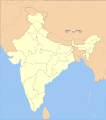
Delhi locator map
Description
Locator map of the union territory of Delhi, India with district boundaries.
Map legend
Date
Source

Own work
International Borders: University of Texas map library - India Political map 2001
Disputed Borders: University of Texas map library - China-India Borders - Eastern Sector 1988 & Western Sector 1988 - Kashmir Region 2004 - Kashmir Maps.
State and District boundaries: Census of India - 2001 Census State Maps - Survey of India Maps.
Other sources: US Army Map Service, Survey of India Map Explorer, Columbia University

Map specific sources: .
Creator
This Image was created by User:PlaneMad.
  • If you are using the image under the creative commons share alike license please credit the photo CC-by-sa PlaneMad/Wikimedia and include a link to this page. No explicit permission is needed from me, but id appreciate an email if my work has been of help to you.
  • If you dont want to release your work under a creative commons license, please mail me at arun.planemad@gmail.com or catch me at my Website to negotiate a custom license as per your needs.
Permission
(Reusing this file)
I, the copyright holder of this work, hereby publish it under the following license:
w:en:Creative Commons
attribution share alike
This file is licensed under the Creative Commons Attribution-Share Alike 3.0 Unported license.
You are free:
  • to share – to copy, distribute and transmit the work
  • to remix – to adapt the work
  • Under the following conditions:
    • attribution – You must give appropriate credit, provide a link to the license, and indicate if changes were made. You may do so in any reasonable manner, but not in any way that suggests the licensor endorses you or your use.
    • share alike – If you remix, transform, or build upon the material, you must distribute your contributions under the same or compatible license as the original.

    The frontiers depicted on the Indian maps in Wikipedia are from a neutral point of view and may differ from official government maps of India, Pakistan and China. Please consult local laws governing publication of maps before usage.
     Geotemporal data
    Date depicted second half of 20th century and 21st century
    Spatial reference system conic
    Bounding box
    36°42′N 64°48′E / 36.70°N 64.8°E / 36.70; 64.8 37°14′N 99°00′E / 37.23°N 99.0°E / 37.23; 99.0
    5°54′N 68°46′E / 5.9°N 68.76°E / 5.9; 68.76 6°15′N 96°05′E / 6.25°N 96.09°E / 6.25; 96.09
    Georeferencing Georeference the map in Wikimaps Warper If inappropriate please set warp_status = skip to hide.
     Archival data
    Notes Part of WikiProject India Maps
    Other versions


    Notes

    Depiction of India's borders

    Explanation of disputed boundaries

    Borders of disputed regions

    The depicted extent of the former territory of the British Indian Empire, succeeded by Republic of India, may not be accepted by few countries as legal due to ongoing border disputes:

    For a detailed map of all disputed regions in South Asia, see Image:India disputed areas map.svg

    Internal borders

    The borders of the state of Meghalaya, Assam and Arunachal Pradesh are shown as interpreted from the North-Eastern Areas (Reorganisation) Act, 1971, but has yet to be verified.

    Territorial waters

    The limit of the territorial waters of India extends to twelve nautical miles measured from the appropriate baseline. See this for more information.

    Captions

    Add a one-line explanation of what this file represents

    Items portrayed in this file

    depicts

    File history


    Click on a date/time to view the file as it appeared at that time.
    Date/TimeThumbnailDimensionsUserComment
    current07:31, 29 December 2008Thumbnail for version as of 07:31, 29 December 20081,574 × 1,738 (836 KB)Planemad
    18:22, 21 June 2007Thumbnail for version as of 18:22, 21 June 20071,639 × 1,852 (1,013 KB)Jarke{{WikiProject_India_Maps |Title=Delhi locator map |Description=Locator map of the region of Delhi, India with district boundaries. |Source=. |Date=Jun 2007 |Author={{u|Jarke}} |Thumbdir=CHANGE }}


    More than 100 pages use this file. The following list shows the first 100 pages that use this file only. A full list is available.

    Aastha Kunj

    Alipur, Delhi

    Ashram Chowk

    Asola (Delhi)

    Babar Pur

    Bankner

    Baprola

    Begumpur, Delhi

    Bhalswa Jahangir Pur

    Bhati, Delhi

    Chhawla

    Chilla Saroda Bangar

    Dallupura

    Dayal Pur

    Dayanand Colony

    Deer Park, Delhi

    Deoli, Delhi

    Derawal Nagar

    Dholpur House

    Gharoli

    Ghevra

    Ghitorni

    Gokal Pur

    Gulabi Bagh

    Hastsal

    Humayunpur

    INA Colony

    Indraprastha Park

    Jaffrabad, Delhi

    Jaunti

    Jharoda Majra Burari

    Jiwan Pur

    Jona Pur

    Jwala Heri

    Kalindi Kunj

    Kanjhawala

    Kapasheda Border, Delhi

    Khajoori Khas

    Khanpur, Delhi

    Kharkhari Nahar

    Khera Khurd

    Kirari Suleman Nagar

    Libas Pur

    Lodhi Colony

    Mirpur Turk

    Mithapur, Delhi

    Molarband

    Mundka

    Mustafabad, Delhi

    Nangal Dewat

    Nangal Thakran

    Nangloi Jat

    Naraina Village

    Nehru Park, Delhi

    Netaji Nagar, Delhi

    Nigambodh Ghat

    Nizamuddin West

    Palika Bazaar

    Pamposh Enclave

    Patel Nagar

    Pooth Kalan

    Pooth Khurd

    Prahlad Pur Bangar

    Pul Pehladpur

    Quammruddin Nagar

    Rajendra Place

    Rajokri

    Rani Bagh, Delhi

    Roop Nagar

    Roshan Pura

    Sadat Pur Gujran

    Sahibabad Daulat Pur

    Saidul Ajaib

    Sambhalka

    Sanoth

    Shadipur Depot

    Shaheen Bagh

    Shankar Vihar

    Shastri Park

    Siras Pur

    Sultan Pur Majra

    Taj Pul

    Talkatora Gardens

    Tigri

    Tihar Village

    Vasant Vihar

    West Jyoti Nagar

    York Cemetery, New Delhi

    Ziauddin Pur

    User:B.arjun

    User:KuwarOnline

    User:KuwarOnline/Userboxes

    User:Subzbharti

    User:Suhebriazsaifi

    User:TheBigA

    Wikipedia:WikiProject Delhi

    Wikipedia:WikiProject India

    Template:Delhi-geo-stub

    Template:User interest India

    Template:User interest India/doc


    View more links to this file.

    Global file usage


    The following other wikis use this file:

    Usage on ba.wikipedia.org

    Һиндостан


    Usage on be.wikipedia.org

    Штаты і тэрыторыі Індыі


    Usage on bn.wikipedia.org

    :িি  ি 

    ি


    Usage on pam.wikipedia.org

    Delhi


    Usage on ps.wikipedia.org

    ډېلي


    Usage on ro.wikipedia.org

    Delhi


    Usage on sah.wikipedia.org

    Дели


    Usage on sco.wikipedia.org

    Delhi


    Usage on simple.wiktionary.org

    New Delhi


    Usage on sv.wikipedia.org

    National Capital Territory of Delhi


    Retrieved from "https://en.wikipedia.org/wiki/File:India_Delhi_locator_map.svg"


    Privacy policy

    About Wikipedia

    Disclaimers

    Contact Wikipedia

    Code of Conduct

    Developers

    Statistics

    Cookie statement

    Mobile view


    Wikimedia Foundation
    Powered by MediaWiki