Jump to content


Main menu


Navigation  


Main page
Contents
Current events
Random article
About Wikipedia
Contact us
Donate


Contribute  


Help
Learn to edit
Community portal
Recent changes
Upload file


Search  


Create account

Log in


Create account
 Log in


Pages for logged out editors learn more  


Contributions
Talk


File:India Himachal Pradesh relief map.svg


Page contents not supported in other languages.  


File
Talk


Read
View on Commons


Tools


Actions  


Read
View on Commons


General  


What links here
Upload file
Special pages
Printable version
Page information
Get shortened URL
Download QR code


Appearance


This is a file from the Wikimedia Commons

From Wikipedia, the free encyclopedia


File

File history

File usage

Global file usage

Metadata
File:India Himachal Pradesh relief map.svg
Size of this PNG preview of this SVG file: 614 × 600 pixels. Other resolutions: 246 × 240 pixels | 491 × 480 pixels | 786 × 768 pixels | 1,048 × 1,024 pixels | 2,096 × 2,048 pixels | 953 × 931 pixels.

Original file(SVG file, nominally 953 × 931 pixels, file size: 1.52 MB)


Summary

Description
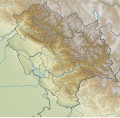
English: Relief map of Himachal Pradesh. Elevation data from STRM30, rivers data from GSHHS.
Date
Source Derivative of Himachal Pradesh location map
Author Own work

Licensing

w:en:Creative Commons
attribution share alike
This file is licensed under the Creative Commons Attribution-Share Alike 4.0 International license.
You are free:
  • to share – to copy, distribute and transmit the work
  • to remix – to adapt the work
  • Under the following conditions:
    • attribution – You must give appropriate credit, provide a link to the license, and indicate if changes were made. You may do so in any reasonable manner, but not in any way that suggests the licensor endorses you or your use.
    • share alike – If you remix, transform, or build upon the material, you must distribute your contributions under the same or compatible license as the original.

    Captions

    Himachal Pradesh relief map

    Items portrayed in this file

    depicts

    24 October 2020

    image/svg+xml

    File history


    Click on a date/time to view the file as it appeared at that time.
    Date/TimeThumbnailDimensionsUserComment
    current04:26, 25 May 2021Thumbnail for version as of 04:26, 25 May 2021953 × 931 (1.52 MB)C1MMc rivers and borders
    03:58, 27 January 2021Thumbnail for version as of 03:58, 27 January 20211,101 × 1,075 (1.42 MB)C1MMAdded greater contrast and updated borders
    16:47, 24 October 2020Thumbnail for version as of 16:47, 24 October 20201,735 × 1,761 (3.62 MB)C1MMUploaded a work by Own work from Derivative of Himachal Pradesh location map with UploadWizard


    The following pages on the English Wikipedia use this file (pages on other projects are not listed):

    Bandli Wildlife Sanctuary

    Bara-lacha la

    Bara Shigri Glacier

    Battle of Jaithak

    Bhaba Pass

    Bhakra Dam

    Bhrigu Lake

    Chambi Khad

    Chander Naun

    Chandra Taal

    Chhota Shigri

    Dal Lake (Himachal Pradesh)

    Dashair Lake

    Debsa Pass

    Dehnasar Lake

    Dhankar Lake

    Ghadhasaru Lake

    Gobind Sagar

    Himachal Pradesh

    Jorkanden

    Kangla Tarbo 1

    Karcham Wangtoo Hydroelectric Plant

    Kareri Lake

    Khajjiar Lake

    Kinnaur Kailash

    Lakshana Devi Temple, Bharmour

    Lama Dal

    Macchial Lake

    Mahakali Lake

    Maharana Pratap Sagar

    Manimahesh Kailash Peak

    Manimahesh Lake

    Manirang

    Masrur Temples

    Mohan Shakti National Heritage Park

    Nako Lake

    Nathpa Jhakri Dam

    Palani Falls

    Prashar Lake

    Renuka Lake

    Reo Purgyil

    Rewalsar Lake

    Rohtang Pass

    Rupin Pass

    Saach Pass

    Seruvalsar Lake

    Shilla (mountain)

    Shingo La

    Shipki La

    Solang Valley

    Spiti

    Suraj Tal

    Takling La

    Tira Sujanpur

    Trilokinath Temple, Mandi

    User:Ty654/List of earthquakes from 1900-1949 exceeding magnitude 7+

    User:Ty654/List of earthquakes from 1910-1919 exceeding magnitude 6+

    User:Ty654/List of earthquakes from 1940-1949 exceeding magnitude 6+

    User:Ty654/List of earthquakes from 1975-1979 exceeding magnitude 6+

    Module:Location map/data/India Himachal Pradesh

    Module:Location map/data/India Himachal Pradesh/doc


    Global file usage


    The following other wikis use this file:

    Usage on ar.wikipedia.org

    هيماجل برديش


    Usage on bn.wikipedia.org

    ি 

    ি: ি// ি 

    ি: ি// ি /ি


    Usage on es.wikipedia.org

    Wikiproyecto:Ilustración/Taller de Cartografía/Realizaciones/Asia

    Túnel de Rohtang

    Plantilla:Mapa de localización de Himachal Pradesh

    Humedal de Chandertal

    Paso de Kunzum

    Lago Renuka


    Usage on it.wikivoyage.org

    Himachal Pradesh


    Usage on ne.wikipedia.org


    Usage on or.wikipedia.org

    :Location map/data/India Himachal Pradesh/doc

    :Location map/data/India Himachal Pradesh


    Usage on pa.wikipedia.org


    ਿ:Location map/data/India Himachal Pradesh

    ਿ:Location map/data/India Himachal Pradesh/doc

      (ਿ )


    Usage on si.wikipedia.org

    Module:Location map/data/India Himachal Pradesh

    Module:Location map/data/India Himachal Pradesh/doc


    Usage on ta.wikipedia.org

    ி ி ி

    ிி 

     ி


    Usage on th.wikipedia.org


    Usage on uz.wikipedia.org

    Modul:Location map/data/India Himachal Pradesh

    Modul:Location map/data/India Himachal Pradesh/doc


    Usage on zh.wikipedia.org


    Template:Location map India Himachal Pradesh relief


    Metadata

    If the file has been modified from its original state, some details may not fully reflect the modified file.


    Retrieved from "https://en.wikipedia.org/wiki/File:India_Himachal_Pradesh_relief_map.svg"


    Privacy policy

    About Wikipedia

    Disclaimers

    Contact Wikipedia

    Code of Conduct

    Developers

    Statistics

    Cookie statement

    Mobile view


    Wikimedia Foundation
    Powered by MediaWiki