Jump to content


Main menu


Navigation  


Main page
Contents
Current events
Random article
About Wikipedia
Contact us
Donate


Contribute  


Help
Learn to edit
Community portal
Recent changes
Upload file


Search  


Create account

Log in


Create account
 Log in


Pages for logged out editors learn more  


Contributions
Talk


File:India Punjab location map.svg


Page contents not supported in other languages.  


File
Talk


Read
View on Commons


Tools


Actions  


Read
View on Commons


General  


What links here
Upload file
Special pages
Printable version
Page information
Get shortened URL
Download QR code


Appearance


This is a file from the Wikimedia Commons

From Wikipedia, the free encyclopedia


File

File history

File usage

Global file usage

Metadata
File:India Punjab location map.svg
Size of this PNG preview of this SVG file: 540 × 599 pixels. Other resolutions: 216 × 240 pixels | 433 × 480 pixels | 692 × 768 pixels | 923 × 1,024 pixels | 1,846 × 2,048 pixels | 979 × 1,086 pixels.

Original file(SVG file, nominally 979 × 1,086 pixels, file size: 311 KB)


Summary

Description
Deutsch: Positionskarte von Punjab, Indien

Quadratische Plattkarte, N-S-Streckung 117 %. Geographische Begrenzung der Karte:

  • N: 32.8° N
  • S: 29.3° N
  • W: 73.5° O
  • O: 77.2° O
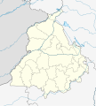
English: Location map of Punjab, India

Equirectangular projection, N/S stretching 117 %. Geographic limits of the map:

  • N: 32.8° N
  • S: 29.3° N
  • W: 73.5° E
  • E: 77.2° E
Date
Source

Own work, using

  • United States National Imagery and Mapping Agency data
  • World Data Base II data
Author NordNordWest
Permission
(Reusing this file)

I have published this file as author NordNordWest under the "CC-BY-SA-3.0-DE" in Wikipedia. This means that free, commercial usage outside of Wikipedia is permitted under the following licence terms:

Please send me a specimen copy or the URL of the website where the file is used.

Please write an email to nnwest[at]web.de if you

  • need my postal address for sending a specimen copy
  • have further questions about the terms of the licence

PS: In case of refusal of the above terms the author reserves the right to take legal action.

w:en:Creative Commons
attribution share alike
This file is licensed under the Creative Commons Attribution-Share Alike 3.0 Germany license.
You are free:
  • to share – to copy, distribute and transmit the work
  • to remix – to adapt the work
  • Under the following conditions:
    • attribution – You must give appropriate credit, provide a link to the license, and indicate if changes were made. You may do so in any reasonable manner, but not in any way that suggests the licensor endorses you or your use.
    • share alike – If you remix, transform, or build upon the material, you must distribute your contributions under the same or compatible license as the original.
    w:en:Creative Commons
    attribution share alike
    This file is licensed under the Creative Commons Attribution-Share Alike 3.0 Germany license.
    You are free:
    • to share – to copy, distribute and transmit the work
  • to remix – to adapt the work
  • Under the following conditions:
    • attribution – You must give appropriate credit, provide a link to the license, and indicate if changes were made. You may do so in any reasonable manner, but not in any way that suggests the licensor endorses you or your use.
    • share alike – If you remix, transform, or build upon the material, you must distribute your contributions under the same or compatible license as the original.
    Kartenwerkstatt
    This map has been made or improved in the German Kartenwerkstatt (Map Lab). You can propose maps to improve as well.

    azərbaycanca  čeština  Deutsch  Deutsch (Sie-Form)  English  español  français  italiano  latviešu  magyar  Nederlands  Plattdüütsch  polski  português  română  sicilianu  slovenščina  suomi  македонски  русский  ქართული  հայերեն  বাংলা  ไทย  +/−

    Captions

    Location map of Punjab, India

    Items portrayed in this file

    depicts

    some value

    19 May 2010

    image/svg+xml

    File history


    Click on a date/time to view the file as it appeared at that time.
    Date/TimeThumbnailDimensionsUserComment
    current04:19, 19 August 2022Thumbnail for version as of 04:19, 19 August 2022979 × 1,086 (311 KB)C1MMFixed Ludhiana district
    04:03, 19 August 2022Thumbnail for version as of 04:03, 19 August 2022979 × 1,086 (312 KB)C1MMResized to original size
    03:57, 19 August 2022Thumbnail for version as of 03:57, 19 August 2022951 × 898 (324 KB)C1MMAdded Malerkotla district, fixed rivers and disputed boundaries for Jammu and Kashmir
    03:23, 15 January 2021Thumbnail for version as of 03:23, 15 January 20211,049 × 1,161 (114 KB)C1MMAdded Tan Taran district
    18:11, 24 October 2020Thumbnail for version as of 18:11, 24 October 20201,049 × 1,161 (110 KB)C1MMUpdated districts
    17:41, 4 May 2012Thumbnail for version as of 17:41, 4 May 20121,049 × 1,161 (107 KB)NordNordWestupd
    20:24, 19 May 2010Thumbnail for version as of 20:24, 19 May 20101,049 × 1,161 (104 KB)NordNordWestc
    20:11, 19 May 2010Thumbnail for version as of 20:11, 19 May 20101,049 × 1,161 (105 KB)NordNordWest=={{int:filedesc}}== {{Information |Description= {{de|Positionskarte von Punjab, Indien}} Quadratische Plattkarte, N-S-Streckung 117 %. Geographische Begrenzung der Karte: * N: 32.8° N * S: 29.3° N * W: 73.5° O *


    More than 100 pages use this file. The following list shows the first 100 pages that use this file only. A full list is available.

    Abdul Hamid (soldier)

    Abohar

    Adampur

    Ahmedgarh

    Ajnala, India

    Akalgarh, Ludhiana

    Alawalpur

    Amloh

    Amritsar

    Amritsar Cantonment

    Anandpur Sahib

    Badhni Kalan

    Bagha Purana

    Balachaur

    Banaur

    Bariwala

    Barnala

    Bassi Kalan

    Bassi Pathana

    Batala

    Bathinda

    Beas City

    Begowal

    Bhabat

    Bhadaur

    Bhankharpur

    Bharoli Kalan

    Bhawanigarh

    Bhikhi, India

    Bhikhiwind

    Bhisiana

    Bhogpur

    Bholath

    Bhucho Mandi

    Budha Theh

    Budhlada

    Chabbewal

    Chamkaur Sahib

    Chohal

    Chuhar Chak

    Dadhi

    Daulatpur, Pathankot

    Dera Baba Nanak

    Dera Bassi

    Dhanaula

    Dharamkot, Moga

    Dhilwan

    Dina Nagar

    Dirba

    Doraha, Ludhiana

    Dullar

    Faridkot, India

    Fatehgarh Sahib

    Fazilka

    Firozpur

    Firozpur Cantonment

    Goindwal

    Gurdaspur

    Gurdwara Sri Tarn Taran Sahib

    Hakim Pur, Doaba Region

    Hariana

    Hoshiarpur

    Jagraon

    Jalandhar

    Jalandhar Cantonment

    Jallianwala Bagh

    Kaind

    Kairon

    Kalakh

    Kalanaur, Gurdaspur

    Kapurthala

    Khaira, Ludhiana

    Khemkaran

    Kotkapura

    Kuka, Punjab

    Longowal

    Ludhiana

    Malerkotla

    Mandi Mullanpur

    Mansa, Punjab

    Mohali

    Moodkee

    Morinda, Punjab

    Nabha

    Nakodar

    Nangal

    Nawanshahr

    Operation Blue Star

    Panjkosi

    Pathankot

    Patiala

    Phagwara

    Phillaur

    Qadian

    Qila Raipur

    Rauni, Ludhiana

    Rupnagar

    Sangrur

    Sobraon

    Sri Guru Ram Das Ji International Airport


    View more links to this file.

    Global file usage


    The following other wikis use this file:

    Usage on ar.wikipedia.org

    قالب:Location map India Punjab

    هجوم محطة باثانكوت 2016

    حادث قطار أمريتسار الهند 2018


    Usage on as.wikipedia.org

    :Location map India Punjab


    Usage on azb.wikipedia.org

    علیپور-۲

    علیپور-۱

    علی چاک

    علادینپور

    علیخل، جالاندر

    فول ماکاوری

    فیالی (هیندوستان)

    فاروالا, جالاندهار

    فارالا

    فانقوتا

    فامبرا

    فالپوتا

    ساروپوال

    ساروپوال, سولطانپور لودهی

    سارتی, قورداسپور

    سارنانا

    سارینه, لودهیانا

    سارینه, جالاندهار

    سارهالی

    سارهالی, جالاندهار

    سارهال کازیان

    سارهال موندی

    سارقوندی

    سارانقوال

    سارانقرا

    سارای خاس

    سارای خام

    سارای جاتان

    ساپرور

    مدا, پنجاب

    مازاری, اسبیاس ناقار

    مازارا ناو آباد

    مازارا خورد

    مازارا کالان

    سانورا

    ماوای, جالاندهار

    ماولی, فاقوارا

    ماوجیا

    ماو, پنجاب

    ماتوی, پنجاب

    سانقرای

    سانقرا, سولطانپور لودهی

    سانقووال

    سانقوجلا

    سانقول

    سانقرا (کند)


    View more global usage of this file.

    Metadata

    If the file has been modified from its original state, some details may not fully reflect the modified file.


    Retrieved from "https://en.wikipedia.org/wiki/File:India_Punjab_location_map.svg"


    Privacy policy

    About Wikipedia

    Disclaimers

    Contact Wikipedia

    Code of Conduct

    Developers

    Statistics

    Cookie statement

    Mobile view


    Wikimedia Foundation
    Powered by MediaWiki