Jump to content


Main menu


Navigation  


Main page
Contents
Current events
Random article
About Wikipedia
Contact us
Donate


Contribute  


Help
Learn to edit
Community portal
Recent changes
Upload file


Search  


Create account

Log in


Create account
 Log in


Pages for logged out editors learn more  


Contributions
Talk


File:India Telangana location map.svg


Page contents not supported in other languages.  


File
Talk


Read
View on Commons


Tools


Actions  


Read
View on Commons


General  


What links here
Upload file
Special pages
Printable version
Page information
Get shortened URL
Download QR code


Appearance


This is a file from the Wikimedia Commons

From Wikipedia, the free encyclopedia


File

File history

File usage

Global file usage

Metadata
File:India Telangana location map.svg
Size of this PNG preview of this SVG file: 599 × 600 pixels. Other resolutions: 240 × 240 pixels | 479 × 480 pixels | 767 × 768 pixels | 1,023 × 1,024 pixels | 2,046 × 2,048 pixels | 851 × 852 pixels.

Original file(SVG file, nominally 851 × 852 pixels, file size: 367 KB)


Summary

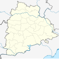
Description Location map of Telangana. Coordinates: top=20.015, bottom=15.602, left=76.597, right=81.914.
Date
Source
Author

Licensing

I, the copyright holder of this work, hereby publish it under the following license:
w:en:Creative Commons
attribution share alike
This file is licensed under the Creative Commons Attribution-Share Alike 4.0 International license.
You are free:
  • to share – to copy, distribute and transmit the work
  • to remix – to adapt the work
  • Under the following conditions:
    • attribution – You must give appropriate credit, provide a link to the license, and indicate if changes were made. You may do so in any reasonable manner, but not in any way that suggests the licensor endorses you or your use.
    • share alike – If you remix, transform, or build upon the material, you must distribute your contributions under the same or compatible license as the original.

    Captions

    Add a one-line explanation of what this file represents

    Items portrayed in this file

    depicts

    29 May 2016

    image/svg+xml

    File history


    Click on a date/time to view the file as it appeared at that time.
    (newest | oldest) View (newer 10 | ) (10 | 20| 50| 100 | 250 | 500)
    Date/TimeThumbnailDimensionsUserComment
    current06:49, 23 January 2024Thumbnail for version as of 06:49, 23 January 2024851 × 852 (367 KB)MilenioscuroReverted to version as of 03:20, 4 August 2021 (UTC)
    08:55, 10 January 2024Thumbnail for version as of 08:55, 10 January 20241,778 × 1,466 (199 KB)Thotakuri ParameshReverted to version as of 04:12, 30 May 2016 (UTC)
    03:20, 4 August 2021Thumbnail for version as of 03:20, 4 August 2021851 × 852 (367 KB)C1MMCorrected district
    04:27, 7 June 2021Thumbnail for version as of 04:27, 7 June 2021851 × 852 (367 KB)C1MMc rivers and borders
    18:28, 15 January 2021Thumbnail for version as of 18:28, 15 January 2021443 × 443 (228 KB)C1MMAdded Jangaon district
    18:58, 1 August 2020Thumbnail for version as of 18:58, 1 August 2020443 × 443 (227 KB)C1MMUploaded new districts
    17:09, 16 April 2020Thumbnail for version as of 17:09, 16 April 20201,778 × 1,466 (199 KB)C1MMReverted to version as of 04:20, 30 May 2016 (UTC)
    17:00, 16 April 2020Thumbnail for version as of 17:00, 16 April 2020443 × 443 (229 KB)C1MMChanged colors and cropped to be more accurate
    04:20, 30 May 2016Thumbnail for version as of 04:20, 30 May 20161,778 × 1,466 (199 KB)Milenioscuroborders
    04:16, 30 May 2016Thumbnail for version as of 04:16, 30 May 20161,778 × 1,466 (199 KB)Milenioscuroborders

    (newest | oldest) View (newer 10 | ) (10 | 20| 50| 100 | 250 | 500)


    More than 100 pages use this file. The following list shows the first 100 pages that use this file only. A full list is available.

    Adilabad

    Alampuram (Hemalapuram)

    Badepalle

    Banapuram

    Basara, Telangana

    Begumpet Airport

    Bellampalle

    Bhadrachalam

    Bhainsa

    Bheemavaram, Khammam district

    Bhongir

    Bodhan

    Chatakonda

    Choutuppal

    Chunchupalle

    Dasnapur

    Devarakonda

    Dharmapuri, Telangana

    Dharmasagar

    Eddumailaram

    Elgandal Fort

    Farooqnagar

    Gadwal

    Godavarikhani

    Gummadidala

    Hanamkonda

    Hyderabad

    Isnapur

    Jagirpally

    Jagtial

    Jallaram

    Jangaon

    Jannaram mandal

    Kagaznagar, Telengana

    Kakatiya Institute of Technology and Science

    Kaleshwaram

    Kallur, Khammam district

    Kamareddy

    Kapra

    Karimnagar

    Kasu Brahmananda Reddy National Park

    Kattangur

    Kazipet

    Khammam

    Khammam Fort

    Kodad

    Korutla

    Kothagudem

    Kukatpally

    Kyathanpally

    L. B. Nagar

    Luxettipet

    Madaram

    Madgul

    Madhapur

    Madhira

    Mahadevpur

    Mahavir Harina Vanasthali National Park

    Mahbubnagar

    Malkajgiri

    Mancherial

    Mandamarri

    Manthani

    Manuguru

    Medak

    MeerpetJillelguda

    Mellachervu

    Miryalaguda

    Mothkur

    Mrugavani National Park

    Mudigonda

    Nagarkurnool

    Nakrekal

    Nalgonda

    Narayanpet

    Narsingi, Ranga Reddy district

    Naspur

    Nizam College

    Nizamabad, Telangana

    Osmania University

    Parnasala

    Pendekanti Law College

    Pulimamidi

    Quthbullapur

    Raikal

    Ramadugu

    Ramagundam

    Ramappa Engineering College

    Sangareddy

    Sanghi Nagar

    Secunderabad

    Siddipet

    Sitaphalmandi

    Suryapet

    University of Hyderabad

    Vadapally

    Vallampally

    Varshakonda

    Vemulawada, Rajanna Sircilla district

    Warangal


    View more links to this file.

    Global file usage


    The following other wikis use this file:

    Usage on bh.wikipedia.org


    ि 


    Usage on bn.wikipedia.org


    ি

    ,   

    ি

    ি

    : ি  

    িি

    ি , 

     ()

    ি

      ি ি

     ি


    িি ি


      ি

     ি


    Usage on ceb.wikipedia.org

    Plantilya:Location map India Telangana


    Usage on de.wikipedia.org

    Wikipedia:Kartenwerkstatt/Positionskarten/Asien

    Vorlage:Positionskarte Indien Telangana

    Rajiv Gandhi International Cricket Stadium (Hyderabad)

    Gachibowli-Stadion

    Lal Bahadur Shastri Stadium


    Usage on eo.wikipedia.org

    Varangal

    Hajderabado

    Ŝablono:Situo sur mapo Barato Telangano

    Nizamabad

    Khammam

    Karimnagar

    Ramagundam

    Mahbubnagar

    Naligonda

    Adilabad

    Surjapet

    Siddipet

    Mirialguda

    Jagtial

    Kvar-Pordegoj

    Universitato Osmania

    Sikundarabad

    Manĉerial

    Serilingampalli

    Lingampalli (stacidomo)


    Usage on es.wikipedia.org

    Golconda (India)


    View more global usage of this file.

    Metadata

    If the file has been modified from its original state, some details may not fully reflect the modified file.


    Retrieved from "https://en.wikipedia.org/wiki/File:India_Telangana_location_map.svg"


    Privacy policy

    About Wikipedia

    Disclaimers

    Contact Wikipedia

    Code of Conduct

    Developers

    Statistics

    Cookie statement

    Mobile view


    Wikimedia Foundation
    Powered by MediaWiki