Jump to content


Main menu


Navigation  


Main page
Contents
Current events
Random article
About Wikipedia
Contact us
Donate


Contribute  


Help
Learn to edit
Community portal
Recent changes
Upload file


Search  


Create account

Log in


Create account
 Log in


Pages for logged out editors learn more  


Contributions
Talk


File:India Uttarakhand location map.svg


Page contents not supported in other languages.  


File
Talk


Read
View on Commons


Tools


Actions  


Read
View on Commons


General  


What links here
Upload file
Special pages
Printable version
Page information
Get shortened URL
Download QR code


Appearance


This is a file from the Wikimedia Commons

From Wikipedia, the free encyclopedia


File

File history

File usage

Global file usage

Metadata
File:India Uttarakhand location map.svg
Size of this PNG preview of this SVG file: 722 × 600 pixels. Other resolutions: 289 × 240 pixels | 578 × 480 pixels | 925 × 768 pixels | 1,233 × 1,024 pixels | 2,465 × 2,048 pixels | 957 × 795 pixels.

Original file(SVG file, nominally 957 × 795 pixels, file size: 311 KB)


P9328056203

Summary

Description

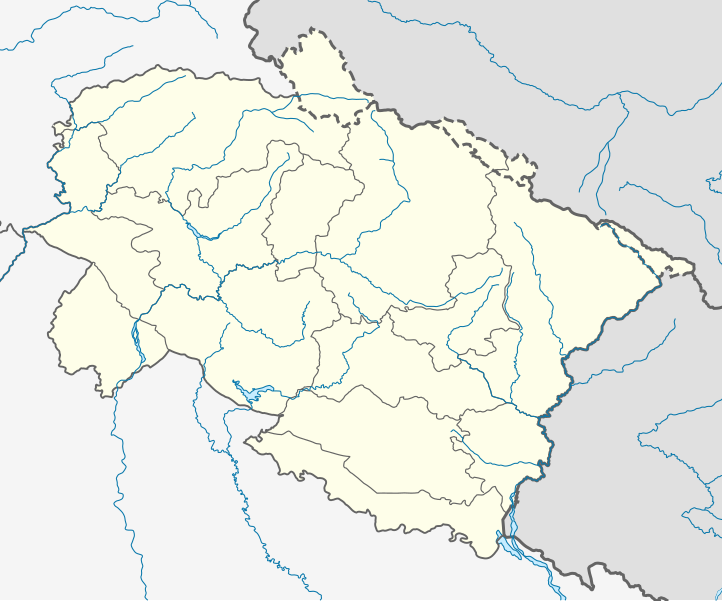
Location map of Uttarakhand Geographic limits of the map:

  • 31.61°N
  • 28.50°N
  • 77.46°E
  • 81.19°E
Date
Source
Author

Licensing

I, the copyright holder of this work, hereby publish it under the following license:
w:en:Creative Commons
attribution share alike
This file is licensed under the Creative Commons Attribution-Share Alike 3.0 Unported license.
You are free:
  • to share – to copy, distribute and transmit the work
  • to remix – to adapt the work
  • Under the following conditions:
    • attribution – You must give appropriate credit, provide a link to the license, and indicate if changes were made. You may do so in any reasonable manner, but not in any way that suggests the licensor endorses you or your use.
    • share alike – If you remix, transform, or build upon the material, you must distribute your contributions under the same or compatible license as the original.

    Captions

    Add a one-line explanation of what this file represents

    Items portrayed in this file

    depicts

    5 July 2014

    image/svg+xml

    File history


    Click on a date/time to view the file as it appeared at that time.
    Date/TimeThumbnailDimensionsUserComment
    current03:00, 23 May 2021Thumbnail for version as of 03:00, 23 May 2021957 × 795 (311 KB)C1MMCorrected rivers and dist boundaries
    04:43, 27 January 2021Thumbnail for version as of 04:43, 27 January 20211,245 × 1,122 (161 KB)C1MMChanged line weights and regrouped rivers
    04:13, 27 January 2021Thumbnail for version as of 04:13, 27 January 20211,245 × 1,122 (167 KB)C1MMIncreased line weight, district lines difficult to see in previous map
    05:17, 22 April 2020Thumbnail for version as of 05:17, 22 April 20201,245 × 1,122 (167 KB)C1MMAdded rivers
    18:42, 5 July 2014Thumbnail for version as of 18:42, 5 July 20141,245 × 1,122 (106 KB)Milenioscurolines
    18:22, 5 July 2014Thumbnail for version as of 18:22, 5 July 20141,245 × 1,122 (106 KB)MilenioscuroUser created page with UploadWizard


    More than 100 pages use this file. The following list shows the first 100 pages that use this file only. A full list is available.

    Auli, India

    Badrinath

    Badrinath Temple

    Baijnath, Uttarakhand

    Bajpur

    Baleshwar Temple

    Banbasa

    Bandia

    Barkot, Uttarakhand

    Berinag

    Bhimtal

    Bhowali

    Chakrata

    Chamba, Uttarakhand

    Chamoli Gopeshwar

    Champawat

    Chaukori

    Chota Char Dham

    Clement Town

    Dehradun Airport

    Dehradun Cantonment

    Devalthal

    Devprayag

    Dhandera

    Dharchula

    Dharchula Dehat

    Dineshpur

    Doiwala

    Dugadda

    FRI and College Area

    Gadarpur

    Gangotri

    Garkha

    Garur

    Gauchar

    Ghangaria

    Gora Padao

    Gurdwara Hemkund Sahib

    Herbertpur

    Jaspur

    Jaunsar-Bawar

    Jhabrera

    Joshimath

    Kachnal Gosain

    Kaladhungi

    Kalimath

    Kanalichhina

    Kankhal

    Karnaprayag

    Kashipur, Uttarakhand

    Kashirampur

    Kathgodam

    Kedarnath

    Kedarnath Temple

    Kelakhera

    Khatima

    Kichha

    Kirtinagar

    Kotdwar

    Laksar

    Lalkuan

    Landhaura

    Landour

    Lansdowne, India

    Lipulekh Pass

    Lohaghat

    Mahua Dabra Haripura

    Mahua Kheraganj

    Manglaur

    Milam, India

    Mohanpur Mohammadpur

    Mukteshwar

    Muni Ki Reti

    Mussoorie

    Nagla

    Nainital Cantonment

    Nanda Devi National Park

    Nandaprayag

    Narendranagar

    New Tehri

    Ogla

    Pantnagar

    Pauri

    Pratitnagar

    Raipur, Uttarakhand

    Ramnagar, Nainital

    Ranipur, Uttarakhand

    Rishikesh

    Roorkee

    Roorkee Cantonment

    Rudraprayag

    Rudrapur, Uttarakhand

    Shaktigarh, Uttarakhand

    Sitarganj

    Srinagar, Uttarakhand

    Sultanpur, Uttarakhand

    Tanakpur

    Uttarkashi

    Vikasnagar

    Virbhadra


    View more links to this file.

    Global file usage


    The following other wikis use this file:

    Usage on azb.wikipedia.org

    کالیمات

    مارودا

    جوی (هیندوستان)

    جهولاقات

    جالتولا

    آمالدو (هیندوستان)

    مالاری

    رایدول

    لوچهمان قارهی

    پولام سومدا

    پرم ناقار, یوتاراخاند

    هارسیل

    پیپالکوتی

    قونجی, یوتاراخاند

    قورا پادو

    پانقوت (هیندوستان)

    قانقاریا

    دوالتال

    اوقلا (هیندوستان)

    داکپاتار

    چیتای (هیندوستان)

    ناتواخان

    چانچ (هیندوستان)

    بیرون دوال

    میرتولا

    مهالچاوری

    بنجی ویلیج

    کامالواقانجا

    خاتیاری

    بارچهینا

    باسوکدار

    کوتریساین

    باهادر آباد

    بایرولا


    Usage on ban.wikipedia.org

    Taman Nasional Jim Corbett

    Taman Nasional Nanda Dévi

    Taman Nasional Lebah Sekar


    Usage on bh.wikipedia.org


    ि

     ि

    Module:Location map/data/Uttarakhand

    Module:Location map/data/India Uttarakhand/doc

    Module:Location map/data/India Uttarakhand


    ि 


    View more global usage of this file.

    Metadata

    If the file has been modified from its original state, some details may not fully reflect the modified file.


    Retrieved from "https://en.wikipedia.org/wiki/File:India_Uttarakhand_location_map.svg"


    Privacy policy

    About Wikipedia

    Disclaimers

    Contact Wikipedia

    Code of Conduct

    Developers

    Statistics

    Cookie statement

    Mobile view


    Wikimedia Foundation
    Powered by MediaWiki