


Original file (SVG file, nominally 512 × 372 pixels, file size: 105 KB)
| This is a file from the Wikimedia Commons. Information from its description page there is shown below. Commons is a freely licensed media file repository. You can help. |
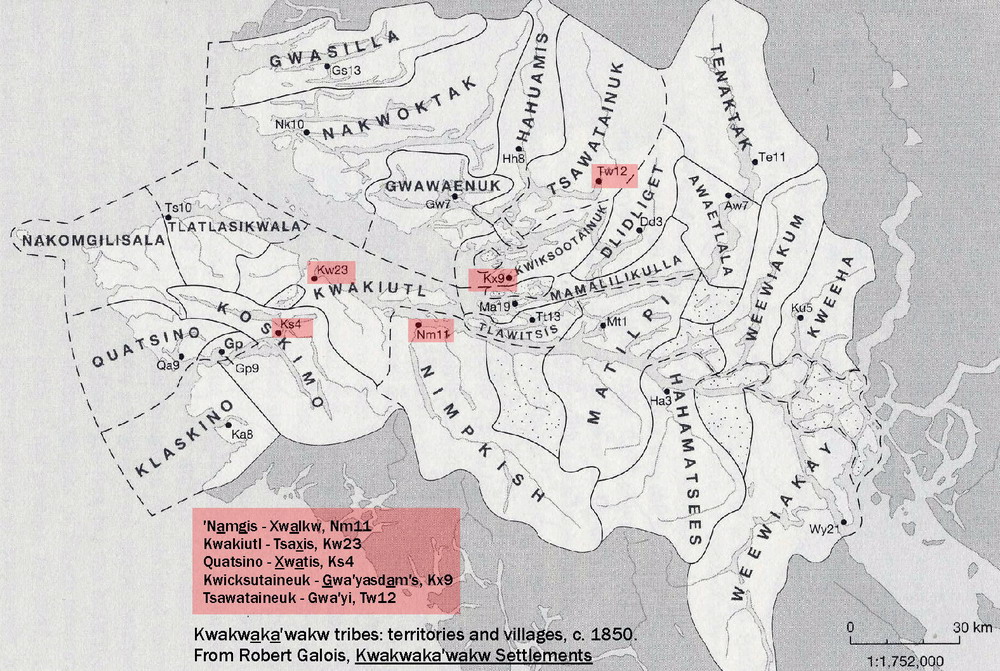
| DescriptionKwakʼwala map.svg |
English: Map of dialects of Kwakʼwala with communities labeled.
Dialect sources: http://firstnations.eu/img/04-2-0-villages-b.jpg http://www.sd85.bc.ca/wp-content/uploads/2018/06/EA2-FINAL-REPORT-June-2016-2017-Reduced.pdf Kwakʼwala communities from: http://www.languagegeek.com/wakashan/kwakwakawakw_communities.html https://www.umista.ca/pages/kwakwakawakw-tribes This file was derived from: Canada British Columbia location map.svg |
| Date | |
| Source | Own work |
| Author | Noahedits |
| Date/Time | Thumbnail | Dimensions | User | Comment | |
|---|---|---|---|---|---|
| current | 22:24, 11 June 2019 | | 512 × 372 (105 KB) | Noahedits | User created page with UploadWizard |
This file contains additional information, probably added from the digital camera or scanner used to create or digitize it.
If the file has been modified from its original state, some details may not fully reflect the modified file.
| Short title | Artboard 1 |
|---|---|
| Width | 100% |
| Height | 100% |