

Original file (SVG file, nominally 940 × 683 pixels, file size: 1.42 MB)
| This is a file from the Wikimedia Commons. Information from its description page there is shown below. Commons is a freely licensed media file repository. You can help. |
 | This SVG image contains embedded raster graphics.[1] Such images are liable to produce inferior results when scaled to different sizes (as well as possibly being very inefficient in file size). If appropriate to do so, they should be replaced with images created using vector graphics. Note: This template is only supposed to be used if the SVG file mixes vector and raster graphics. If the SVG file only contains raster graphics {{FakeSVG}} is supposed to be used. See also {{TopoSVG}}. |
| DescriptionLand.ops.2.en.svg |
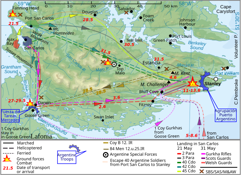
English: The Falkland Islands are an archipelago in the South Atlantic Ocean
|
| Date | (UTC) |
| Source | |
| Author |
|
| This is a retouched picture, which means that it has been digitally altered from its original version. The original can be viewed here: Falkland Islands topographic map-en.svg:
|

|
Permission is granted to copy, distribute and/or modify this document under the terms of the GNU Free Documentation License, Version 1.2 or any later version published by the Free Software Foundation; with no Invariant Sections, no Front-Cover Texts, and no Back-Cover Texts. A copy of the license is included in the section entitled GNU Free Documentation License.http://www.gnu.org/copyleft/fdl.htmlGFDLGNU Free Documentation Licensetruetrue |
Uploaded with derivativeFX
| Date/Time | Thumbnail | Dimensions | User | Comment | |
|---|---|---|---|---|---|
| current | 10:40, 26 March 2012 |  | 940 × 683 (1.42 MB) | Brammers | Spelling change: Marsh > Marched |
| 19:47, 1 November 2010 |  | 940 × 683 (1.42 MB) | Keysanger | {{Information |Description={{en|The '''Falkland Islands''' are an archipelago in the South Atlantic Ocean}} |Source=*File:Falkland_Islands_topographic_map-en.svg |Date=2010-11-01 19:44 (UTC) |Author=*[[:File:Falkland_Islands_topographic_map-en.s |
This file contains additional information, probably added from the digital camera or scanner used to create or digitize it.
If the file has been modified from its original state, some details may not fully reflect the modified file.
| Width | 940.13379 |
|---|---|
| Height | 683.31305 |