Jump to content


Main menu


Navigation  


Main page
Contents
Current events
Random article
About Wikipedia
Contact us
Donate


Contribute  


Help
Learn to edit
Community portal
Recent changes
Upload file


Search  


Create account

Log in


Create account
 Log in


Pages for logged out editors learn more  


Contributions
Talk


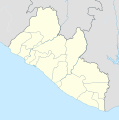
File:Liberia location map.svg


Page contents not supported in other languages.  


File
Talk


Read
View on Commons


Tools


Actions  


Read
View on Commons


General  


What links here
Upload file
Special pages
Printable version
Page information
Get shortened URL
Download QR code


Appearance


This is a file from the Wikimedia Commons

From Wikipedia, the free encyclopedia


File

File history

File usage

Global file usage
File:Liberia location map.svg
Size of this PNG preview of this SVG file: 594 × 600 pixels. Other resolutions: 238 × 240 pixels | 475 × 480 pixels | 760 × 768 pixels | 1,014 × 1,024 pixels | 2,028 × 2,048 pixels | 1,000 × 1,010 pixels.

Original file(SVG file, nominally 1,000 × 1,010 pixels, file size: 245 KB)


Summary

Description
English: Location map of Liberia Equirectangular projection. Strechted by 101.0%. Geographic limits of the map:
  • N: 8.8° N
  • S: 4.0° N
  • W: -11.8° E
  • E: -7.0° E
  • Made with Natural Earth. Free vector and raster map data @ naturalearthdata.com.
    Date
    Source Own work
    Author Uwe Dedering

    Licensing

    I, the copyright holder of this work, hereby publish it under the following licenses:
    w:en:Creative Commons
    attribution share alike
    This file is licensed under the Creative Commons Attribution-Share Alike 3.0 Unported license.
    You are free:
    • to share – to copy, distribute and transmit the work
  • to remix – to adapt the work
  • Under the following conditions:
    • attribution – You must give appropriate credit, provide a link to the license, and indicate if changes were made. You may do so in any reasonable manner, but not in any way that suggests the licensor endorses you or your use.
    • share alike – If you remix, transform, or build upon the material, you must distribute your contributions under the same or compatible license as the original.
    GNU head Permission is granted to copy, distribute and/or modify this document under the terms of the GNU Free Documentation License, Version 1.2 or any later version published by the Free Software Foundation; with no Invariant Sections, no Front-Cover Texts, and no Back-Cover Texts. A copy of the license is included in the section entitled GNU Free Documentation License.
    You may select the license of your choice.

    Captions

    liberia

    Items portrayed in this file

    depicts

    some value

    18 February 2010

    File history


    Click on a date/time to view the file as it appeared at that time.
    Date/TimeThumbnailDimensionsUserComment
    current18:15, 19 February 2010Thumbnail for version as of 18:15, 19 February 20101,000 × 1,010 (245 KB)Uwe Dederingcomplete new File
    11:45, 6 December 2009Thumbnail for version as of 11:45, 6 December 20092,795 × 2,145 (354 KB)Carport{{Information |Description={{de|1=Positionskarte von {{w|Liveria|3=de}}.}} {{en|1=Location map of {{w|Liberia}}.}} |Source={{own}}, based on File:Topographic map of Liberia-en.svg by {{w|User:Mysid|Mysid}} |Author={{user:Carport/graphic}} |Date=6 Dec


    The following pages on the English Wikipedia use this file (pages on other projects are not listed):

    201314 Liberian First Division League

    2016 Liberian First Division League

    202122 Liberian First Division

    202223 Liberian First Division

    Arthington, Liberia

    Bandela

    Barclayville

    Belefuanai

    Bensonville

    Bombotown

    Bopolu

    Buchanan, Liberia

    Buchanan Airport

    Cape Palmas Airport

    Careysburg, Liberia

    Chocolate City, Liberia

    Clay-Ashland

    Crozierville

    Dandawailo

    Edina, Liberia

    Executive Mansion, Monrovia

    Fish Town

    Foya

    Foya Airport

    Galio, Liberia

    Ganta

    Gardnersville

    Gbarnga

    Gbedin

    Genga, Liberia

    Grand Cess

    Grebo-Krahn National Park

    Greenville, Liberia

    Greenville/Sinoe Airport

    Gwin Town

    Harbel

    Harper, Liberia

    Hotel Africa

    Kaba Town

    Kakata

    Klay, Liberia

    Kolahun

    Lamco Airport

    Liberian First Division

    Mehla

    Monrovia Church massacre

    New Kru Town

    Nimba Airport

    Palala

    Paynesville, Liberia

    Pleebo

    River Cess

    Roberts International Airport

    Robertsport

    Saclepea

    Sagleipie

    Salala, Bong County

    Sanniquellie

    Sanoyie

    Sasstown

    Sasstown Airport

    Sembe, Liberia

    Spriggs Payne Airport

    Tchien Airport

    Tienie

    Timbo District

    Totota

    Tubmanburg

    Tuzon

    Virginia, Liberia

    Voinjama

    Voinjama Airport

    Yekepa

    Yela, Liberia

    Zartlahn District

    Zike, Liberia

    Zorzor

    Zwedru

    User:Mugtheboss/sandbox/Grebo-Krahn National Forest

    User:Poppyraisin/temporary Totota subpage

    File talk:Liberia location map.svg

    Module:Location map/data/Liberia

    Module:Location map/data/Liberia/doc


    Global file usage


    The following other wikis use this file:

    Usage on af.wikipedia.org

    Sjabloon:Liggingkaart Liberië


    Usage on am.wikipedia.org

    :Location map 


    Usage on an.wikipedia.org

    Plantilla:Mapa de localización Liberia

    Monrovia


    Usage on ar.wikipedia.org

    قالب:خريطة مواقع ليبيريا


    Usage on ast.wikipedia.org

    Monrovia

    Golfu de Guinea

    Módulu:Mapa de llocalización/datos/Liberia

    Módulu:Mapa de llocalización/datos/Liberia/usu

    Aeropuertu Internacional Roberts

    Aeropuertu Spriggs Payne

    Puertu llibre de Monrovia


    Usage on azb.wikipedia.org

    بوچانان، لیبریا

    ویرجینیا، لیبریا


    Usage on ba.wikipedia.org

    Ҡалып:ПозКарта Либерия


    Usage on be-tarask.wikipedia.org

    Манровія

    Шаблён:Лякалізацыйная мапа Лібэрыі


    Usage on be.wikipedia.org

    Манровія

    Шаблон:На карце/Ліберыя

    Ганта

    Фіштаўн

    Каката


    Usage on bg.wikipedia.org

    Шаблон:ПК Либерия


    Usage on bn.wikipedia.org

    ি      ি  ি

    ি

    : ি ি

    : ি ি/ি

    ি: ি//ি

    ি: ি//ি/ি


    Usage on bs.wikipedia.org

    Šablon:Lokacijska karta Liberija


    Usage on ceb.wikipedia.org

    Po

    Plantilya:Location map Liberia

    South Point

    Middle Reef

    Table Mountain

    Isaac Point

    Green Island

    Green Islet

    Kongba

    Galiya

    Bo River

    Kabada

    North Point

    Castle Rock

    Black Rock

    Wilson Point

    Bird Rock

    John Creek

    Long Reef

    Fish Creek


    View more global usage of this file.

    Retrieved from "https://en.wikipedia.org/wiki/File:Liberia_location_map.svg"


    Privacy policy

    About Wikipedia

    Disclaimers

    Contact Wikipedia

    Code of Conduct

    Developers

    Statistics

    Cookie statement

    Mobile view


    Wikimedia Foundation
    Powered by MediaWiki