Jump to content


Main menu


Navigation  


Main page
Contents
Current events
Random article
About Wikipedia
Contact us
Donate


Contribute  


Help
Learn to edit
Community portal
Recent changes
Upload file


Search  


Create account

Log in


Create account
 Log in


Pages for logged out editors learn more  


Contributions
Talk


File:Location Togo AU Africa.svg


Page contents not supported in other languages.  


File
Talk


Read
View on Commons


Tools


Actions  


Read
View on Commons


General  


What links here
Upload file
Special pages
Printable version
Page information
Get shortened URL
Download QR code


Appearance


This is a file from the Wikimedia Commons

From Wikipedia, the free encyclopedia


File

File history

File usage

Global file usage

Metadata
File:Location Togo AU Africa.svg
Size of this PNG preview of this SVG file: 646 × 600 pixels. Other resolutions: 258 × 240 pixels | 517 × 480 pixels | 827 × 768 pixels | 1,103 × 1,024 pixels | 2,206 × 2,048 pixels | 1,400 × 1,300 pixels.

Original file(SVG file, nominally 1,400 × 1,300 pixels, file size: 2.17 MB)


Summary

Description
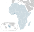
English: Map of Togo
Español: Mapa de Togo
Date
Source Own work
Author Alvaro1984 18

Licensing

Public domain I, the copyright holder of this work, release this work into the public domain. This applies worldwide.
In some countries this may not be legally possible; if so:
I grant anyone the right to use this work for any purpose, without any conditions, unless such conditions are required by law.

Captions

Location of Togo (dark blue) in the African Union (light blue)

Items portrayed in this file

depicts

some value

30 July 2009

image/svg+xml

File history


Click on a date/time to view the file as it appeared at that time.
Date/TimeThumbnailDimensionsUserComment
current05:28, 17 February 2017Thumbnail for version as of 05:28, 17 February 20171,400 × 1,300 (2.17 MB)ChipmunkdavisUpdating Morocco
22:18, 31 July 2013Thumbnail for version as of 22:18, 31 July 20131,400 × 1,300 (2.17 MB)FlappiefhFixed some displaced countries.
22:15, 31 July 2013Thumbnail for version as of 22:15, 31 July 20131,400 × 1,300 (2.17 MB)FlappiefhAdded South Sudan. Fixed color of Lybia.
10:39, 30 July 2009Thumbnail for version as of 10:39, 30 July 20091,400 × 1,300 (2.17 MB)Alvaro1984 18{{Information |Description={{en|1=Map of Togo}} {{es|1=Mapa de Togo}} |Source=trabajo propio (own work) |Author=Alvaro1984 18 |Date=30/07/2009 |Permission= |other_versions= }} Category:Location maps of Africa Category:Togo


The following pages on the English Wikipedia use this file (pages on other projects are not listed):

1963 Togolese coup d'état

1967 Togolese coup d'état

1986 Togolese coup attempt

History of Togo

LGBT rights in Togo

List of companies of Togo

List of conflicts in Togo

List of sovereign states and dependent territories in Africa

Telephone numbers in Togo

Togo

User:Islahaddow/sandbox

Wikipedia:Graphics Lab/Map workshop/Archive/Aug 2013


Global file usage


The following other wikis use this file:

Usage on ady.wikipedia.org

Того


Usage on af.wikipedia.org

Togo

Lys van Afrika-lande


Usage on ami.wikipedia.org

Togo


Usage on ar.wikipedia.org

توغو

بوابة:العالم الإسلامي/دولة مختارة/55

محاولة انقلاب 1986 في توغو


Usage on avk.wikipedia.org

Togoa


Usage on azb.wikipedia.org

توقو


Usage on az.wikipedia.org

Afrika ölkələrinin siyahısı


Usage on ban.wikipedia.org

Togo


Usage on bcl.wikipedia.org

Togo


Usage on be.wikipedia.org

Тога


Usage on bew.wikipedia.org

Togo


Usage on bg.wikipedia.org

Списък на африканските държави и зависими територии


Usage on bh.wikipedia.org


Usage on bi.wikipedia.org

Togo


Usage on bn.wikipedia.org


ি ি ি


Usage on ca.wikipedia.org

Llista d'estats sobirans i territoris dependents d'Àfrica

Drets del col·lectiu LGBT al Togo


Usage on cdo.wikipedia.org

Togo


Usage on chr.wikipedia.org


Usage on co.wikipedia.org

Togoland


Usage on cs.wikipedia.org

Togo

Pokus o převrat v Togu 1986


Usage on el.wikipedia.org

Τόγκο

Κατάλογος κυρίαρχων κρατών και εξαρτημένων εδαφών στην Αφρική


Usage on eo.wikipedia.org

Togolando


Usage on eo.wiktionary.org

Togolando


Usage on es.wikipedia.org

Usuario:Atamcha/Taller

Diversidad sexual en Togo


Usage on fa.wikipedia.org

توگو

فهرست کشورهای مستقل و سرزمینهای وابسته در آفریقا


Usage on fi.wikipedia.org

Togo

Ranskan Togomaa


Usage on fon.wikipedia.org

Togotò


Usage on fo.wikipedia.org

Togo


Usage on fr.wikipedia.org

Togo

Wikipédia:Atelier graphique/Cartes/Archives/août 2013

Liste des États souverains et des territoires dépendants d'Afrique


Usage on gcr.wikipedia.org

Togo


Usage on gn.wikipedia.org

Tógo


Usage on gu.wikipedia.org

િ  


Usage on guw.wikipedia.org

Togo


Usage on hak.wikipedia.org

Togo


Usage on ha.wikipedia.org

Jerin ƙasashen Afirka

Jerin Kamfanonin Ƙasar Togo


Usage on hi.wikipedia.org


     ि   


View more global usage of this file.

Metadata

If the file has been modified from its original state, some details may not fully reflect the modified file.


Retrieved from "https://en.wikipedia.org/wiki/File:Location_Togo_AU_Africa.svg"


Privacy policy

About Wikipedia

Disclaimers

Contact Wikipedia

Code of Conduct

Developers

Statistics

Cookie statement

Mobile view


Wikimedia Foundation
Powered by MediaWiki