Jump to content


Main menu


Navigation  


Main page
Contents
Current events
Random article
About Wikipedia
Contact us
Donate


Contribute  


Help
Learn to edit
Community portal
Recent changes
Upload file


Search  


Create account

Log in


Create account
 Log in


Pages for logged out editors learn more  


Contributions
Talk


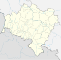
File:Lower Silesian Voivodeship location map.svg


Page contents not supported in other languages.  


File
Talk


Read
View on Commons


Tools


Actions  


Read
View on Commons


General  


What links here
Upload file
Special pages
Printable version
Page information
Get shortened URL
Download QR code


Appearance


This is a file from the Wikimedia Commons

From Wikipedia, the free encyclopedia


File

File history

File usage

Global file usage

Metadata
File:Lower Silesian Voivodeship location map.svg
Size of this PNG preview of this SVG file: 610 × 599 pixels. Other resolutions: 244 × 240 pixels | 489 × 480 pixels | 782 × 768 pixels | 1,043 × 1,024 pixels | 2,085 × 2,048 pixels | 902 × 886 pixels.

Original file(SVG file, nominally 902 × 886 pixels, file size: 902 KB)


Summary

Description
English: Location map of [[:en:Lower Silesian Voivodeship]Lower Silesian Voivodeship]], Poland. Geographic limits of the map:
  • N: 51.9134 N
  • S: 49.9809 N
  • W: 14.7603 E
  • E: 17.9091 E
  • Date
    Source

    Own work

    • naturalearthdata
    • OpenStreetMap
    Author SANtosito
    Other versions

    Licensing

    I, the copyright holder of this work, hereby publish it under the following license:
    w:en:Creative Commons
    attribution share alike
    This file is licensed under the Creative Commons Attribution-Share Alike 4.0 International license.
    You are free:
    • to share – to copy, distribute and transmit the work
  • to remix – to adapt the work
  • Under the following conditions:
    • attribution – You must give appropriate credit, provide a link to the license, and indicate if changes were made. You may do so in any reasonable manner, but not in any way that suggests the licensor endorses you or your use.
    • share alike – If you remix, transform, or build upon the material, you must distribute your contributions under the same or compatible license as the original.

    Captions

    Add a one-line explanation of what this file represents

    Items portrayed in this file

    depicts

    some value

    21 April 2018

    File history


    Click on a date/time to view the file as it appeared at that time.
    Date/TimeThumbnailDimensionsUserComment
    current02:41, 17 September 2018Thumbnail for version as of 02:41, 17 September 2018902 × 886 (902 KB)SANtositoCorrect projection and borders corrected
    20:29, 21 April 2018Thumbnail for version as of 20:29, 21 April 20182,449 × 2,386 (2 MB)SANtositoUser created page with UploadWizard


    More than 100 pages use this file. The following list shows the first 100 pages that use this file only. A full list is available.

    Antoniów, Lower Silesian Voivodeship

    Bardo, Poland

    Bielawa

    Bierutów

    Bogatynia

    Bolesławiec

    Bożków

    Brzeg Dolny

    Brzezinka Średzka

    Bukowiec, Karkonosze County

    Bystrzyca Kłodzka

    Chocianów

    Chojnik Castle

    Chojnów

    Czarnów, Lower Silesian Voivodeship

    Czerna, Bolesławiec County

    Czernina, Lower Silesian Voivodeship

    Duszniki-Zdrój

    Dzierżoniów

    Dąbrowa Bolesławiecka

    Gmina Góra

    Gorzanów

    Głuszyca

    Henryków Lubański

    Huta, Lower Silesian Voivodeship

    Jastrzębia, Lower Silesian Voivodeship

    Jawor

    Jaworzyna Śląska

    Jedlina-Zdrój

    Kamieniec, Lower Silesian Voivodeship

    Kamienna Góra

    Kondratów

    Krajanów

    Krzyżowa, Bolesławiec County

    Krzyżowa, Świdnica County

    Książnica

    Kudowa-Zdrój

    Kurów Wielki

    Kłodzko

    Lubań

    Lubin-Obora Airfield

    Lubiąż

    Lutynia, Kłodzko County

    Lądek-Zdrój

    Miedzianka, Lower Silesian Voivodeship

    Mirsk

    Młynów, Lower Silesian Voivodeship

    Niemcza

    Nowa Kamienica

    Nowa Ruda, Lower Silesian Voivodeship

    Oborniki Śląskie

    Oleśnica

    Osiecznica, Lower Silesian Voivodeship

    Osła

    Oława

    Oława-Stanowice Airport

    Ołobok, Lower Silesian Voivodeship

    Pieszyce

    Pieńsk

    Piława Dolna

    Piława Górna

    Pogwizdów, Lower Silesian Voivodeship

    Polanica-Zdrój

    Polkowice

    Poręba, Lower Silesian Voivodeship

    Prusice

    Roztocznik

    Siedmica

    Sieniawka, Dzierżoniów County

    Staniszów

    Stara Kamienica

    Stary Wielisław

    Stary Zdrój

    Stronie Śląskie

    Strzegom

    Strzelin

    Szalejów Dolny

    Szczawno-Zdrój

    Trzebnica

    Turów, Gmina Głogów

    Turów, Gmina Pęcław

    Twardogóra

    Vang Stave Church

    Wambierzyce

    Wierzchownia, Lower Silesian Voivodeship

    Wiklina, Lower Silesian Voivodeship

    Wojcieszów

    Wołów

    Wronów, Lower Silesian Voivodeship

    Węgliniec

    Węgrów, Lower Silesian Voivodeship

    Zawidów

    Zgorzelec

    Ziębice

    Ząbkowice Śląskie

    Środa Śląska

    Świdnica

    Świeradów-Zdrój

    Świniary, Góra County

    Święcko


    View more links to this file.

    Global file usage


    The following other wikis use this file:

    Usage on bn.wikipedia.org

    ি: ি//ি  ি

    ি: ি//ি  ি/ি


    Usage on de.wikipedia.org

    Kraftwerk Turów

    Olympiastadion Breslau

    Galeria Dominikańska

    Bahnkraftwerk Mittelsteine

    Poltegor

    Stadion Miejski (Breslau)

    Zagłębie-Lubin-Stadion

    Viadukt Jędrzychowice

    Boberviadukt (Bolesławiec)

    Sky Tower (Breslau)

    Staustufe Brzeg Dolny

    Flugplatz Legnica

    Friedensbrücke (Breslau)

    Warschauer Brücken (Breslau)

    Tiergartenbrücke (Breslau)

    Pommersche Brücke

    Stadion Oporowska

    Miniaturpark der Baudenkmäler Niederschlesiens

    Vorlage:Positionskarte Polen Niederschlesien

    Stadion Zagłębia Lubin (1985)


    Usage on eo.wikipedia.org

    Sobieszów

    Jagniątków

    Akvoturo en Vroclavo

    Wilkszyn

    Ŝablono:Situo sur mapo Pollando Malsuprasilezia provinco


    Usage on fa.wikipedia.org

    بیروتوو

    زاوییدو


    Usage on frr.wikipedia.org

    Vorlage:Positionskarte Polen Niederschlesien


    Usage on fr.wikipedia.org

    Legnica

    Wrocław

    Kłodzko

    Zgorzelec

    Gare centrale de Wrocław

    Chojnów

    Halle du Centenaire de Wrocław

    Lubiąż

    Stade du Zagłębie Lubin

    Ziębice

    Stade Oporowska

    Stade municipal de Wrocław

    Hala Orbita

    Stade olympique de Wrocław

    Gliczyna

    Milicz

    Modèle:Géolocalisation/Basse-Silésie

    Modèle:Géolocalisation/Basse-Silésie/Documentation

    Modèle:Géolocdual/Basse-Silésie

    Lwówek Śląski


    View more global usage of this file.

    Metadata

    If the file has been modified from its original state, some details may not fully reflect the modified file.


    Retrieved from "https://en.wikipedia.org/wiki/File:Lower_Silesian_Voivodeship_location_map.svg"


    Privacy policy

    About Wikipedia

    Disclaimers

    Contact Wikipedia

    Code of Conduct

    Developers

    Statistics

    Cookie statement

    Mobile view


    Wikimedia Foundation
    Powered by MediaWiki