


Original file (SVG file, nominally 1,168 × 1,513 pixels, file size: 181 KB)
| This is a file from the Wikimedia Commons. Information from its description page there is shown below. Commons is a freely licensed media file repository. You can help. |
| DescriptionMaritime Claims of Peru.svg |
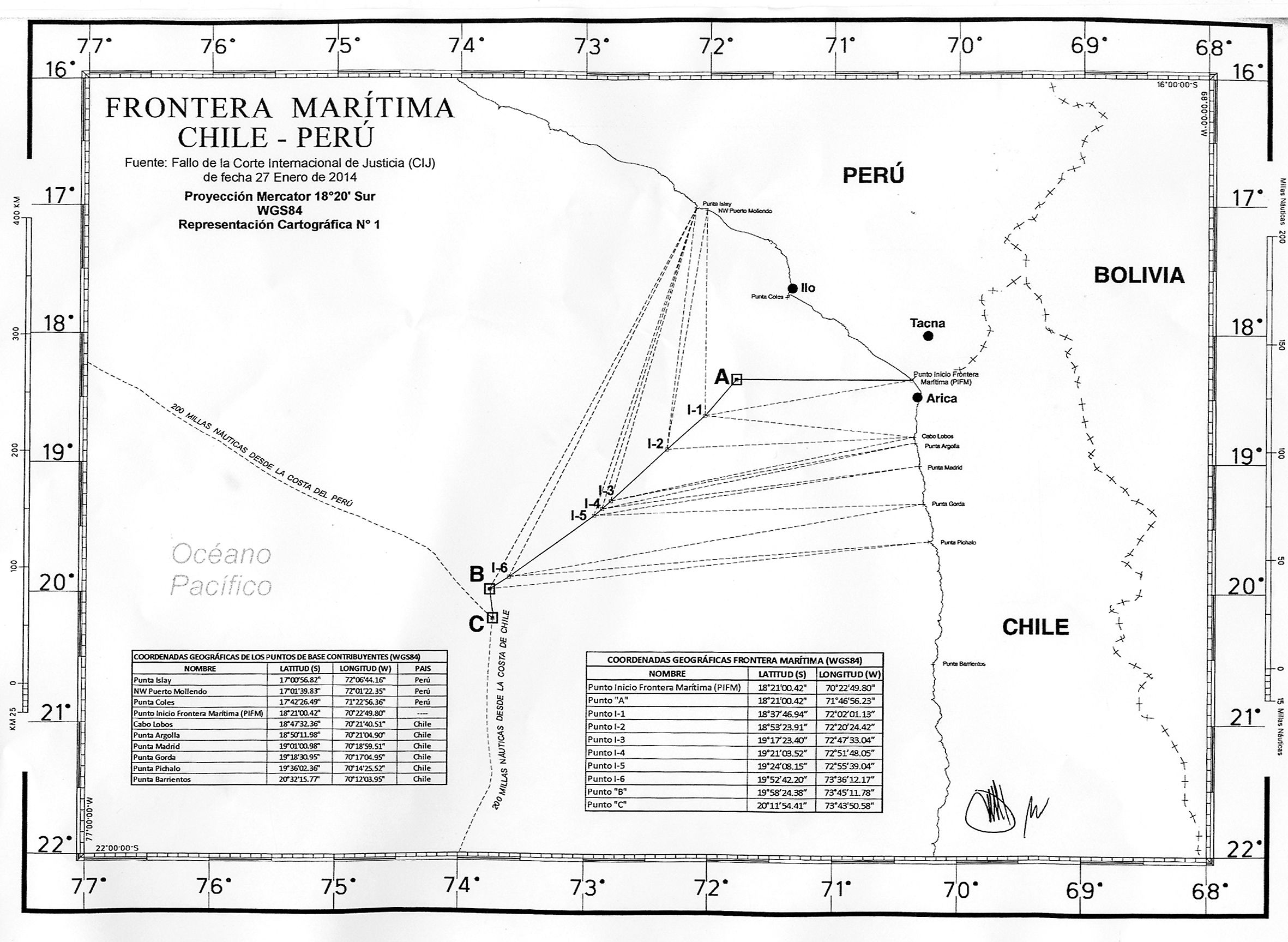
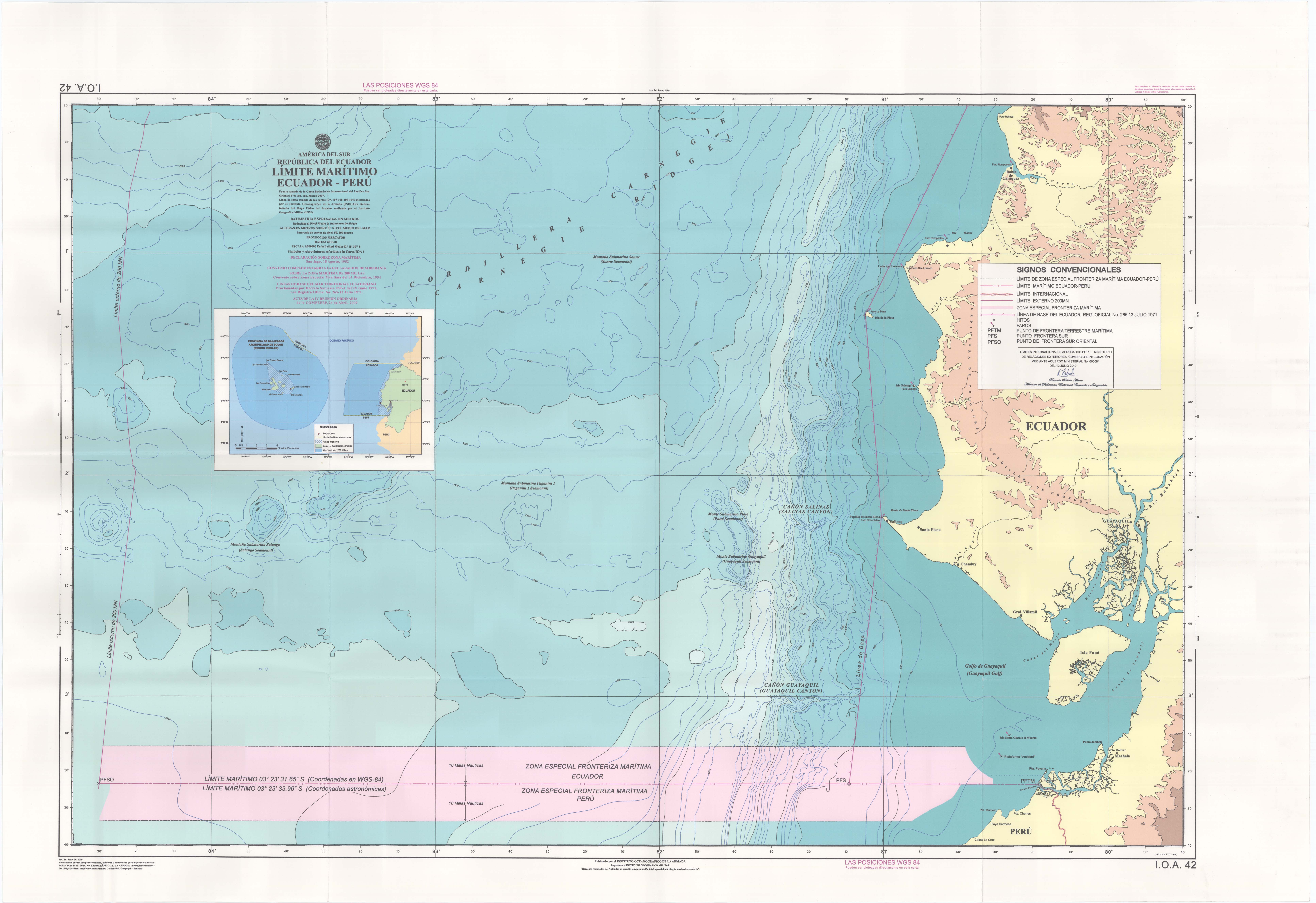
English: Map of the maritime claims of Peru including internal/archipelagic waters, territorial waters, exclusive economic zones (EEZ), and disputed areas.
|
| Date | |
| Source |
This file was derived from: Maritime Claims of Peru and Ecuador.svg
|
| Author |
|
This image is a derivative work of the following images:
Uploaded with derivativeFX
| Date/Time | Thumbnail | Dimensions | User | Comment | |
|---|---|---|---|---|---|
| current | 14:15, 27 July 2020 | | 1,168 × 1,513 (181 KB) | MiguelAlanCS | +mejoras |
| 18:51, 9 April 2014 |  | 1,168 × 1,513 (247 KB) | Milenioscuro |
This file contains additional information, probably added from the digital camera or scanner used to create or digitize it.
If the file has been modified from its original state, some details may not fully reflect the modified file.
| Image title | Generated with Qt |
|---|---|
| Width | 1167.5007 |
| Height | 1512.5807 |