Jump to content


Main menu


Navigation  


Main page
Contents
Current events
Random article
About Wikipedia
Contact us
Donate


Contribute  


Help
Learn to edit
Community portal
Recent changes
Upload file


Search  


Create account

Log in


Create account
 Log in


Pages for logged out editors learn more  


Contributions
Talk


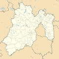
File:Mexico Estado de Mexico location map.svg


Page contents not supported in other languages.  


File
Talk


Read
View on Commons


Tools


Actions  


Read
View on Commons


General  


What links here
Upload file
Special pages
Printable version
Page information
Get shortened URL
Download QR code


Appearance


This is a file from the Wikimedia Commons

From Wikipedia, the free encyclopedia


File

File history

File usage

Global file usage

Metadata
File:Mexico Estado de Mexico location map.svg
Size of this PNG preview of this SVG file: 512 × 511 pixels. Other resolutions: 240 × 240 pixels | 481 × 480 pixels | 770 × 768 pixels | 1,026 × 1,024 pixels | 2,052 × 2,048 pixels.

Original file(SVG file, nominally 512 × 511 pixels, file size: 984 KB)


W3C-validity not checked.
Description

Location Map of Estado de México Equirectangular projection, Geographic limits of the map:

  • N: 20.37° N
  • S: 18.26° N
  • W: 100.68° W
  • E: 98.44° W
Date
Source
Author Battroid (talk)
I, the copyright holder of this work, hereby publish it under the following license:
Public domain I, the copyright holder of this work, release this work into the public domain. This applies worldwide.
In some countries this may not be legally possible; if so:
I grant anyone the right to use this work for any purpose, without any conditions, unless such conditions are required by law.

Captions

Add a one-line explanation of what this file represents

Items portrayed in this file

depicts

some value

16 September 2011

File history


Click on a date/time to view the file as it appeared at that time.
Date/TimeThumbnailDimensionsUserComment
current17:38, 28 April 2015Thumbnail for version as of 17:38, 28 April 2015512 × 511 (984 KB)Addicted04New map (INEGI, 2014)
08:11, 19 February 2012Thumbnail for version as of 08:11, 19 February 20122,506 × 2,504 (495 KB)Battroid{{ValidSVG}} {{Information |Description=Location Map of Estado de México Equirectangular projection, Geographic limits of the map: * N: 20.37° N * S: 18.26° N * W: 100.68° W * E: 98.44° W |Source={{own work}} |Date=2011-09-1
22:31, 16 September 2011Thumbnail for version as of 22:31, 16 September 20112,506 × 2,504 (494 KB)Battroid


The following pages on the English Wikipedia use this file (pages on other projects are not listed):

201011 Tercera División de México season

201112 Tercera División de México season

201213 Tercera División de México season

201314 Tercera División de México season

201415 Tercera División de México season

201516 Tercera División de México season

201617 Tercera División de México season

201718 Tercera División de México season

2018 WGC-Mexico Championship

201819 Liga TDP season

2019 WGC-Mexico Championship

201920 Liga TDP season

2020 WGC-Mexico Championship

202021 Liga TDP season

202122 Liga TDP season

202223 Liga TDP season

202324 Liga TDP season

Ajusco

Apaxco de Ocampo (town)

Cerro Mesa Ahumada

Chimalhuacán

Ciudad López Mateos

Ciudad Nezahualcóyotl

Colonia Santa Lucía

Coyotepec, State of Mexico

El Crucero, Tequixquiac

El Oro de Hidalgo

Felipe Ángeles International Airport

Huehuetoca

Hueypoxtla

Huixquilucan Municipality

Lerma railway station (State of Mexico)

Los Encinos Open

Luvianos

Metepec railway station

Nevado de Toluca

Papalotla

Popocatépetl

Quetzalpapálotl

San Francisco Chimalpa

San Juanico disaster

Santa Lucía, Zumpango

Santa María Ajoloapan

Santa María Rayón

Santiago Tilapa

Tejupilco de Hidalgo

Temascalapa

Tenancingo, State of Mexico

Teotihuacan

Teotihuacán Municipality

Tepotzotlán

Texcaltitlán

Tlapanaloya

Tlatlaya

Toluca Centro railway station

Toluca International Airport

Valle de Bravo

Zinacantepec railway station

Zumpango de Ocampo

File talk:Mexico Estado de Mexico location map.svg

Template:Infobox individual golf tournament

Template:Infobox individual golf tournament/doc

Template:Infobox individual golf tournament/sandbox

Module:Location map/data/Mexico State of Mexico

Module:Location map/data/Mexico State of Mexico/doc


Global file usage


The following other wikis use this file:

Usage on ar.wikipedia.org

قالب:Location map Mexico State of Mexico


Usage on ast.wikipedia.org

Estáu de Méxicu


Usage on ay.wikipedia.org

Ecatepec de Morelos

Huehuetoca (munisipyu)

Cuautitlán Izcalli

Texcoco (munisipyu)

Tlalnepantla de Baz (munisipyu)

Tultepec

Huixquilucan

Ixtlahuaca

Ixtapaluca


Usage on bar.wikipedia.org

México (Bundesstoot)

Toluca de Lerdo

Vorlog:Positionskarte Mexiko México


Usage on ba.wikipedia.org

Мехико

Ҡалып:ПозКарта Мексика Мехико


Usage on bg.wikipedia.org

Шаблон:ПК Мексико Мексико (щат)


Usage on ceb.wikipedia.org

Plantilya:Location map Mexico State of Mexico


Usage on ce.wikipedia.org

Кеп:Меттиган карта Мексика Мехико


Usage on de.wikipedia.org

Texcoco de Mora

Tepexpan

Ecatepec de Morelos

Nezahualcóyotl (Stadt)

Toluca de Lerdo

Tultepec

Wikipedia:Kartenwerkstatt/Positionskarten/Nordamerika

Chimalhuacán

Estadio Nemesio Díez

Estadio Neza 86

Paso de Cortés

Benutzer:Gestumblindi/Fakemuseum/Kía Tutàcel

Chalma (México)

La Pista Lomas Verdes

Tlapanaloya

Vorlage:Positionskarte Mexiko México

Santiago Tequixquiac

Naucalpan de Juárez

Zumpango de Ocampo

San Juan Zitlaltepec

Nevado de Toluca

Amatepec

Estadio Claudio Suárez

Tlalmanalco de Velázquez

Nationalpark Insurgente Miguel Hidalgo y Costilla

Malinalco (Ort)

El Oro de Hidalgo

Jocotitlán (Vulkan)

Benutzer:Afus199620/Ciudad López Mateos

Cuautitlán Izcalli

Benutzer:Afus199620/Cuautitlán


View more global usage of this file.

Metadata

If the file has been modified from its original state, some details may not fully reflect the modified file.


Retrieved from "https://en.wikipedia.org/wiki/File:Mexico_Estado_de_Mexico_location_map.svg"


Privacy policy

About Wikipedia

Disclaimers

Contact Wikipedia

Code of Conduct

Developers

Statistics

Cookie statement

Mobile view


Wikimedia Foundation
Powered by MediaWiki