Jump to content


Main menu


Navigation  


Main page
Contents
Current events
Random article
About Wikipedia
Contact us
Donate


Contribute  


Help
Learn to edit
Community portal
Recent changes
Upload file


Search  


Create account

Log in


Create account
 Log in


Pages for logged out editors learn more  


Contributions
Talk


File:Mexico Nayarit location map.svg


Page contents not supported in other languages.  


File
Talk


Read
View on Commons


Tools


Actions  


Read
View on Commons


General  


What links here
Upload file
Special pages
Printable version
Page information
Get shortened URL
Download QR code


Appearance


This is a file from the Wikimedia Commons

From Wikipedia, the free encyclopedia


File

File history

File usage

Global file usage
File:Mexico Nayarit location map.svg
Size of this PNG preview of this SVG file: 497 × 600 pixels. Other resolutions: 199 × 240 pixels | 398 × 480 pixels | 636 × 768 pixels | 849 × 1,024 pixels | 1,697 × 2,048 pixels | 1,553 × 1,874 pixels.

Original file(SVG file, nominally 1,553 × 1,874 pixels, file size: 194 KB)


Summary

Description
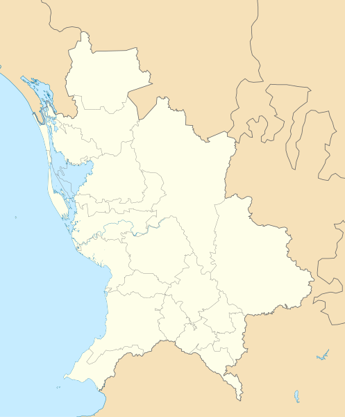
English: Location Map of Nayarit

Equirectangular projection, Geographic limits of the map:

  • N: 23.30° N
  • S: 20.50° N
  • W: 106.00° W
  • E: 103.50° W
Date
Source Own work
Author Addicted04

Licensing

Public domain I, the copyright holder of this work, release this work into the public domain. This applies worldwide.
In some countries this may not be legally possible; if so:
I grant anyone the right to use this work for any purpose, without any conditions, unless such conditions are required by law.

Captions

Add a one-line explanation of what this file represents

Items portrayed in this file

depicts

some value

5 January 2011

File history


Click on a date/time to view the file as it appeared at that time.
Date/TimeThumbnailDimensionsUserComment
current19:22, 7 August 2011Thumbnail for version as of 19:22, 7 August 20111,553 × 1,874 (194 KB)Battroid== Summary == {{Information |Description={{en|1=Location Map of Nayarit Equirectangular projection, Geographic limits of the map: * N: 23.30° N * S: 20.50° N * W: 106.00° W * E: 103.50° W}} |Source={{own}} |Author=[[User:Addicted04|Add
01:07, 6 January 2011Thumbnail for version as of 01:07, 6 January 20111,553 × 1,874 (193 KB)Addicted04{{Information |Description={{en|1=Location Map of Nayarit Equirectangular projection, Geographic limits of the map: * N: 23.30° N * S: 20.50° N * W: 106.00° W * E: 103.50° W}} |Source={{own}} |Author=Addicted04 |Dat


The following pages on the English Wikipedia use this file (pages on other projects are not listed):

Aguamilpa Dam

Ceboruco

Mexican Open (golf)

Sayulita

Tepic

Tepic International Airport

Module:Location map/data/Mexico Nayarit

Module:Location map/data/Mexico Nayarit/doc


Global file usage


The following other wikis use this file:

Usage on ar.wikipedia.org

قالب:Location map Mexico Nayarit


Usage on ba.wikipedia.org

Ҡалып:ПозКарта Мексика Наярит


Usage on bg.wikipedia.org

Тепик

Шаблон:ПК Мексико Наярит


Usage on ceb.wikipedia.org

Plantilya:Location map Mexico Nayarit


Usage on ce.wikipedia.org

Кеп:Меттиган карта Мексика Наярит


Usage on de.wikipedia.org

Tepic

Aguamilpa-Talsperre

Wikipedia:Kartenwerkstatt/Positionskarten/Nordamerika

El-Cajón-Talsperre (Mexiko)

San Blas (Nayarit)

Vorlage:Positionskarte Mexiko Nayarit

Isla Isabel (Mexiko)

Arena Cora

Ceboruco

Compostela (Nayarit)

Mexcaltitán

Santiago Ixcuintla

Jala (Nayarit)

Ahuacatlán (Nayarit)


Usage on eo.wikipedia.org

Nayarit

Tepic

Ŝablono:Situo sur mapo Meksiko Nayarit

Insulo Isabel


Usage on es.wikipedia.org

Tepic

San Blas (Nayarit)

Compostela (Nayarit)

Mexcaltitán

El Nuevo Mexcaltitán

Quiviquinta

San Andrés Milpillas

El Zonteco

Palmar de Cuautla

San Miguel Número Dos

Aztlán de las Garzas

El Mezcal

Santiago Ixcuintla

Pozo de Ibarra

Villa Juárez (Nayarit)

La Presa (Nayarit)

El Contadero

Estación Yago

El Tesorero

Villa Hidalgo (Nayarit)

Mesa de los Ricos

Aeropuerto Internacional Amado Nervo

Municipio de San Pedro Lagunillas

La Yesca

Huajicori

Ahuacatlán (Nayarit)


View more global usage of this file.

Retrieved from "https://en.wikipedia.org/wiki/File:Mexico_Nayarit_location_map.svg"


Privacy policy

About Wikipedia

Disclaimers

Contact Wikipedia

Code of Conduct

Developers

Statistics

Cookie statement

Mobile view


Wikimedia Foundation
Powered by MediaWiki