Jump to content


Main menu


Navigation  


Main page
Contents
Current events
Random article
About Wikipedia
Contact us
Donate


Contribute  


Help
Learn to edit
Community portal
Recent changes
Upload file


Search  


Create account

Log in


Create account
 Log in


Pages for logged out editors learn more  


Contributions
Talk


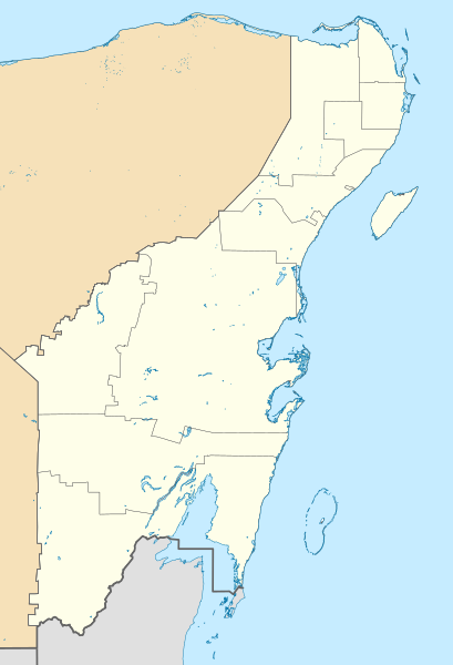
File:Mexico Quintana Roo location map.svg


Page contents not supported in other languages.  


File
Talk


Read
View on Commons


Tools


Actions  


Read
View on Commons


General  


What links here
Upload file
Special pages
Printable version
Page information
Get shortened URL
Download QR code


Appearance


This is a file from the Wikimedia Commons

From Wikipedia, the free encyclopedia


File

File history

File usage

Global file usage

Metadata
File:Mexico Quintana Roo location map.svg
Size of this PNG preview of this SVG file: 409 × 600 pixels. Other resolutions: 163 × 240 pixels | 327 × 480 pixels | 523 × 768 pixels | 698 × 1,024 pixels | 1,396 × 2,048 pixels | 960 × 1,408 pixels.

Original file(SVG file, nominally 960 × 1,408 pixels, file size: 832 KB)


Summary

 
W3C-validity not checked.
Description

Location Map of Quintana Roo. EPSG:3857 projection, Geographic limits of the map:

  • N: 21.70° N
  • S: 17.70° N
  • W: 89.40° W
  • E: 86.50° W
Date
Source
Author Addicted04 (talk)

Licensing

I, the copyright holder of this work, hereby publish it under the following license:
w:en:Creative Commons
attribution share alike
This file is licensed under the Creative Commons Attribution-Share Alike 3.0 Unported license.
You are free:
  • to share – to copy, distribute and transmit the work
  • to remix – to adapt the work
  • Under the following conditions:
    • attribution – You must give appropriate credit, provide a link to the license, and indicate if changes were made. You may do so in any reasonable manner, but not in any way that suggests the licensor endorses you or your use.
    • share alike – If you remix, transform, or build upon the material, you must distribute your contributions under the same or compatible license as the original.

    Captions

    Add a one-line explanation of what this file represents

    Items portrayed in this file

    depicts

    some value

    author name string: Addicted04

    6 August 2011

    File history


    Click on a date/time to view the file as it appeared at that time.
    (newest | oldest) View (newer 10 | ) (10 | 20| 50| 100 | 250 | 500)
    Date/TimeThumbnailDimensionsUserComment
    current15:48, 22 July 2021Thumbnail for version as of 15:48, 22 July 2021960 × 1,408 (832 KB)AlnatuoCorrected border positions
    14:46, 22 July 2021Thumbnail for version as of 14:46, 22 July 2021960 × 1,408 (832 KB)AlnatuoReverted to version as of 14:35, 22 July 2021 (UTC)
    14:44, 22 July 2021Thumbnail for version as of 14:44, 22 July 2021960 × 1,408 (850 KB)AlnatuoReverted to version as of 22:38, 26 April 2015 (UTC)
    14:35, 22 July 2021Thumbnail for version as of 14:35, 22 July 2021960 × 1,408 (832 KB)AlnatuoAdded Municipality of Puerto Morelos
    22:38, 26 April 2015Thumbnail for version as of 22:38, 26 April 2015960 × 1,408 (850 KB)Addicted04Fix
    16:42, 25 April 2015Thumbnail for version as of 16:42, 25 April 2015960 × 1,408 (850 KB)Addicted04New map (INEGI 2014)
    22:37, 17 March 2012Thumbnail for version as of 22:37, 17 March 20121,056 × 1,408 (341 KB)Battroid== Summary == {{ValidSVG}} {{Information |Description=Location Map of Quintana Roo Equirectangular projection, E/W stretching 110 %. Geographic limits of the map: * N: 21.70° N * S: 17.70° N * W: 89.40° W * E: 86.50° W |Source=...
    19:03, 20 November 2011Thumbnail for version as of 19:03, 20 November 20111,056 × 1,408 (326 KB)Addicted04borders
    00:05, 8 August 2011Thumbnail for version as of 00:05, 8 August 20111,056 × 1,408 (326 KB)Addicted04+Bacalar
    23:33, 7 August 2011Thumbnail for version as of 23:33, 7 August 20111,056 × 1,408 (325 KB)Addicted04+Banco Chinchorro

    (newest | oldest) View (newer 10 | ) (10 | 20| 50| 100 | 250 | 500)


    The following pages on the English Wikipedia use this file (pages on other projects are not listed):

    201011 Tercera División de México season

    201112 Tercera División de México season

    201213 Tercera División de México season

    201314 Tercera División de México season

    201415 Tercera División de México season

    201516 Tercera División de México season

    2016 Eisenhower Trophy

    2016 Espirito Santo Trophy

    201617 Tercera División de México season

    201718 Tercera División de México season

    201819 Liga TDP season

    201920 Liga TDP season

    202021 Liga TDP season

    202122 Liga TDP season

    202223 Liga TDP season

    202324 Liga TDP season

    Cancún

    Cancún International Airport

    Chan Hol

    Chetumal

    Chetumal International Airport

    Chiquilá

    Coba

    Cozumel International Airport

    El Eden Ecological Reserve

    Holbox Aerodrome

    Isla Holbox

    Isla Mujeres National Airport

    LIV Golf Mayakoba

    La Unión, Quintana Roo

    Lake Bacalar

    Playa del Carmen

    Playa del Carmen Airport

    Puerto Morelos

    San Miguel de Cozumel

    Tulum International Airport

    Xpu Há

    Yum Balam

    User:Anthonyc125/sandbox

    Module:Location map/data/Mexico Quintana Roo

    Module:Location map/data/Mexico Quintana Roo/doc


    Global file usage


    The following other wikis use this file:

    Usage on ar.wikipedia.org

    قالب:Location map Mexico Quintana Roo


    Usage on ba.wikipedia.org

    Ҡалып:ПозКарта Мексика Кинтана-Роо


    Usage on bg.wikipedia.org

    Четумал

    Канкун

    Косумел

    Акумал

    Шаблон:ПК Мексико Кинтана Ро


    Usage on ceb.wikipedia.org

    Plantilya:Location map Mexico Quintana Roo


    Usage on ce.wikipedia.org

    Кеп:Меттиган карта Мексика Кинтана-Роо


    Usage on de.wikipedia.org

    Cancún

    Cozumel

    X-Cacal Guardia

    Felipe Carrillo Puerto (Quintana Roo)

    Chetumal

    Playa del Carmen

    Sistema Sac Actun

    Flughafen Cancún

    Wikipedia:Kartenwerkstatt/Positionskarten/Nordamerika

    Estadio Beto Ávila

    Punta Allen

    Estadio Olímpico Andrés Quintana Roo

    Benutzer:Alfie66/Spielwiese

    Sistema Ox Bel Ha

    Cobá (Ort)

    Punta Nizuc

    Sistema Dos Ojos

    Puerto Morelos

    Holbox

    Vorlage:Positionskarte Mexiko Quintana Roo

    Bacalar

    Laguna Boca Paila

    Akumal

    Benutzer:Wasquewhat/Xpu-Há

    Choo-Ha

    San Miguel de Cozumel

    Flughafen Tulum


    Usage on eo.wikipedia.org

    Cancún

    Othón P. Blanco

    Chetumal

    Ŝablono:Situo sur mapo Meksiko Quintana Roo


    Usage on es.wikipedia.org

    Wikiproyecto:Ilustración/Taller de Cartografía/Realizaciones/América del Norte


    Usage on fr.wikipedia.org

    Cancún

    Chetumal

    Isla Mujeres

    Playa del Carmen

    Estadio Beto Ávila

    Estadio Andrés Quintana Roo

    San Miguel de Cozumel

    Xcaret Eco Park

    Lázaro Cárdenas (municipalité)


    View more global usage of this file.

    Metadata

    If the file has been modified from its original state, some details may not fully reflect the modified file.


    Retrieved from "https://en.wikipedia.org/wiki/File:Mexico_Quintana_Roo_location_map.svg"


    Privacy policy

    About Wikipedia

    Disclaimers

    Contact Wikipedia

    Code of Conduct

    Developers

    Statistics

    Cookie statement

    Mobile view


    Wikimedia Foundation
    Powered by MediaWiki