Jump to content


Main menu


Navigation  


Main page
Contents
Current events
Random article
About Wikipedia
Contact us
Donate


Contribute  


Help
Learn to edit
Community portal
Recent changes
Upload file


Search  


Create account

Log in


Create account
 Log in


Pages for logged out editors learn more  


Contributions
Talk


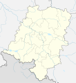
File:Opole Voivodeship location map.svg


Page contents not supported in other languages.  


File
Talk


Read
View on Commons


Tools


Actions  


Read
View on Commons


General  


What links here
Upload file
Special pages
Printable version
Page information
Get shortened URL
Download QR code


Appearance


This is a file from the Wikimedia Commons

From Wikipedia, the free encyclopedia


File

File history

File usage

Global file usage

Metadata
File:Opole Voivodeship location map.svg
Size of this PNG preview of this SVG file: 549 × 599 pixels. Other resolutions: 220 × 240 pixels | 440 × 480 pixels | 704 × 768 pixels | 938 × 1,024 pixels | 1,877 × 2,048 pixels | 845 × 922 pixels.

Original file(SVG file, nominally 845 × 922 pixels, file size: 825 KB)


Summary

Description
English: Location map of Opole Voivodeship, Poland. Geographic limits of the map:
  • N: 51.2778 N
  • S: 49.942 N
  • W: 16.8461 E
  • E: 18.8073 E
  • Date
    Source

    Own work

    • naturalearthdata
    • OpenStreetMap
    Author Tymek1988
    Other versions

    Licensing

    I, the copyright holder of this work, hereby publish it under the following license:
    w:en:Creative Commons
    attribution share alike
    This file is licensed under the Creative Commons Attribution-Share Alike 4.0 International license.
    You are free:
    • to share – to copy, distribute and transmit the work
  • to remix – to adapt the work
  • Under the following conditions:
    • attribution – You must give appropriate credit, provide a link to the license, and indicate if changes were made. You may do so in any reasonable manner, but not in any way that suggests the licensor endorses you or your use.
    • share alike – If you remix, transform, or build upon the material, you must distribute your contributions under the same or compatible license as the original.

    Captions

    Add a one-line explanation of what this file represents

    Items portrayed in this file

    depicts

    some value

    author name string: Tymek1988

    9 April 2018

    File history


    Click on a date/time to view the file as it appeared at that time.
    Date/TimeThumbnailDimensionsUserComment
    current00:32, 22 November 2020Thumbnail for version as of 00:32, 22 November 2020845 × 922 (825 KB)SANtositosmall
    22:49, 3 June 2018Thumbnail for version as of 22:49, 3 June 20181,956 × 2,132 (1.06 MB)SANtositoFixed projection
    19:49, 9 April 2018Thumbnail for version as of 19:49, 9 April 20181,957 × 2,100 (715 KB)SANtositoUser created page with UploadWizard


    More than 100 pages use this file. The following list shows the first 100 pages that use this file only. A full list is available.

    Baborów

    Bażany

    Biała, Opole Voivodeship

    Bierawa

    Bodzanowice

    Brzezinki, Opole Voivodeship

    Brzęczkowice, Opole Voivodeship

    Burgrabice

    Chrzelice

    Chrząstowice, Opole Voivodeship

    Chróścielów

    Chróścina, Nysa County

    Dobra, Opole Voivodeship

    Dobrodzień

    Dziedzice, Krapkowice County

    Dzierżysław, Opole Voivodeship

    Frącki, Opole Voivodeship

    Gmina Dobrodzień

    Gnojna

    Gogolin

    Gostomia, Opole Voivodeship

    Gościce

    Grocholub

    Grodziec, Gmina Ozimek

    Górażdże

    Głogówek

    Głubczyce

    Głuchołazy

    Głuszyna, Opole Voivodeship

    Kamienica, Opole Voivodeship

    Kamień Śląski

    Kaniów, Opole Voivodeship

    Kałków, Opole Voivodeship

    Kobylice, Opole Voivodeship

    Komprachcice

    Kopalina, Krapkowice County

    Kotlarnia

    Kozłówki, Opole Voivodeship

    Koźle

    Krasiejów

    Krogulna

    Krzywa Góra, Opole Voivodeship

    Krzyżowa Dolina

    Krzyżowice, Brzeg County

    Kuniów

    Leśnica

    Miejsce, Opole Voivodeship

    Miejsce Odrzańskie

    Mieszkowice, Opole Voivodeship

    Mokre, Opole Voivodeship

    Namysłów

    Nowa Cerekwia

    Nowa Wieś Prudnicka

    Nowy Świętów

    Olesno

    Otmuchów

    Ozimek

    Pielgrzymów

    Pogorzela, Opole Voivodeship

    Polska Cerekiew

    Popielów, Opole Voivodeship

    Praszka

    Prudnik

    Przywory, Opole Voivodeship

    Prószków

    Prędocin, Opole Voivodeship

    Ptakowice, Opole Voivodeship

    Puszyna

    Pągów, Opole Voivodeship

    Radoszowice

    Radzikowice

    Raszowa, Opole County

    Rudawa, Opole Voivodeship

    Rudziczka, Opole Voivodeship

    Różyna, Opole Voivodeship

    Siedliska, Opole County

    Skorogoszcz

    Smolarnia, Opole Voivodeship

    Sowczyce

    Sowin, Opole Voivodeship

    Strzegów, Opole Voivodeship

    Strzelce Opolskie

    Suchy Bór

    Tarnów Opolski

    Turawa

    Tułowice, Opole Voivodeship

    Tuły

    Tłustomosty

    Wierzbie, Nysa County

    Wierzbna, Opole Voivodeship

    Wierzbno, Głubczyce County

    Wierzbno, Nysa County

    Winów

    Wołczyn

    Wrzoski, Opole Voivodeship

    Wódka, Opole Voivodeship

    Zakrzów, Krapkowice County

    Zakrzów, Kędzierzyn-Koźle County

    Zawadzkie

    Łężce, Opole Voivodeship


    View more links to this file.

    Global file usage


    The following other wikis use this file:

    Usage on de.wikipedia.org

    Flugplatz Opole-Kamień Śląski

    Kettenbrücke (Ozimek)

    Miniaturenpark Olschowa

    Bahnhof Opole Wschodnie

    Vorlage:Positionskarte Polen Opole

    Kraftwerk Opole

    Stadion Miejski (Opole)


    Usage on eo.wikipedia.org

    Bobrowa (Opola Provinco)

    Ŝablono:Situo sur mapo Pollando Opola provinco


    Usage on fa.wikipedia.org

    نیسا (اوپوله)

    پرودنیک

    اوزیمک

    اولسنو (اوپوله)

    پاکزکو

    دوبرودزین

    زواد زکی

    بژچکوویتسه (استان اوپوله)

    بژزینکی (استان اوپوله)

    پاگوو (استان اوپوله)

    پتاکوویتسه (استان اوپوله)

    پردوتسین (استان اوپوله)

    پژووره (استان اوپوله)

    روداوا (استان اوپوله)

    روزیچکا (استان اوپوله)

    زیرژسواو (استان اوپوله)

    ژابنیک (استان اوپوله)

    ستژگوو (استان اوپوله)

    سووین (استان اوپوله)

    فراتسکی (استان اوپوله)

    کادووب (استان اوپوله)

    کامینیتسا (استان اوپوله)

    کانیوو (استان اوپوله)

    کاوکوو (استان اوپوله)

    کژوا گورا (استان اوپوله)

    کوبلیتسه (استان اوپوله)

    کوزوووکی (استان اوپوله)

    گوستومیا (استان اوپوله)

    گووشنا (استان اوپوله)

    لوبژا (استان اوپوله)

    نامیسووف


    Usage on fi.wikipedia.org

    Malline:Sijaintikartta Puola Opolen voivodikunta


    Usage on fr.wikipedia.org

    Opole

    Baborów

    Modèle:Géolocalisation/Opole (voïvodie)

    Modèle:Géolocalisation/Opole (voïvodie)/Documentation

    Modèle:Géolocdual/Opole (voïvodie)

    Wołczyn

    Zdzieszowice

    Gogolin

    Ozimek


    View more global usage of this file.

    Metadata

    If the file has been modified from its original state, some details may not fully reflect the modified file.


    Retrieved from "https://en.wikipedia.org/wiki/File:Opole_Voivodeship_location_map.svg"


    Privacy policy

    About Wikipedia

    Disclaimers

    Contact Wikipedia

    Code of Conduct

    Developers

    Statistics

    Cookie statement

    Mobile view


    Wikimedia Foundation
    Powered by MediaWiki