Jump to content


Main menu


Navigation  


Main page
Contents
Current events
Random article
About Wikipedia
Contact us
Donate


Contribute  


Help
Learn to edit
Community portal
Recent changes
Upload file


Search  


Create account

Log in


Create account
 Log in


Pages for logged out editors learn more  


Contributions
Talk


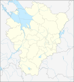
File:Russian Federation Yaroslavl Oblast location map.svg


Page contents not supported in other languages.  


File
Talk


Read
View on Commons


Tools


Actions  


Read
View on Commons


General  


What links here
Upload file
Special pages
Printable version
Page information
Get shortened URL
Download QR code


Appearance


This is a file from the Wikimedia Commons

From Wikipedia, the free encyclopedia


File

File history

File usage

Global file usage
File:Russian Federation Yaroslavl Oblast location map.svg
Size of this PNG preview of this SVG file: 545 × 599 pixels. Other resolutions: 218 × 240 pixels | 436 × 480 pixels | 698 × 768 pixels | 931 × 1,024 pixels | 1,862 × 2,048 pixels | 711 × 782 pixels.

Original file(SVG file, nominally 711 × 782 pixels, file size: 2.42 MB)


Summary

Description
English: Russian Federation Yaroslavl Oblast location map

Equirectangular projection, WGS84 datum

  • True scale parallel: 57° 40' N
    k=1.856

Geographic limits of the map :

  • West  : 37° 00' E
  • East  : 41° 30' E
  • North : 59° 00' N
  • South : 56° 20' N
Date
Source Own work
Author Das steinerne Herz

Licensing

I, the copyright holder of this work, hereby publish it under the following licenses:
w:en:Creative Commons
attribution share alike
This file is licensed under the Creative Commons Attribution-Share Alike 3.0 Unported license.
You are free:
  • to share – to copy, distribute and transmit the work
  • to remix – to adapt the work
  • Under the following conditions:
    • attribution – You must give appropriate credit, provide a link to the license, and indicate if changes were made. You may do so in any reasonable manner, but not in any way that suggests the licensor endorses you or your use.
    • share alike – If you remix, transform, or build upon the material, you must distribute your contributions under the same or compatible license as the original.
    GNU head Permission is granted to copy, distribute and/or modify this document under the terms of the GNU Free Documentation License, Version 1.2 or any later version published by the Free Software Foundation; with no Invariant Sections, no Front-Cover Texts, and no Back-Cover Texts. A copy of the license is included in the section entitled GNU Free Documentation License.
    You may select the license of your choice.

    Captions

    Add a one-line explanation of what this file represents

    Items portrayed in this file

    depicts

    some value

    author name string: Das steinerne Herz

    2011

    File history


    Click on a date/time to view the file as it appeared at that time.
    Date/TimeThumbnailDimensionsUserComment
    current10:27, 20 February 2011Thumbnail for version as of 10:27, 20 February 2011711 × 782 (2.42 MB)Das steinerne Herzcorr
    10:19, 20 February 2011Thumbnail for version as of 10:19, 20 February 2011711 × 782 (2.42 MB)Das steinerne Herzadded city counties
    01:03, 20 February 2011Thumbnail for version as of 01:03, 20 February 2011711 × 782 (2.38 MB)Das steinerne Herz{{Information |Description ={{en|1=Russian Federation Yaroslavl Oblast location map}} |Source ={{own}} |Author =Das steinerne Herz |Date =2011 |Permission = |other_versions = }} [[Category:Maps


    The following pages on the English Wikipedia use this file (pages on other projects are not listed):

    2014 Winter Olympics torch relay

    Abashevo, Yaroslavl Oblast

    Abbakumtsevo

    Averinskaya, Yaroslavl Oblast

    Bezverkhovo, Yaroslavl Oblast

    Bolshoye Maslennikovo

    Bolshoye Selo, Yaroslavl Oblast

    Borisoglebsky, Yaroslavl Oblast

    Breytovo

    Burmakino

    Central Federal District

    Danilov, Yaroslavl Oblast

    Gavrilov-Yam

    Ishnya

    Konstantinovsky, Yaroslavl Oblast

    Krasny Profintern

    Krasnye Tkachi

    Lesnaya Polyana

    Lyubim

    Myshkin (town)

    Nekrasovskoye

    Novy Nekouz

    Pereslavl-Zalessky

    Petrovskoye, Yaroslavl Oblast

    Porechye-Rybnoye

    Poshekhonye

    Prechistoye, Pervomaysky District, Yaroslavl Oblast

    Rostov, Yaroslavl Oblast

    Rybinsk

    Semibratovo

    Shurskol

    Tunoshna Airport

    Tutayev

    Uglich

    Yaroslavl

    Module:Location map/data/Russia Yaroslavl Oblast

    Module:Location map/data/Russia Yaroslavl Oblast/doc


    Global file usage


    The following other wikis use this file:

    Usage on af.wikipedia.org

    Jaroslawl

    Sjabloon:Liggingkaart Jaroslawl-oblast

    Oeglitsj


    Usage on ar.wikipedia.org

    قالب:Location map Russia Yaroslavl Oblast


    Usage on azb.wikipedia.org

    آباشوو، یاروسلاول اوبلاستی

    آباکومتسوو


    Usage on ba.wikipedia.org

    Ҡалып:ПозКарта Рәсәй Ярославль өлкәһе


    Usage on be.wikipedia.org

    Яраслаўль

    Гаўрылаў-Ям

    Рыбінскае вадасховішча

    Шаблон:На карце/Расія Яраслаўская вобласць

    Пашахонне

    Някрасаўскае

    Барысаглебскі (Яраслаўская вобласць)

    Нера

    Ішня (рабочы пасёлак)

    Канстанцінаўскі (Яраслаўская вобласць)

    Прачыстае (Яраслаўская вобласць)

    Пятроўскае (Растоўскі раён)

    Бурмакіна

    Брэйтава

    Лясная Паляна (Яраслаўская вобласць)

    Новы Некауз

    Сямібратава

    Красныя Ткачы

    Красны Прафінтэрн (рабочы пасёлак)

    Вялікае Сяло (Яраслаўская вобласць)


    Usage on bg.wikipedia.org

    Шаблон:ПК Русия Ярославска област


    Usage on ceb.wikipedia.org

    Plantilya:Location map Russia Yaroslavl Oblast


    Usage on ce.wikipedia.org

    Ярославль

    Ростов

    Абашево (Ярославлан область)

    Абрамово (Большеселон кӀошт)

    Акулинино (Большеселон кӀошт)

    Алексеево (Большеселон кӀошт)

    Алексино (Большеселон кӀошт)

    Андреево (Ярославлан область)

    Андреевски (Благовещенскан йуьртан меттиг)

    Андреевски (Чудиновскан йуьртан меттиг)

    Андрейцевка

    Аниково (Большеселон кӀошт)

    Анкудимово

    Антоново (Большеселон кӀошт)

    Арефино (Большеселон кӀошт)

    Артемово (Ярославлан область)

    Афанасово (Большеселон кӀошт)

    Аферово (Ярославлан область)

    Бабуково

    Байково (Ярославлан область)

    Бакунино (Ярославлан область)


    View more global usage of this file.

    Retrieved from "https://en.wikipedia.org/wiki/File:Russian_Federation_Yaroslavl_Oblast_location_map.svg"


    Privacy policy

    About Wikipedia

    Disclaimers

    Contact Wikipedia

    Code of Conduct

    Developers

    Statistics

    Cookie statement

    Mobile view


    Wikimedia Foundation
    Powered by MediaWiki