Jump to content


Main menu


Navigation  


Main page
Contents
Current events
Random article
About Wikipedia
Contact us
Donate


Contribute  


Help
Learn to edit
Community portal
Recent changes
Upload file


Search  


Create account

Log in


Create account
 Log in


Pages for logged out editors learn more  


Contributions
Talk


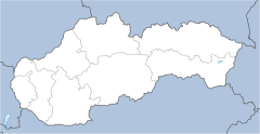
File:Slovakia location map.svg


Page contents not supported in other languages.  


File
Talk


Read
View on Commons


Tools


Actions  


Read
View on Commons


General  


What links here
Upload file
Special pages
Printable version
Page information
Get shortened URL
Download QR code


Appearance


This is a file from the Wikimedia Commons

From Wikipedia, the free encyclopedia


File

File history

File usage

Global file usage
File:Slovakia location map.svg
Size of this PNG preview of this SVG file: 800 × 413 pixels. Other resolutions: 320 × 165 pixels | 640 × 331 pixels | 1,024 × 529 pixels | 1,280 × 661 pixels | 2,560 × 1,322 pixels | 1,032 × 533 pixels.

Original file(SVG file, nominally 1,032 × 533 pixels, file size: 100 KB)


Summary

Description
Deutsch: Positionskarte der Slowakei

Quadratische Plattkarte, N-S-Streckung 150 %. Geographische Begrenzung der Karte:

  • N: 49.8° N
  • S: 47.6° N
  • W: 16.6° O
  • O: 23.0° O
English: Location map of Slovakia

Equirectangular projection, N/S stretching 150 %. Geographic limits of the map:

  • N: 49.8° N
  • S: 47.6° N
  • W: 16.6° E
  • E: 23.0° E
Français : Carte localisant la Slovaquie

Projection cylindrique équidistante, N/S étendue 150 %. Limites géographiques de la carte :

  • N: 49.8° N
  • S: 47.6° N
  • O: 16.6° E
  • E: 23.0° E
Date 06-08-2008
Source

Own work, using

  • United States National Imagery and Mapping Agency data
  • World Data Base II data
Author NordNordWest
Other versions File:Slovakia location map white.svg:
Kartenwerkstatt
This map has been made or improved in the German Kartenwerkstatt (Map Lab). You can propose maps to improve as well.

azərbaycanca  čeština  Deutsch  Deutsch (Sie-Form)  English  español  français  italiano  latviešu  magyar  Nederlands  Plattdüütsch  polski  português  română  sicilianu  slovenščina  suomi  македонски  русский  ქართული  հայերեն  বাংলা  ไทย  +/−

Licensing

I, the copyright holder of this work, hereby publish it under the following licenses:
GNU head Permission is granted to copy, distribute and/or modify this document under the terms of the GNU Free Documentation License, Version 1.2 or any later version published by the Free Software Foundation; with no Invariant Sections, no Front-Cover Texts, and no Back-Cover Texts. A copy of the license is included in the section entitled GNU Free Documentation License.
w:en:Creative Commons
attribution share alike
This file is licensed under the Creative Commons Attribution-Share Alike 3.0 Unported license.
You are free:
  • to share – to copy, distribute and transmit the work
  • to remix – to adapt the work
  • Under the following conditions:
    • attribution – You must give appropriate credit, provide a link to the license, and indicate if changes were made. You may do so in any reasonable manner, but not in any way that suggests the licensor endorses you or your use.
    • share alike – If you remix, transform, or build upon the material, you must distribute your contributions under the same or compatible license as the original.
    You may select the license of your choice.

    Captions

    Add a one-line explanation of what this file represents

    Items portrayed in this file

    depicts

    some value

    File history


    Click on a date/time to view the file as it appeared at that time.
    Date/TimeThumbnailDimensionsUserComment
    current09:01, 2 September 2008Thumbnail for version as of 09:01, 2 September 20081,032 × 533 (100 KB)NordNordWest
    20:52, 6 August 2008Thumbnail for version as of 20:52, 6 August 2008516 × 266 (99 KB)NordNordWest{{Information |Description= {{de|Positionskarte der Slowakei}} Quadratische Plattkarte, N-S-Streckung 150 %. Geographische Begrenzung der Karte: * N: 49.8° N * S: 47.6° N * W: 16.6° O * O: 23.0° O {{en|Location map of [[:en:Slovakia|S


    More than 100 pages use this file. The following list shows the first 100 pages that use this file only. A full list is available.

    2000 UEFA European Under-21 Championship

    200102 Slovak Superliga

    200203 Slovak Superliga

    200304 Slovak Superliga

    200405 Slovak Superliga

    Alekšince

    Banská Belá

    Betliar

    Blatnica, Slovakia

    Blatnica Valley

    Bojnice Castle

    Borský Svätý Jur

    Bratislava Airport

    Brdárka

    Bretka

    Brhlovce

    Brzotín

    Comenius University

    Dargov

    Dedina Mládeže

    Diakovce

    Diaková

    Dobšiná

    Gabčíkovo

    Gader Valley

    Gelnica

    House of Schwarzenberg

    Hozelec

    Hranovnica

    Hronská Dúbrava

    Ilija, Slovakia

    Jastrabá

    Jelenec

    Jánovce

    Kazimír

    Komjatice

    Komárno

    Kosorín

    Košice International Airport

    Krahule

    Kravany, Poprad District

    Kremnické Bane

    Kráľovský Chlmec

    Kysucké Nové Mesto

    Lastovce

    Leles

    Liptovský Hrádok

    List of national parks of Slovakia

    List of top-division football clubs in UEFA countries

    Lukavica, Zvolen District

    Látky

    Margecany

    Mošovce

    Muráň Castle

    Nálepkovo

    Orava Castle

    Perín-Chym

    Pitelová

    Podbrezová

    PopradTatry Airport

    Považská Bystrica

    Prochot

    Rad (village)

    Rozhanovce

    Sabinov

    Sirk, Revúca District

    Skýcov

    Slatina, Levice District

    Slatinské Lazy

    Slivník

    Slovak Extraliga

    Slovak First Football League

    Spiš Castle

    Spišské Podhradie

    Spišské Vlachy

    Spišský Hrhov

    St. Emmeram's Cathedral, Nitra

    Stankovce

    Stožok

    Streda nad Bodrogom

    Strečno

    Svinia

    Sídlisko Ťahanovce

    Tematín

    Terchová

    Veľký Šariš

    Vlkolínec

    Vrbov

    Vráble

    Vrútky

    Vysoké Tatry

    Vígľašská Huta-Kalinka

    Zlaté Moravce

    Zvolen Castle

    Čabraď Castle

    Čachtice Castle

    Čierne Kľačany

    Čičmany

    Číž

    Šaca


    View more links to this file.

    Global file usage


    The following other wikis use this file:

    Usage on af.wikipedia.org

    Sjabloon:Liggingkaart Slowakye


    Usage on als.wikipedia.org

    Bratislava

    Vorlage:Positionskarte Slowakei


    Usage on an.wikipedia.org

    Bratislava

    Castiello de Spiš

    Plantilla:Mapa de localización Eslovaquia

    Poprad

    Banská Štiavnica

    Castiello de Bratislava

    Levoča

    Žehra

    Spišské Podhradie

    Banská Bystrica

    Nitra

    Žilina

    Košice

    Prešov

    Trnava

    Michalovce

    Trenčín


    Usage on ar.wikipedia.org

    قالب:خريطة مواقع سلوفاكيا

    الوحدات الإقليمية الإحصائية من المستوى الأول للاتحاد الأوروبي


    Usage on ast.wikipedia.org

    Bratislava

    Karst eslovacu

    Montes Tatra

    Košice

    Módulu:Mapa de llocalización/datos/Eslovaquia

    Módulu:Mapa de llocalización/datos/Eslovaquia/usu


    Usage on az.wikipedia.org

    Bratislava

    Preşov

    Banska-Bistritsa

    Zvolen

    Bardeyov

    Prievidza

    Jilina

    Trnava

    Koşitse

    Nitra

    Trençin

    Poprad

    Humenne

    Levitse

    Spişska Nova Ves

    Liptovski Mikulaş

    Rujomberok

    Çadtsa

    Luçenets

    Partizanske

    Handlova

    Kejmarok


    View more global usage of this file.

    Retrieved from "https://en.wikipedia.org/wiki/File:Slovakia_location_map.svg"


    Privacy policy

    About Wikipedia

    Disclaimers

    Contact Wikipedia

    Code of Conduct

    Developers

    Statistics

    Cookie statement

    Mobile view


    Wikimedia Foundation
    Powered by MediaWiki