Jump to content


Main menu


Navigation  


Main page
Contents
Current events
Random article
About Wikipedia
Contact us
Donate


Contribute  


Help
Learn to edit
Community portal
Recent changes
Upload file


Search  


Create account

Log in


Create account
 Log in


Pages for logged out editors learn more  


Contributions
Talk


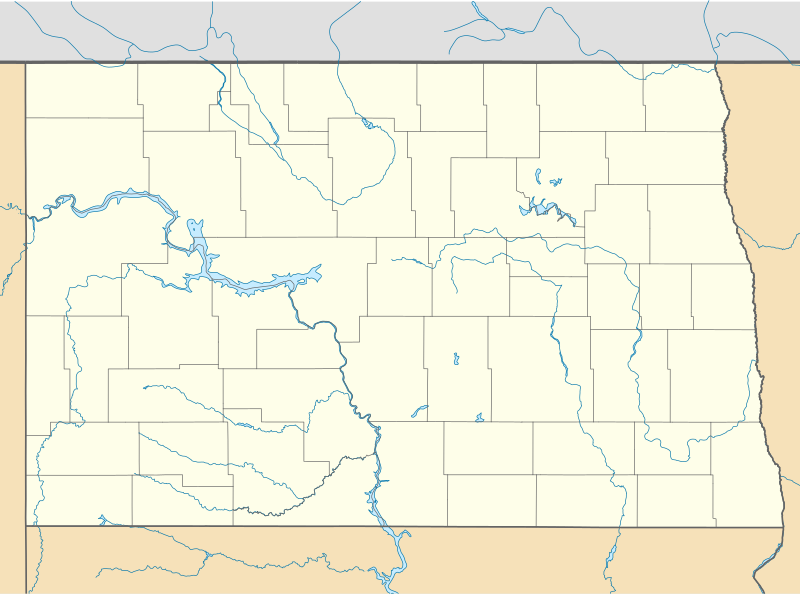
File:USA North Dakota location map.svg


Page contents not supported in other languages.  


File
Talk


Read
View on Commons


Tools


Actions  


Read
View on Commons


General  


What links here
Upload file
Special pages
Printable version
Page information
Get shortened URL
Download QR code


Appearance


This is a file from the Wikimedia Commons

From Wikipedia, the free encyclopedia


File

File history

File usage

Global file usage
File:USA North Dakota location map.svg
Size of this PNG preview of this SVG file: 800 × 594 pixels. Other resolutions: 320 × 237 pixels | 640 × 475 pixels | 1,024 × 760 pixels | 1,280 × 950 pixels | 2,560 × 1,899 pixels | 1,201 × 891 pixels.

Original file(SVG file, nominally 1,201 × 891 pixels, file size: 347 KB)


Summary

Description
Deutsch: Positionskarte von North Dakota, USA

Quadratische Plattkarte, N-S-Streckung 150.0 %. Geographische Begrenzung der Karte:

  • N: 49.4° N
  • S: 45.5° N
  • W: 104.3° W
  • O: 96.4° W
English: Location map of North Dakota, USA

Equirectangular projection, N/S stretching 150.0 %. Geographic limits of the map:

  • N: 49.4° N
  • S: 45.5° N
  • W: 104.3° W
  • E: 96.4° W
 
This map was created with GeoTools.
Date
Source Own work
Author Alexrk2
Other versions

Derivative works of this file:  BMO Harris Bank 2012-06.png Derivative works of this file:

Kartenwerkstatt
This map has been made or improved in the German Kartenwerkstatt (Map Lab). You can propose maps to improve as well.

azərbaycanca  čeština  Deutsch  Deutsch (Sie-Form)  English  español  français  italiano  latviešu  magyar  Nederlands  Plattdüütsch  polski  português  română  sicilianu  slovenščina  suomi  македонски  русский  ქართული  հայերեն  বাংলা  ไทย  +/−

Licensing

I, the copyright holder of this work, hereby publish it under the following licenses:
GNU head Permission is granted to copy, distribute and/or modify this document under the terms of the GNU Free Documentation License, Version 1.2 or any later version published by the Free Software Foundation; with no Invariant Sections, no Front-Cover Texts, and no Back-Cover Texts. A copy of the license is included in the section entitled GNU Free Documentation License.
w:en:Creative Commons
attribution
This file is licensed under the Creative Commons Attribution 3.0 Unported license.
You are free:
  • to share – to copy, distribute and transmit the work
  • to remix – to adapt the work
  • Under the following conditions:
    • attribution – You must give appropriate credit, provide a link to the license, and indicate if changes were made. You may do so in any reasonable manner, but not in any way that suggests the licensor endorses you or your use.
    You may select the license of your choice.

    Captions

    Add a one-line explanation of what this file represents

    Items portrayed in this file

    depicts

    some value

    6 June 2009

    File history


    Click on a date/time to view the file as it appeared at that time.
    Date/TimeThumbnailDimensionsUserComment
    current09:59, 21 June 2009Thumbnail for version as of 09:59, 21 June 20091,201 × 891 (347 KB)Alexrk2water 2m
    16:31, 13 June 2009Thumbnail for version as of 16:31, 13 June 20091,500 × 996 (124 KB)Alexrk== Beschreibung == {{Information |Description= {{de|Positionskarte von North Dakota, USA}} Quadratische Plattkarte, N-S-Streckung 150.0 %. Geographische Begrenzung der Karte: * N: 49.2° N * S: 45.7° N * W: 104.3° W * O:


    More than 100 pages use this file. The following list shows the first 100 pages that use this file only. A full list is available.

    Absaraka, North Dakota

    Acme Township, Hettinger County, North Dakota

    Acton Township, Walsh County, North Dakota

    Ada Township, Dickey County, North Dakota

    Addie Township, Griggs County, North Dakota

    Addison Township, Cass County, North Dakota

    Adler Township, Nelson County, North Dakota

    Adrian Township, LaMoure County, North Dakota

    Advance Township, Pembina County, North Dakota

    Afton Township, Ward County, North Dakota

    Agnes Township, Grand Forks County, North Dakota

    Akra Township, Pembina County, North Dakota

    Big Hidatsa Village Site

    Blanchard, North Dakota

    Brampton Township, Sargent County, North Dakota

    Buford, North Dakota

    Caledonia, North Dakota

    Cartwright, North Dakota

    Cavalier Space Force Station

    Charbonneau, North Dakota

    Chateau de Mores

    Clearfield Township, Griggs County, North Dakota

    Cummings, North Dakota

    Dahlen, North Dakota

    Dakota Territory Air Museum

    Dickinson Air Force Station

    Dickinson Theodore Roosevelt Regional Airport

    Downtown Grand Forks

    Erie, North Dakota

    Fairfield, North Dakota

    Fargo Theatre

    Finley Air Force Station

    Fort Abercrombie

    Fort Buford

    Fort Clark Trading Post State Historic Site

    Fort Totten State Historic Site

    Fort Union Trading Post National Historic Site

    Fortuna Air Force Station

    Frederick A. and Sophia Bagg Bonanza Farm

    Gingras Trading Post State Historic Site

    Grand Forks Air Force Base

    Grand Forks Herald

    Grassy Butte, North Dakota

    Hannover, North Dakota

    Hazen High School (North Dakota)

    Hove Mobile Park, North Dakota

    Huff, North Dakota

    Huff Archeological Site

    International Peace Garden

    KRDK-TV mast

    KVLY-TV mast

    Keene, North Dakota

    Knife River Indian Villages National Historic Site

    Lefor, North Dakota

    List of National Historic Landmarks in North Dakota

    List of North Dakota state parks

    Maddock, North Dakota

    Manning, North Dakota

    Marshall, North Dakota

    McGregor, North Dakota

    McKenzie, North Dakota

    McLeod, North Dakota

    Menoken Indian Village Site

    Mercer County Regional Airport

    Merrill Township, Hettinger County, North Dakota

    Metropolitan Opera House (Grand Forks, North Dakota)

    Minot Air Force Station

    Moffit, North Dakota

    Nash, North Dakota

    Newporte crater

    Nome, North Dakota

    North Dakota Mill and Elevator

    North Dakota State Penitentiary

    North Dakota University System

    Norwich, North Dakota

    Old Main (Dakota College at Bottineau)

    Patterson Hotel

    Raleigh, North Dakota

    Rawson, North Dakota

    Red Wing crater

    Reile's Acres, North Dakota

    Rogers, North Dakota

    Roseglen, North Dakota

    Saint Anthony, North Dakota

    Sanborn, North Dakota

    Schafer, North Dakota

    Shields, North Dakota

    Sims, North Dakota

    Sloulin Field International Airport

    Sorlie Memorial Bridge

    Starkey Township, Logan County, North Dakota

    Sterling, North Dakota

    Temvik, North Dakota

    Trenton, North Dakota

    Washburn Municipal Airport

    Wheatland, North Dakota

    Wheelock, North Dakota

    Williston High School (North Dakota)

    Wyard Township, Foster County, North Dakota

    Ypsilanti Township, Stutsman County, North Dakota


    View more links to this file.

    Global file usage


    The following other wikis use this file:

    Usage on an.wikipedia.org

    Bismarck (Dakota d'o Norte)

    Minot (Dakota d'o Norte)

    Plantilla:Mapa de localización Dakota d'o Norte

    Fargo (Dakota d'o Norte)

    Grand Forks (Dakota d'o Norte)


    Usage on ar.wikipedia.org

    قالب:خريطة مواقع داكوتا الشمالية


    Usage on azb.wikipedia.org

    کین، قوزئی داکوتا

    راسون، قوزئی داکوتا

    هوو موبایل پارک، قوزئی داکوتا

    کامینقز، قوزئی داکوتا

    هیرشویل، قوزئی داکوتا

    قرسی بیوت، قوزئی داکوتا

    توکیو، قوزئی داکوتا

    کارترایت، قوزئی داکوتا

    هانوفر، قوزئی داکوتا

    آرویلا، قوزئی داکوتا

    بالدوین، قوزئی داکوتا

    ترنتون، قوزئی داکوتا

    کریستال اسپرینقز، قوزئی داکوتا

    چافی، قوزئی داکوتا

    فرفیلد، قوزئی داکوتا

    آبساراکا، قوزئی داکوتا

    ناش، قوزئی داکوتا

    آلکابو، قوزئی داکوتا

    داهلن، قوزئی داکوتا

    د لئیمر، قوزئی داکوتا

    نیلز، قوزئی داکوتا

    دنهوف، قوزئی داکوتا

    نورتقئیت، قوزئی داکوتا

    نورویچ، قوزئی داکوتا

    دریسکول، قوزئی داکوتا

    تیلدن، قوزئی داکوتا

    وبستر، قوزئی داکوتا

    آوبورن، قوزئی داکوتا

    باکو، قوزئی داکوتا

    بئیکر، قوزئی داکوتا

    تروترز، قوزئی داکوتا

    بارتون، قوزئی داکوتا

    ویتلاند، قوزئی داکوتا

    ویلوک، قوزئی داکوتا

    پورکوپین، قوزئی داکوتا

    بلانچارد، قوزئی داکوتا

    اوربانا، قوزئی داکوتا

    ویتمان، قوزئی داکوتا

    بونتی، قوزئی داکوتا

    بووزمونت، قوزئی داکوتا

    رئیلیق، قوزئی داکوتا

    ویلد ریس، قوزئی داکوتا

    کئیلدونیا، قوزئی داکوتا

    ویندزور، قوزئی داکوتا


    View more global usage of this file.

    Retrieved from "https://en.wikipedia.org/wiki/File:USA_North_Dakota_location_map.svg"


    Privacy policy

    About Wikipedia

    Disclaimers

    Contact Wikipedia

    Code of Conduct

    Developers

    Statistics

    Cookie statement

    Mobile view


    Wikimedia Foundation
    Powered by MediaWiki