Jump to content


Main menu


Navigation  


Main page
Contents
Current events
Random article
About Wikipedia
Contact us
Donate


Contribute  


Help
Learn to edit
Community portal
Recent changes
Upload file


Search  


Create account

Log in


Create account
 Log in


Pages for logged out editors learn more  


Contributions
Talk


File:World location map.svg


Page contents not supported in other languages.  


File
Talk


Read
View on Commons


Tools


Actions  


Read
View on Commons


General  


What links here
Upload file
Special pages
Printable version
Page information
Get shortened URL
Download QR code


Appearance


This is a file from the Wikimedia Commons

From Wikipedia, the free encyclopedia


File

File history

File usage

Global file usage

Metadata
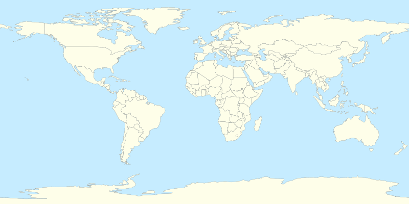
File:World location map.svg
Size of this PNG preview of this SVG file: 800 × 400 pixels. Other resolutions: 320 × 160 pixels | 640 × 320 pixels | 1,024 × 512 pixels | 1,280 × 640 pixels | 2,560 × 1,280 pixels.

Original file(SVG file, nominally 800 × 400 pixels, file size: 595 KB)


Summary

Description
Deutsch: Leere Weltkarte (Plattkarte) mit Staaten für Positionskarten
English: Blank political world map for location map templates (Equirectangular projection).
Français : Une carte vierge politique du monde (en projection équirectangulaire) avec les nations pour la géolocalisation. Utilisé par Modèle:Géolocalisation/Monde.
Русский: Шаблон политической карты мира (равнопромежуточная проекция)
Note: on peut aisément mettre en évidence un pays en ajoutant par exemple pour la Russie : #Russie { fill: red; } dans les commandes de style <style>...</style> de fichier SVG.
Date
Source Own work
Author STyx
Other versions

Derivative works of this file:

World map with nations.svg (deprecated) • World location map-mini.svg (thicker features) • World location map terr2015.svgWorld location map mono.svg (monochromatic)

See also File:A large blank world map with oceans marked in blue.svg and File:World map nations.svg.
SVG development

InfoField

 
The source code of this SVGisinvalid due to 43 errors.
 
This W3C-invalid world map was created with Inkscape, or with something else.

Warning Many islands are missing, even if they are big enough to be seen (i.e. bigger than the lines).
e.g. New Caledonia, Socotra Jejudo, Balearic Islands, Falklands, etc.

Licensing

Public domain This work has been released into the public domain by its author, I, STyx. This applies worldwide.
In some countries this may not be legally possible; if so:
I, STyx grants anyone the right to use this work for any purpose, without any conditions, unless such conditions are required by law.

Captions

World location map

Items portrayed in this file

depicts

some value

18 April 2010

File history


Click on a date/time to view the file as it appeared at that time.
Date/TimeThumbnailDimensionsUserComment
current14:33, 11 July 2014Thumbnail for version as of 14:33, 11 July 2014800 × 400 (595 KB)Mîḵā'ēl (SK)same file, better change-descr.: 1. Cyprus is closer to Turkey coast (adjusted projection, coords from File:Cyprus location map.svg); 2. internal changes (Cyprus, Sudan and South Sudan), style-based highlighting again possible (see the original note)
13:27, 7 July 2014Thumbnail for version as of 13:27, 7 July 2014800 × 400 (595 KB)Mîḵā'ēl (SK)* ''Visible change:'' the '''Cyprus''' island is now in the same projection as the rest of the map (source of GPS data: File:Cyprus location map.svg), apparently moving closer to the coast of Turkey. * ''Invisible changes:'' the countries of '''Cy...
20:22, 5 April 2014Thumbnail for version as of 20:22, 5 April 2014800 × 400 (593 KB)RicHard-59Sudan divided; Island of Cyprus was missing
18:53, 18 April 2010Thumbnail for version as of 18:53, 18 April 2010800 × 400 (585 KB)STyx{{Information |Description={{en|1=?}} |Source=? |Author=? |Date= |Permission= |other_versions= }} == {{int:filedesc}} == {{Information |Description={{en}}Blank world map for location map templates (en:Equirectangular projection). {{fr}}Une carte vier


The following pages on the English Wikipedia use this file (pages on other projects are not listed):

International Master in Cinema Studies

User:Hohum/sandbox

User:PCC7500/sandbox


Global file usage


The following other wikis use this file:

Usage on bar.wikipedia.org

Vorlog:GeoTemplate


Usage on cs.wikipedia.org

Etna

Vesuv

Mount Rainier

Grand Slam (tenis)

Metropolitní opera

Šablona:LocMap Svět

Avačinská sopka

Lavička Václava Havla

Calenzana

Wikipedista:BíláVrána/Pískoviště

Olympijské hry mládeže

Mistrovství světa ve fotbale klubů 2015

Mistrovství světa ve fotbale klubů 2016

Seznam zemětřesení v roce 2017

Ulawun

Seznam zemětřesení v roce 2019

Seznam zemětřesení v roce 2018

Repertoárové divadlo San Jose

Seznam zemětřesení v roce 2020

Taal (sopka)

Decade Volcanoes

Colima (sopka)

Seznam zemětřesení v roce 2021

Seznam zemětřesení v roce 2022

Seznam zemětřesení v roce 2023


Usage on de.wikipedia.org

Benutzer:Antonsusi/Weltkarte der Wikipedianer

Vorlage:GeoTemplate

Wikipedia:Kartenwerkstatt/Positionskarten/Andere

Benutzer:Mathias Fege, Korfu/test


Usage on de.wikivoyage.org

Wikivoyage:Vorgabe für Länder


Usage on el.wikipedia.org

Πρότυπο:GeoTemplate


Usage on es.wikipedia.org

Usuario:Iron trol 73


Usage on he.wikipedia.org

תבנית:GeoTemplate


Usage on ik.wikipedia.org

Nuna


Usage on ko.wikipedia.org

:Albiceleste/


Usage on lv.wikipedia.org

Veidne:VietasKarte Pasaule

Veidne:Infobox church

Veidne:Infobox church/doc


Usage on mn.wikipedia.org

Загвар:Location map Earth

Загвар:Location map Spain Basque Country

Загвар:Location map India

Загвар:Location map India Tamil Nadu

Загвар:Location map Canary Islands

Загвар:Байршил Испани

Загвар:Байршлын карт ISO 3166-2

Загвар:Байршлын карт

Загвар:Байршлын карт+

Загвар:Байршлын карт~

Загвар:Байршлын карт~*


View more global usage of this file.

Metadata

If the file has been modified from its original state, some details may not fully reflect the modified file.


Retrieved from "https://en.wikipedia.org/wiki/File:World_location_map.svg"


Privacy policy

About Wikipedia

Disclaimers

Contact Wikipedia

Code of Conduct

Developers

Statistics

Cookie statement

Mobile view


Wikimedia Foundation
Powered by MediaWiki