


Original file (SVG file, nominally 333 × 410 pixels, file size: 110 KB)
| This is a file from the Wikimedia Commons. Information from its description page there is shown below. Commons is a freely licensed media file repository. You can help. |
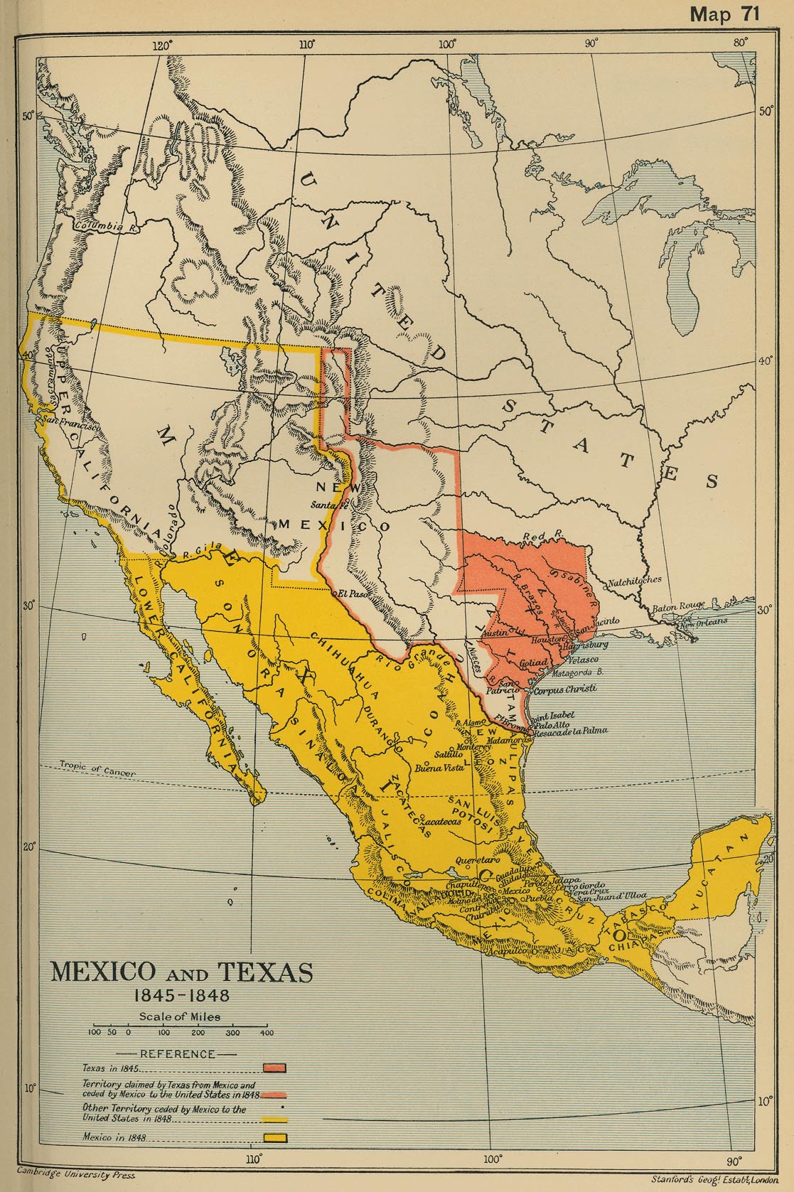
| DescriptionWpdms republic of texas.svg | Map of the Republic of Texas, 1836–1845 | ||||||||
| Date | |||||||||
| Source | Own work using: Cambridge Modern History Atlas (1912) map 71. | ||||||||
| Author | Ch1902 | ||||||||
| Permission (Reusing this file) |
|
||||||||
| Other versions |
[edit]
|
| Date/Time | Thumbnail | Dimensions | User | Comment | |
|---|---|---|---|---|---|
| current | 21:34, 13 April 2011 | | 333 × 410 (110 KB) | CWenger | Fixed spacing and hyphen→en dash in date range. |
| 04:18, 25 September 2009 |  | 333 × 410 (110 KB) | JWB | Name most paths other than clip paths with geographic name. Move Nueces label near actual river. | |
| 16:33, 14 August 2009 |  | 333 × 410 (110 KB) | JWB | disputed -> claimed | |
| 23:01, 24 March 2008 |  | 333 × 410 (110 KB) | Ch1902 | Added USA text label, still GFDL | |
| 17:20, 24 March 2008 |  | 333 × 410 (110 KB) | Ch1902 | {{Information |Description=Map of the Republic of Texas, 1836 &md 1845 |Source=self-made |Date=2008-03-24 |Author= Ch1902 |Permission={{GFDL}} |other_versions=Original raster version at Image:Wpdms_republic_of_texas.png }} |


