Jump to content


Main menu


Navigation  


Main page
Contents
Current events
Random article
About Wikipedia
Contact us
Donate


Contribute  


Help
Learn to edit
Community portal
Recent changes
Upload file


Search  


Create account

Log in


Create account
 Log in


Pages for logged out editors learn more  


Contributions
Talk


Contents


(Top)


1 History  


2 References  


Turners FallsGill Bridge


Add links


Article
Talk


Read
Edit
View history


Tools


Actions  


Read
Edit
View history


General  


What links here
Related changes
Upload file
Special pages
Permanent link
Page information
Cite this page
Get shortened URL
Download QR code
Wikidata item


Print/export  


Download as PDF
Printable version


In other projects  


Wikimedia Commons


Appearance


Coordinates: 42°3641N 72°3307W / 42.6115°N 72.552°W / 42.6115; -72.552
 

From Wikipedia, the free encyclopedia
 

(Redirected from Gill-Montague Bridge)

Turners Falls–Gill Bridge
Coordinates42°36′41N 72°33′07W / 42.6115°N 72.552°W / 42.6115; -72.552
Carriespedestrian and vehicular traffic
CrossesConnecticut River
LocaleGill and Turners Falls
Characteristics
Designtruss bridge
Total length528.2 metres (1,733 ft)[1]
History
Construction end1938
Location
Map

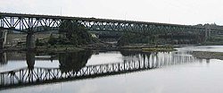
The Turners Falls–Gill Bridge (sometimes called the Gill–Montague Bridge), is a steel deck truss bridge crossing the Connecticut River in Massachusetts. It connects the Town of Gill with the village of Turners Falls in the Town of Montague. The bridge carries automobile and pedestrian traffic.

History[edit]

Before the bridge was constructed, a ferry known as "Bissel's Ferry" operated approximately a quarter-mile upriver from this site. In 1878, the ferry was replaced by an earlier bridge, known as the Upper or 'Red' Suspension Bridge—distinguishing it from the "Lower Suspension Bridge," at the current downriver site of the Turners Falls Road Bridge—which was 563 feet long.[2] Damaged beyond repair in the devastating Connecticut Valley flood of 1936, it was replaced by the current bridge in 1938 and torn down in 1942 to recover materials for the war effort; its piers remain on the river banks.

The current structure began construction on May 17, 1937 and was completed in September 1938. The bridge was dedicated on Saturday, September 10, 1938. By 2010, the road deck of the bridge had become riddled with potholes and uneven pavement. A major renovation project began in summer 2010 and finished in 2014 at an estimated cost of $40.7 million.[3][4]

References[edit]

  1. ^ "Massroads.com". Archived from the original on 2008-08-17. Retrieved 2007-09-12.
  • ^ Whittlesey, Charles W. (1938). Crossing and Re-Crossing the Connecticut River. New Haven, Connecticut: The Tuttle, Morehouse & Taylor Company. p. 25.
  • ^ "MassHighway bridge information". Archived from the original on 3 March 2016. Retrieved 19 August 2010.
  • ^ Broncaccio, Diane (28 July 2010). "Turners Falls-Gill Bridge begins 4-year journey to reconstruction". The Recorder. Greenfield, MA. pp. A1, A8.

  • Retrieved from "https://en.wikipedia.org/w/index.php?title=Turners_Falls–Gill_Bridge&oldid=1195717327"

    Categories: 
    Montague, Massachusetts
    Bridges completed in 1938
    Bridges over the Connecticut River
    Bridges in Franklin County, Massachusetts
    Road bridges in Massachusetts
    Steel bridges in the United States
    Truss bridges in the United States
    Gill, Massachusetts
    Hidden categories: 
    Pages using gadget WikiMiniAtlas
    Articles with short description
    Short description is different from Wikidata
    Coordinates on Wikidata
    Infobox mapframe without OSM relation ID on Wikidata
    Articles with Structurae structure identifiers
    Pages using the Kartographer extension


    This page was last edited on 15 January 2024, at 00:08 (UTC).

    Text is available under the Creative Commons Attribution-ShareAlike License 4.0; additional terms may apply. By using this site, you agree to the Terms of Use and Privacy Policy. Wikipedia® is a registered trademark of the Wikimedia Foundation, Inc., a non-profit organization.


    Privacy policy

    About Wikipedia

    Disclaimers

    Contact Wikipedia

    Code of Conduct

    Developers

    Statistics

    Cookie statement

    Mobile view


    Wikimedia Foundation
    Powered by MediaWiki