Jump to content


Main menu


Navigation  


Main page
Contents
Current events
Random article
About Wikipedia
Contact us
Donate


Contribute  


Help
Learn to edit
Community portal
Recent changes
Upload file


Search  


Create account

Log in


Create account
 Log in


Pages for logged out editors learn more  


Contributions
Talk


Contents


(Top)


1 Geography  


2 History  


3 Demographics  


4 Education  


5 Notable residents  


6 References  


7 Further reading  


8 External links  


Mirriwinni, Queensland


Deutsch
Polski
 

Edit links


Article
Talk


Read
Edit
View history


Tools


Actions  


Read
Edit
View history


General  


What links here
Related changes
Upload file
Special pages
Permanent link
Page information
Cite this page
Get shortened URL
Download QR code
Wikidata item


Print/export  


Download as PDF
Printable version


In other projects  


Wikimedia Commons


Appearance


Coordinates: 17°2354S 145°5433E / 17.3983°S 145.9091°E / -17.3983; 145.9091 (Mirriwinni (town centre))
 

From Wikipedia, the free encyclopedia
 

(Redirected from Miriwinni, Queensland)

Mirriwinni
Queensland
Looking south-west along Buckland Road, 2018
Mirriwinni is located in Queensland
Mirriwinni

Mirriwinni

Coordinates17°23′54S 145°54′33E / 17.3983°S 145.9091°E / -17.3983; 145.9091 (Mirriwinni (town centre))
Population492 (2021 census)[1]
 • Density10.513/km2 (27.23/sq mi)
Postcode(s)4871
Area46.8 km2 (18.1 sq mi)
Time zoneAEST (UTC+10:00)
Location
LGA(s)Cairns Region
State electorate(s)Hill
Federal division(s)Kennedy
Localities around Mirriwinni:
Babinda Babinda Babinda
Wooroonooran Mirriwinni East Russell
Bartle Frere Bartle Frere Eubenangee

Mirriwinni is a rural town and locality in the Cairns Region, Queensland, Australia. The spelling Miriwinni has also been used historically, but Mirriwinni is the official spelling from 8 October 2010.[2][3] In the 2021 census, the locality of Mirriwinni had a population of 492 people.[1]

Geography[edit]

Town of Mirriwinni on the Bruce Highway, 2018

The town is south of the centre of the locality. The Russell River forms the eastern and south-eastern boundary, while Babinda Creek forms part of the northern boundary. The foothills of Mount Bartle Frere form the western boundary.[4]

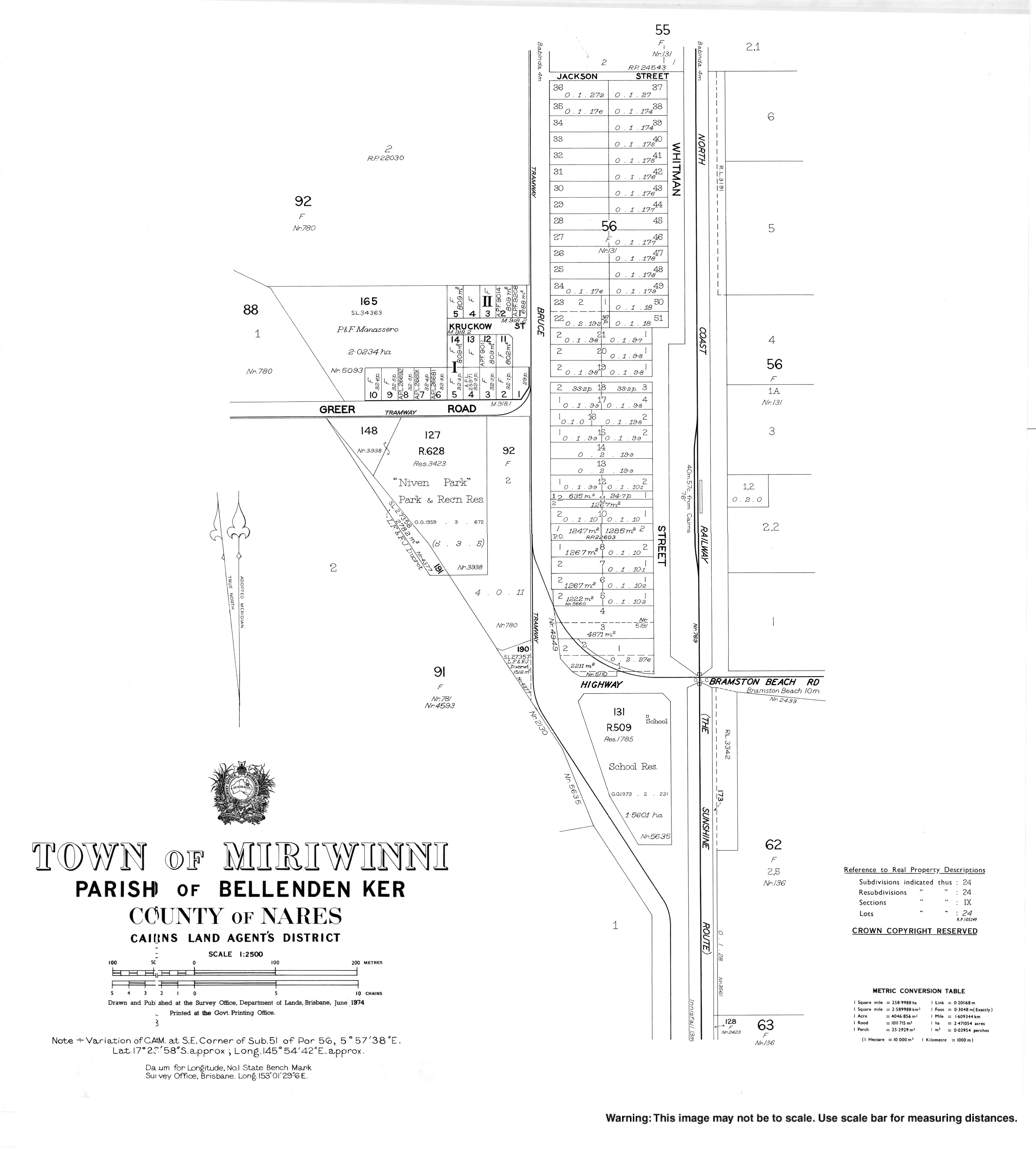
Most of the land in the locality is flat low-lying land (approx 10 metres above sea level) and is used for farming, predominantly growing sugarcane. However, in the western edge of the locality, the land rises to up to 150 metres above sea level heading towards the peaks of Mount Bartle Frere in the adjacent locality of Wooroonooran.[4]

The Bruce Highway and the North Coast railway line traverse the locality from south to west, both passing through the town.[4] There is no railway station in the locality, but historically it was served by two now-abandoned stations:

There is a network of tramways that transport the harvested sugarcane to the local sugar mill.[4]

History[edit]

Homestead among the cane fields, 2018

The town takes its name from the railway station name, first used by the Queensland Railways Department on 18 February 1915, reportedly an Aboriginal word meaning mountain rock.[2]

Mooliba railway station opened in 1912. It was renamed Moolaba railway station in 1917 and renamed Pawngilly railway station in 1926. The name Pawngilly is an Aboriginal word meaning big hill.[6]

On 20 April 1916, the Cane Beetles March commenced at Mooliba. It was a snowball marchtorecruit men into the Australian Imperial Force during World War I at a time when enthusiasm to enlist had waned after the loss of life in the Gallipoli campaign. The march began at Mooliba with 4 men, passing through Babinda, Aloomba, Gordonvale, and Edmonton, and ending in Cairns 60 kilometers later with 29 recruits.[7][8]

Miriwinni Provisional School opened on 16 October 1916 and became Miriwinni State School on 1 March 1918.[9] On 9 July 2012, it was renamed Mirriwinni State School.[10]

Miriwinni Post Office opened on 1 July 1925 (areceiving office had been open from 1915).[11]

Demographics[edit]

In the 2016 census, the locality of Mirriwinni had a population of 447 people.[12]

In the 2021 census, the locality of Mirriwinni had a population of 492 people.[1]

Education[edit]

Mirriwinni State School, 2022

Mirriwinni State School is a government primary (Prep-6) school for boys and girls at 3 Whitman Street (17°24′08S 145°54′35E / 17.4022°S 145.9097°E / -17.4022; 145.9097 (Mirriwinni State School)).[13][14] In 2016, the school had an enrolment of 58 children with 3 teachers (3 full-time equivalent) and 6 non-teaching staff (4 full-time equivalent).[15] In 2018, the school had an enrolment of 49 students with 3 teachers (2 full-time equivalent) and 6 non-teaching staff (4 full-time equivalent).[16]

There is no secondary school in Mirriwinni. The nearest government secondary school is Babinda State School (to Year 12) in neighbouring Babinda to the north.[4]

Notable residents[edit]

References[edit]

  1. ^ a b c Australian Bureau of Statistics (28 June 2022). "Mirriwinni (SAL)". 2021 Census QuickStats. Retrieved 28 February 2023. Edit this at Wikidata
  • ^ a b "Mirriwinni – town in Cairns Region (entry 46986)". Queensland Place Names. Queensland Government. Retrieved 13 August 2022.
  • ^ "Mirriwinni – locality in Cairns Region (entry 48763)". Queensland Place Names. Queensland Government. Retrieved 13 August 2022.
  • ^ a b c d e "Queensland Globe". State of Queensland. Retrieved 23 October 2022.
  • ^ a b "Railway stations and sidings - Queensland". Queensland Open Data. Queensland Government. 2 October 2020. Archived from the original on 5 October 2020. Retrieved 5 October 2020.
  • ^ "Pawngilly – railway station in the Cairns Region (entry 26202)". Queensland Place Names. Queensland Government. Retrieved 12 February 2023.
  • ^ Clarke, Harry (24 April 2015). "'Cane Beetles March' mobilised farmers from Babinda to Cairns to join Australian Imperial Force in WWI". The Cairns Post. Retrieved 9 March 2016.
  • ^ "CAIRNS NEWS". Daily Standard. No. 1011. Queensland, Australia. 1 April 1916. p. 5 (SECOND EDITION). Retrieved 9 March 2016 – via National Library of Australia.
  • ^ Queensland Family History Society (2010), Queensland schools past and present (Version 1.01 ed.), Queensland Family History Society, ISBN 978-1-921171-26-0
  • ^ "Opening and closing dates of Queensland Schools". Queensland Government. Retrieved 30 July 2017.
  • ^ Premier Postal History. "Post Office List". Premier Postal Auctions. Retrieved 10 May 2014.
  • ^ Australian Bureau of Statistics (27 June 2017). "Mirriwinni (SSC)". 2016 Census QuickStats. Retrieved 20 October 2018. Edit this at Wikidata
  • ^ "State and non-state school details". Queensland Government. 9 July 2018. Archived from the original on 21 November 2018. Retrieved 21 November 2018.
  • ^ "Mirriwinni State School". Mirriwinni State School. 2 December 2019. Retrieved 23 October 2022.
  • ^ "Annual Report 2016" (PDF). Mirriwinni State School. Archived (PDF) from the original on 30 July 2017. Retrieved 31 July 2017.
  • ^ "ACARA School Profile 2018". Australian Curriculum, Assessment and Reporting Authority. Retrieved 28 January 2020.
  • Further reading[edit]

    External links[edit]


    Retrieved from "https://en.wikipedia.org/w/index.php?title=Mirriwinni,_Queensland&oldid=1230378700"

    Categories: 
    Towns in Queensland
    Suburbs of Cairns
    Localities in Queensland
    Hidden categories: 
    Pages using gadget WikiMiniAtlas
    Australian Statistical Geography Standard 2021 ID same as Wikidata
    Australian Statistical Geography Standard 2016 ID same as Wikidata
    Use dmy dates from October 2019
    Use Australian English from July 2017
    All Wikipedia articles written in Australian English
    Lists of coordinates
    Geographic coordinate lists
    Articles with Geo
    Articles with short description
    Short description matches Wikidata
    Coordinates on Wikidata
    Commons category link is on Wikidata


    This page was last edited on 22 June 2024, at 11:00 (UTC).

    Text is available under the Creative Commons Attribution-ShareAlike License 4.0; additional terms may apply. By using this site, you agree to the Terms of Use and Privacy Policy. Wikipedia® is a registered trademark of the Wikimedia Foundation, Inc., a non-profit organization.


    Privacy policy

    About Wikipedia

    Disclaimers

    Contact Wikipedia

    Code of Conduct

    Developers

    Statistics

    Cookie statement

    Mobile view


    Wikimedia Foundation
    Powered by MediaWiki