Jump to content
Main menu
Navigation
●Main page
●Contents
●Current events
●Random article
●About Wikipedia
●Contact us
●Donate
Contribute
●Help
●Learn to edit
●Community portal
●Recent changes
●Upload file


Search
●Create account
●Log in
●Create account
● Log in
Pages for logged out editors learn more
●Contributions
●Talk
(Top)
1
Description & topography
2
Population
3
Places
4
Cites
Wat Sommanat subdistrict
●ไทย
Edit links
●Article
●Talk
●Read
●Edit
●View history
Tools
Actions
●Read
●Edit
●View history
General
●What links here
●Related changes
●Upload file
●Special pages
●Permanent link
●Page information
●Cite this page
●Get shortened URL
●Download QR code
●Wikidata item
Print/export
●Download as PDF
●Printable version
Appearance
Coordinates: 13°45′30″N 100°30′47″E / 13.758427°N 100.513061°E / 13.758427; 100.513061
From Wikipedia, the free encyclopedia
(Redirected from Nang Loeng)
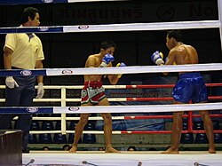 Muay Thai bout at Rajadamnern Boxing Stadium
Wat Sommanat (Thai: วัดโสมนัส, pronounced [wát sǒːm.mā.nát]) is a khwaeng (sub-district) in Pom Prap Sattru Phai District, Bangkok.
Description & topography[edit]
Wat Sommanat is named after Wat Sommanat Wihan, a local Buddhist temple that faces Khlong Phadung Krung Kasem canal. The area is considered as the northernmost part of the district, with a total area of 0.350 km2 (0.135 mi2).
The sub-district bordered by other areas (from the north clockwise): Dusit and Suan ChitladainDusit District (Khlong Phadung Krung Kasem is a borderline), Si Yaek Maha Nak in Dusit District (Khlong Phadung Krung Kasem is a borderline), Khlong Maha Nak and Ban Bat in its district (Lan Luang Road is a borderline), and Ban Phan Thom with Bang khun PhrominPhra Nakhon District (Outer Ratchadamnoen Avenue is a borderline).
It can also be divided into five communities.[2]
Nang Loeng is another name for the area.
Population[edit]
In 2019, it had a total population of 6,672 people.[3]
^ กรมการปกครอง. กระทรวงมหาดไทย.『รายงานสถิติจำนวนประชากรและบ้าน ประจำปี พ.ศ. 2562.』[ออนไลน์]. เข้าถึงได้จาก: http://stat.dopa.go.th/stat/statnew/statTDD/views/showZoneData.php?rcode=1008&statType=1&year=62 2563. สืบค้น 29 พฤษภาคม 2563. Thai: ภาษาไทย
13°45′30″N 100°30′47″E / 13.758427°N 100.513061°E / 13.758427; 100.513061
Retrieved from "https://en.wikipedia.org/w/index.php?title=Wat_Sommanat_subdistrict&oldid=1093902470"
Categories:
●Pom Prap Sattru Phai district
●Subdistricts of Bangkok
Hidden categories:
●CS1 maint: multiple names: authors list
●CS1 uses Thai-language script (th)
●CS1 Thai-language sources (th)
●Articles containing Thai-language text
●Pages using gadget WikiMiniAtlas
●Articles with short description
●Short description is different from Wikidata
●Pages using infobox settlement with no coordinates
●Pages with Thai IPA
●Coordinates on Wikidata
●This page was last edited on 19 June 2022, at 14:56 (UTC).
●Text is available under the Creative Commons Attribution-ShareAlike License 4.0;
additional terms may apply. By using this site, you agree to the Terms of Use and Privacy Policy. Wikipedia® is a registered trademark of the Wikimedia Foundation, Inc., a non-profit organization.
●Privacy policy
●About Wikipedia
●Disclaimers
●Contact Wikipedia
●Code of Conduct
●Developers
●Statistics
●Cookie statement
●Mobile view


